2000s (21st Century) Maps of Armstrong County, Pennsylvania
Explore 24 historic maps of Armstrong County from the 2000s (21st Century). These maps offer a rare glimpse into what life looked like during the 2000s — showing old roads, neighborhoods, homes, and landmarks that have changed or disappeared over time.
Whether you're researching your family's past, planning a metal detecting trip, or studying how Armstrong County's landscape evolved across the 2000s, these high-resolution maps are a powerful tool for exploring the history of this region.
- Focus on a specific era: All maps on this page are from the 2000s, giving you a focused view of this time period.
- See what’s changed: Compare century-old streets, trails, and buildings to today's modern landscape using overlays and satellite layers.
- Research with precision: Use these maps for genealogy, historical research, land use analysis, or educational projects.
- View, download, or print: Maps are fully viewable online in high resolution, and can be downloaded or printed for your own records.
Start exploring Armstrong County's history through authentic maps from the 2000s. This is your window into the past.
Armstrong County, PA maps
(24)- 2023 Map of McIntyre, 2023 Print
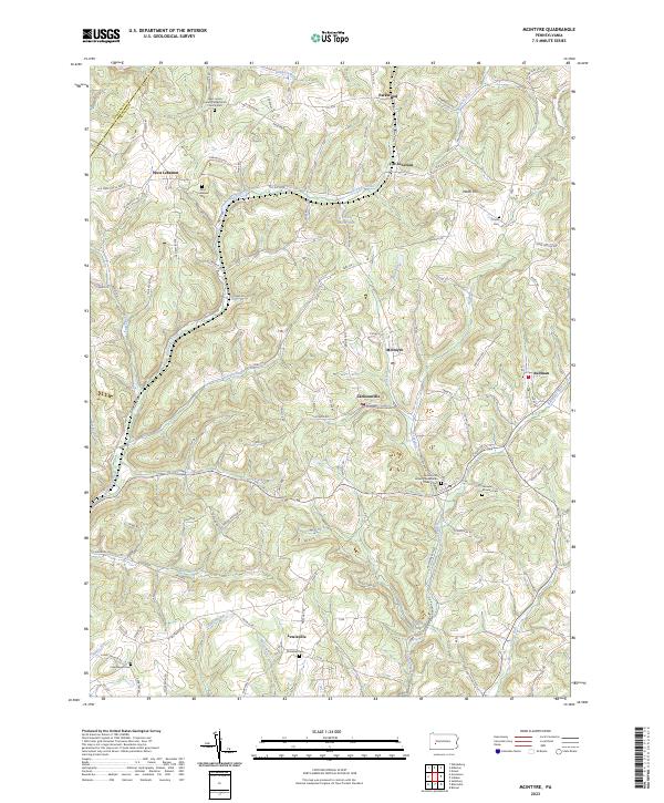 2023 McIntyre2023 Print · USGSIndiana County's coal and rail country is detailed here during the early twenty-first century. Genealogists can trace family roots at Ebenezer Cem or explore the settlements of Jacksonville and West Lebanon.
 - 2023 Map of Rural Valley, 2023 Print
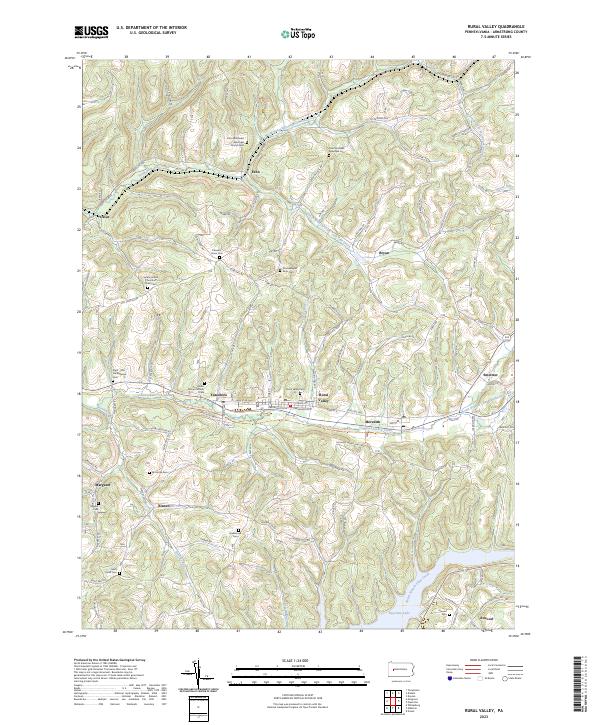 2023 Rural Valley2023 Print · USGSArmstrong County’s rural valleys and high ridges are captured here in the 2020s, showing a landscape shaped by historical paths and small-town resilience. Genealogists can trace family ties through numerous sites like Rural Valley Cem, the Harkleroad Cem, or the Great Shamokin Path Trail.
 - 2023 Map of Sligo, 2023 Print
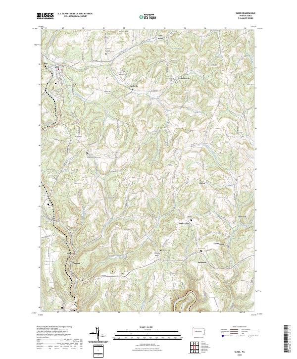 2023 Sligo2023 Print · USGSClarion County’s upland settlements and rural cemeteries are preserved in this recent topographic survey. Researchers can trace family history at the Clarion County Poorhouse Cem and explore old rail corridors like the Sligo Branch Line Trl.
 - 2023 Map of Parker, 2023 Print
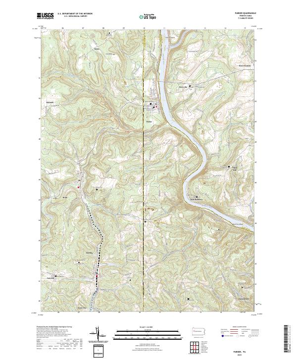 2023 Parker2023 Print · USGSThe confluence of the Allegheny and Clarion rivers defines this Pennsylvania landscape near the turn of the millennium. Trace family history at the Grand Army of the Republic Cem or explore the river-bend settlements of Parker and West Monterey.
 - 2023 Map of New Bethlehem, 2023 Print
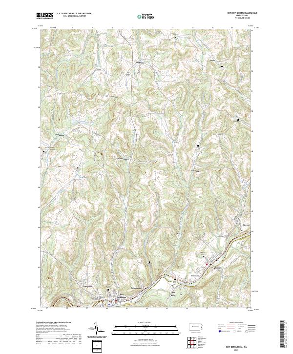 2023 New Bethlehem2023 Print · USGSThe hill country of western Pennsylvania comes into focus here, showing the river-bound settlements and upland hamlets of the early twenty-first century. Genealogists can locate family-named landmarks and several rural burial sites, including Salem Cem and Frazier Cem.
 - 2023 Map of Rimersburg, 2023 Print
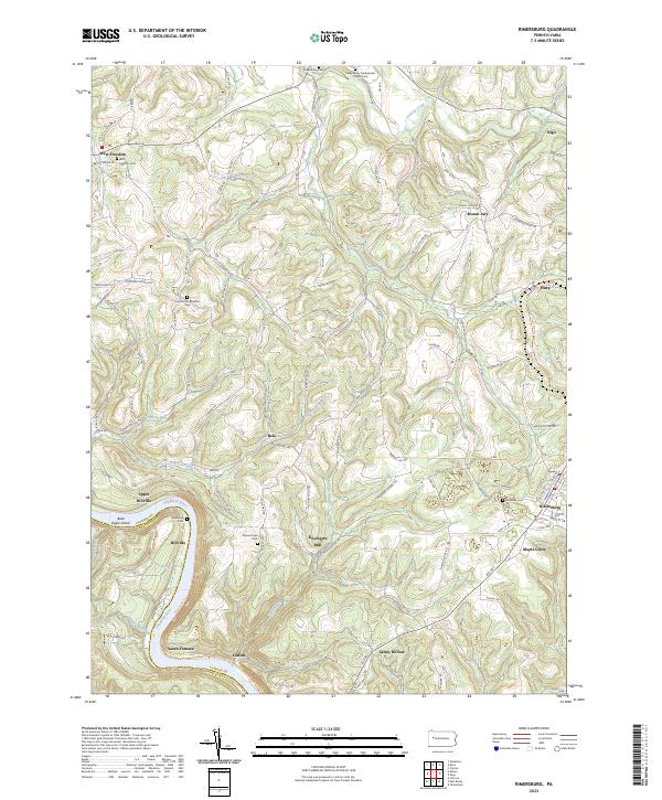 2023 Rimersburg2023 Print · USGSThe Allegheny River and Clarion County highlands come alive in this recent survey. Genealogists and local historians can trace family ties through Sarah Furnace, Kissingers Mill, and the Concord Presbyterian Cem.
 - 2023 Map of Summerville, 2023 Print
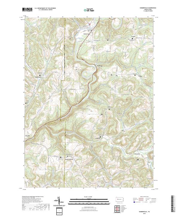 2023 Summerville2023 Print · USGSThis Jefferson County landscape is defined by the winding waters of Redbank Creek and its many tributaries during the early twenty-first century. Genealogists can trace family heritage through numerous rural burial grounds like Smith Cem, Zion Cem, and Shannondale Union Cem.
 - 2023 Map of Emlenton, 2023 Print
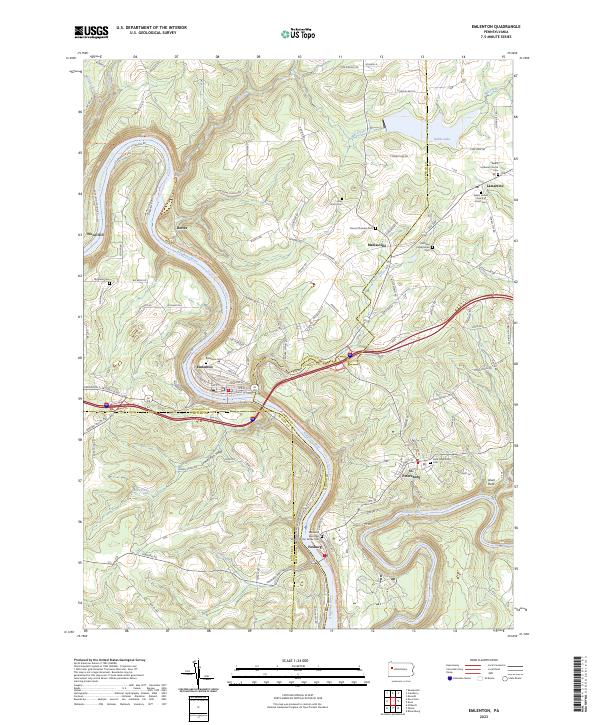 2023 Emlenton2023 Print · USGSThe Allegheny and Clarion rivers meet in this riverside landscape during the early 2020s. Genealogists can trace family roots through numerous burial grounds like Richland Presbyterian Cem and Saint Petersburg Cem or the riverfront borough of Emlenton.
 - 2023 Map of Ernest, 2023 Print
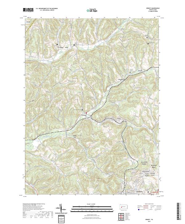 2023 Ernest2023 Print · USGSIndiana County's northern hills are shown in detail as they appeared recently, revealing a landscape defined by deep valleys and high-elevation cemeteries. Genealogists can trace family connections at Old Washington Cem or Center Presbyterian Cem while exploring rural hamlets like Willet and Kimmel.
 - 2023 Map of Freeport, 2023 Print
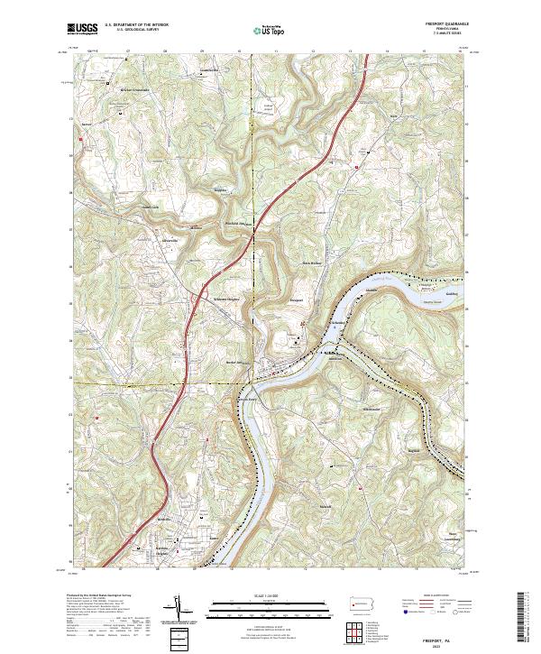 2023 Freeport2023 Print · USGSThe river valleys of southwestern Pennsylvania are captured here at the busy junction of the Allegheny and Kiskiminetas. Researchers can trace historical churchyards and river landings at Garvers Ferry, Saint Marys Cem, and the rail corridors through Butler Junction.
 - 2023 Map of Dayton, 2023 Print
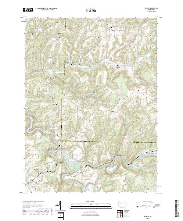 2023 Dayton2023 Print · USGSThe rural borderlands of Armstrong and Jefferson counties are captured here in a detailed contemporary study. Genealogists can trace family legacies at Timblin United Methodist Cem, Zion Cem, and the settlement of Corbettown.
 - 2023 Map of Chicora, 2023 Print
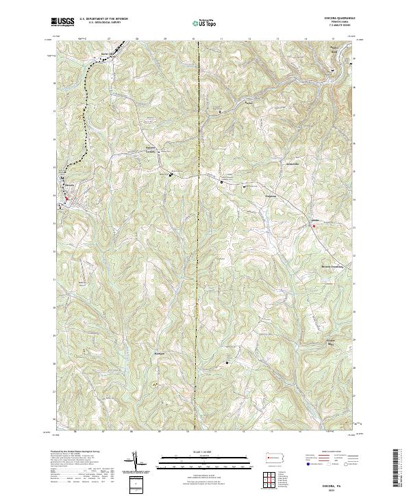 2023 Chicora2023 Print · USGSButler and Armstrong counties appear in 2023 with their intricate network of ridge-top settlements and creek valleys. Researchers can trace family history through numerous rural burial sites like Saint Patricks Cem and Hillview Cem or locate old community hubs like Fosters Mills and Kepples Corners.
 - 2023 Map of Templeton, 2023 Print
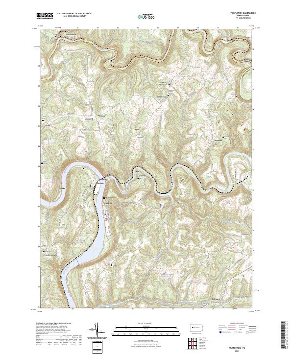 2023 Templeton2023 Print · USGSThe river valleys of Armstrong County come into focus in the 2020s, showing the enduring layout of the Pennsylvania countryside. Researchers can trace family history through a dense network of burial sites, including Stewardson Furnace Cem, Tidal Cem, and Walthour Cem.
 - 2023 Map of Worthington, 2023 Print
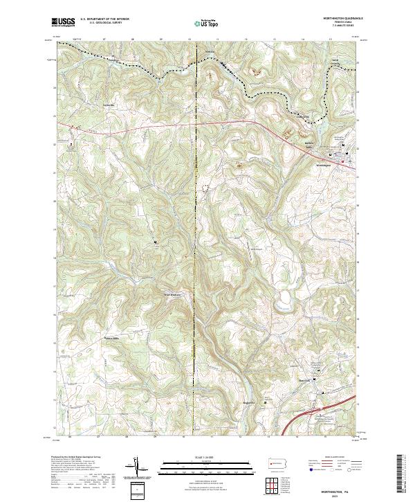 2023 Worthington2023 Print · USGSThe rural borderlands of Butler and Armstrong counties come alive in this recent survey. Researchers can trace family history through numerous church grounds including the Buffalo United Presbyterian Church Cem or locate legacy sites like Buffalo Mills and Slate Lick.
 - 2023 Map of East Brady, 2023 Print
 2023 East Brady2023 Print · USGSThe Allegheny River valley in western Pennsylvania is shown here in its modern rural character, bridging the Clarion and Armstrong county line. Genealogists can locate numerous family burial sites such as Crissman Family Cem and Croyle Cem near Adrian and Cowansville.
 - 2023 Map of Elderton, 2023 Print
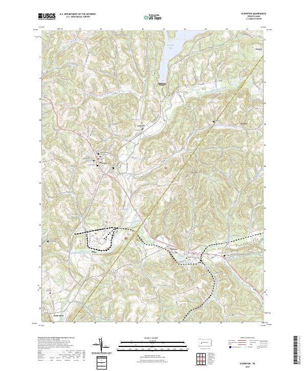 2023 Elderton2023 Print · USGSThe borderlands of Armstrong and Indiana Counties are captured here in the early 2020s, showing a rural landscape shaped by narrow valleys and local waterways. Family historians can trace numerous burial sites like Kimmel Cem and Montgomery Family Cem or locate the quiet crossroads of Gastown and Atwood.
 - 2023 Map of Mosgrove, 2023 Print
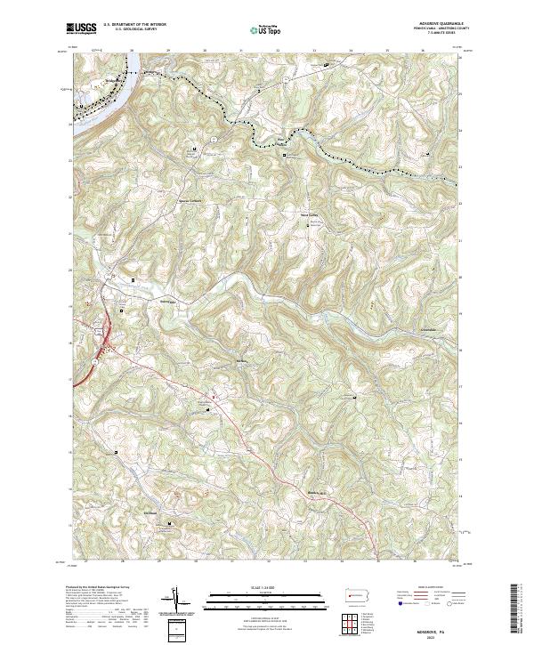 2023 Mosgrove2023 Print · USGSThe hill country of Armstrong County is seen here in recent detail, where winding creek valleys meet a dense network of country roads. Genealogists can trace family roots through numerous rural landmarks like Mount Union Davis Cem, Blanket Hill, and Pine Furnace.
 - 2023 Map of Avonmore, 2023 Print
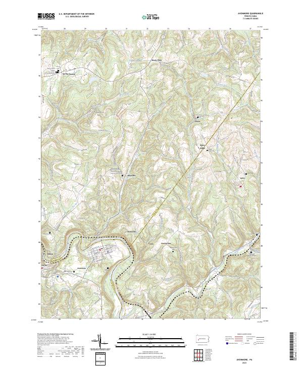 2023 Avonmore2023 Print · USGSNear the tri-county junction of Westmoreland, Armstrong, and Indiana, this survey shows the Kiskiminetas River valley and its surrounding hill country in the early twenty-first century. Researchers can trace family history through numerous burial sites like Townsend Cem, West View Cem, and the Covenanter Cem.
 - 2023 Map of Plumville, 2023 Print
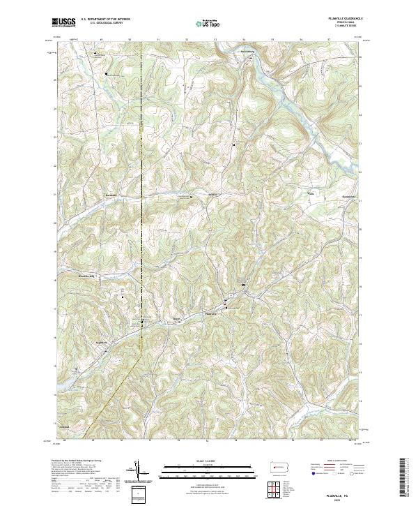 2023 Plumville2023 Print · USGSWestern Pennsylvania's rural landscape is captured here in the early twenty-first century, spanning the border of Armstrong and Indiana Counties. Genealogists can trace family landmarks and numerous local burial sites including Plumville Cem and Slate Hill Cem.
 - 2023 Map of Kittanning, 2023 Print
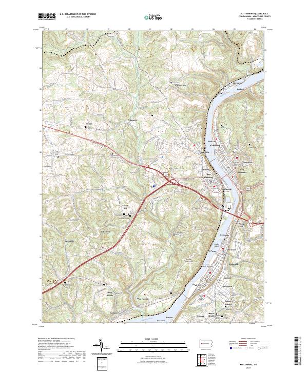 2023 Kittanning2023 Print · USGSThe Allegheny River valley comes into sharp focus during this modern era, showing the dense settlement patterns from Kittanning to Ford City. Researchers can trace local heritage through sites like the Armstrong County Courthouse and numerous burial grounds including Saint Marys Cem and Lawn Haven Burial Estates.
 - 2023 Map of Vandergrift, 2023 Print
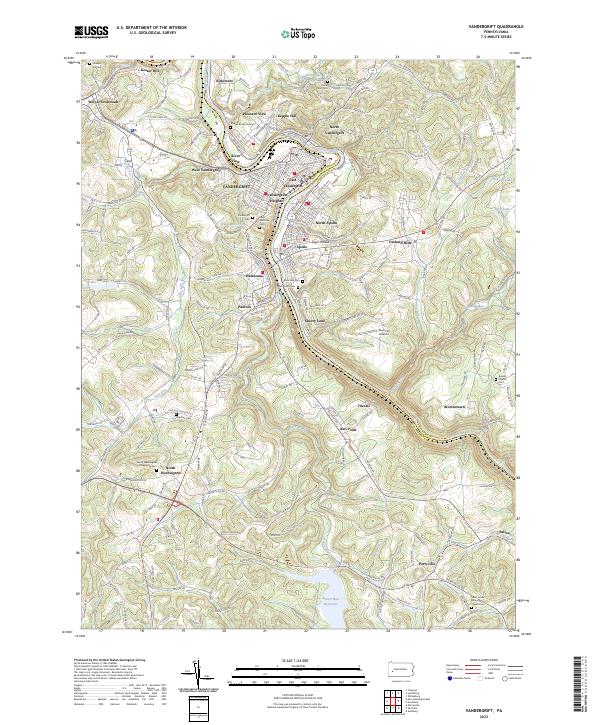 2023 Vandergrift2023 Print · USGSThe riverfront boroughs of Westmoreland and Armstrong counties are shown here as they appear today, centered on the historic bend of the Kiskiminetas River. Researchers can trace local heritage through numerous burial sites like Saint Gertrude Cem and family-named landmarks such as Gosser Hill.
 - 2023 Map of Distant, 2023 Print
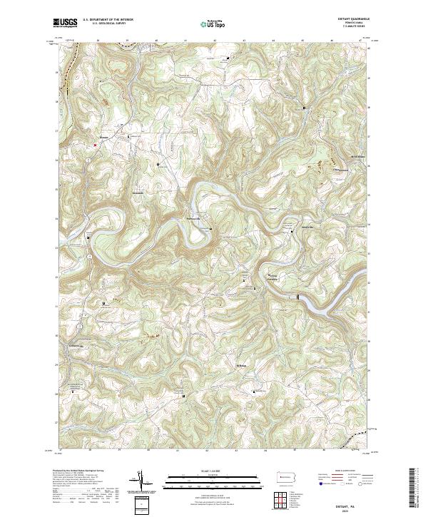 2023 Distant2023 Print · USGSThe rural border of Armstrong and Clarion counties is captured here in the contemporary era, showing a landscape of small crossroads settlements and creek-side villages. Genealogists and historians can locate numerous family and church burial sites, including the Milliron Family Cem, McCrea Furnace, and Putneyville.
 - 2023 Map of Leechburg, 2023 Print
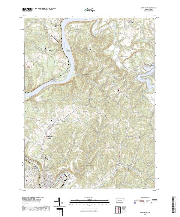 2023 Leechburg2023 Print · USGSLeechburg and its river-carved surroundings are captured in this recent survey at the confluence of the Kiskiminetas and Allegheny. Researchers can trace numerous family and denominational sites like Smail Family Cem, Grinder Cem, and Bethel Lutheran Church Cem.
 - 2023 Map of Whitesburg, 2023 Print
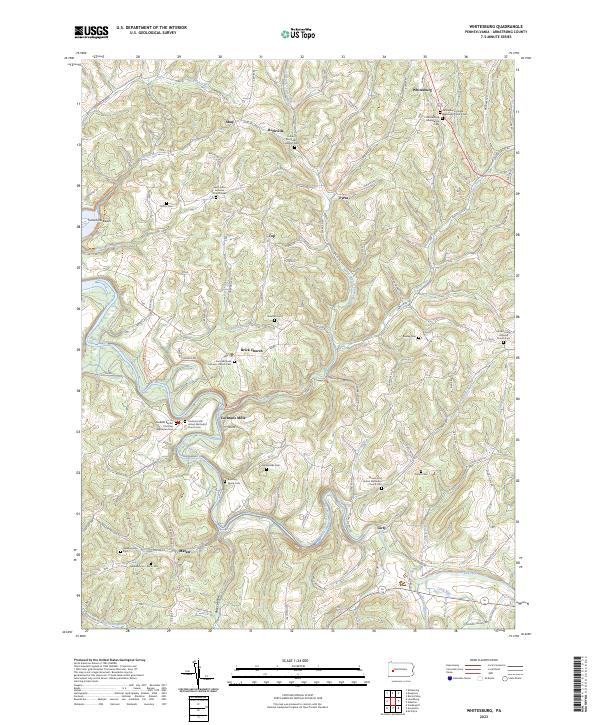 2023 Whitesburg2023 Print · USGSArmstrong County's rural landscape is captured here in the early twenty-first century, showing a network of upland farms and creek valleys. Genealogists can trace family names at Ramaley Family Cem, McDonalds Cem, and the historic settlement of Cochrans Mills.
End of results
Showing maps 1-24 of 24
Top cities of Armstrong County
- Kittanning historical maps
- Ford City historical maps
- North Buffalo Township historical maps
- Leechburg historical maps
- Freeport historical maps
- West Kittanning historical maps
See more
Frequently asked questions
- What are the different types of historical maps available for Armstrong County?
- What is the oldest map of Armstrong County?
- Where can I purchase historical maps of Armstrong County for my home or office?
- Where can I download high-res historical maps of Armstrong County?
- Are there historical topographic maps available for Armstrong County?
- Is there historical aerial imagery available for Armstrong County?
- Where are historical maps of Armstrong County sourced from?