2020s Maps of Columbia Township, Pennsylvania
Explore 4 historic maps of Columbia Township from the 2020s. These maps offer a rare glimpse into what life looked like during the 2020s — showing old roads, neighborhoods, homes, and landmarks that have changed or disappeared over time.
Whether you're researching your family's past, planning a metal detecting trip, or studying how Columbia Township's landscape evolved across the 2020s, these high-resolution maps are a powerful tool for exploring the history of this region.
- Focus on a specific era: All maps on this page are from the 2020s, giving you a focused view of this time period.
- See what’s changed: Compare century-old streets, trails, and buildings to today's modern landscape using overlays and satellite layers.
- Research with precision: Use these maps for genealogy, historical research, land use analysis, or educational projects.
- View, download, or print: Maps are fully viewable online in high resolution, and can be downloaded or printed for your own records.
Start exploring Columbia Township's history through authentic maps from the 2020s. This is your window into the past.
Columbia Township, PA maps
(4)- 2023 Map of Gillett, 2023 Print
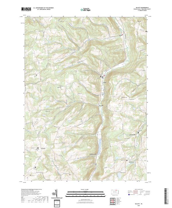 2023 Gillett2023 Print · USGSBradford County's northern highlands come into focus in this contemporary survey of the Pennsylvania borderlands. Genealogists can trace deep family roots through numerous burial grounds including Wolf Settlement Cem, Checkerville Cem, and Baptist Hill Cem.
 - 2023 Map of Millerton, 2023 Print
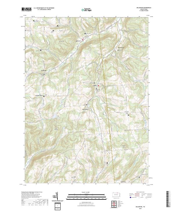 2023 Millerton2023 Print · USGSThe northern Pennsylvania borderlands come into focus in this contemporary survey of the high country between Tioga and Bradford counties. Genealogists can trace family legacies at the Old Daggett Burial Ground, Harris Family Cem, and the small settlement of Jobs Corners.
 - 2023 Map of Troy, 2023 Print
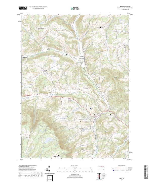 2023 Troy2023 Print · USGSTroy and the surrounding Bradford County valleys are shown here during a period of modern stability. Genealogists can trace family names through numerous burial sites like Grover Hill Cem and Brace Cem or locate old homesteads near Columbia Cross Roads.
 - 2023 Map of Roseville, 2023 Print
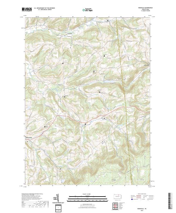 2023 Roseville2023 Print · USGSRoseville and the surrounding Tioga County highlands are captured here in the early twenty-first century. Genealogists can locate family burial sites like Clark Burying Ground, Reynolds Cem, and State Road Cem.
End of results
Showing maps 1-4 of 4
Top cities near Columbia Township
- Southport historical maps
- Elmira historical maps
- Southport historical maps
- Mansfield historical maps
- Chemung historical maps
- Caton historical maps
See more
Top neighborhoods of Columbia Township
- Sopertown historical maps
- Austinville historical maps
- Columbia Cross Roads historical maps
- Snedekerville historical maps
Frequently asked questions
- What are the different types of historical maps available for Columbia Township?
- What is the oldest map of Columbia Township?
- Where can I purchase historical maps of Columbia Township for my home or office?
- Where can I download high-res historical maps of Columbia Township?
- Are there historical topographic maps available for Columbia Township?
- Is there historical aerial imagery available for Columbia Township?
- Where are historical maps of Columbia Township sourced from?