Old Maps of Columbia Township, Pennsylvania for Genealogy
Trace your family roots with 34 historic maps of Columbia Township. These high-res maps reveal old neighborhoods, homesites, landmarks, and streets — helping you uncover where your ancestors lived and how the area evolved over time.
- Explore historic neighborhoods: Identify where your relatives may have lived in the 1800s or 1900s.
- Compare maps over time: Trace the changes in streets, buildings, and landmarks for multi-generational research.
- Perfect for genealogy & ancestry research: Used by family historians and researchers to map out lineage and migration.
These maps are an incredible resource for exploring your personal connection to Columbia Township's past.
Columbia Township, PA maps
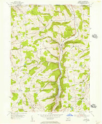
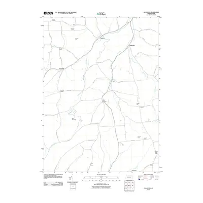
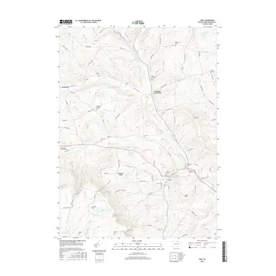
(34)- 1931 Map of Troy
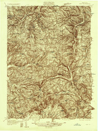 1931 Troy1931 Print · USGSBradford County’s northern valleys and high ridges appear here in the early 1930s, showing a landscape of small hamlets and cross-country rail lines. Genealogists can locate family landmarks such as Besley Cem, Mitchells Mill, and early schools like Doty Hill Sch.2 unique versions available
 - 1938 Map of Troy
 1938 Troy1938 Print · USGSNorthern Bradford and Tioga Counties are captured here in the late 1930s, showing a landscape of upland farms and railroad hamlets. Genealogists can trace family footprints at Roseville Rutland PO, the Armenia Ch, or the Besley Cem.3 unique versions available
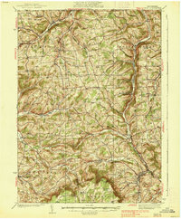
 - 1953 Map of Roseville, 1954 Print
 1953 Roseville1954 Print · USGSTioga and Bradford counties are captured here in the early 1950s, showing a landscape defined by upland farms and quiet crossroads. Researchers can trace ancestral roots at State Road Ch, find early settlements like Austinville, or follow the path of the Roosevelt Highway.2 unique versions available
 - 1954 Map of Williamsport
 1954 Williamsport1954 Print · USGSNorth-central Pennsylvania in the mid-fifties is defined by the winding West Branch Susquehanna River and its industrial valley. Local historians can trace the massive Susquehanna Ordnance Depot and the extensive rail networks of the Pennsylvania Railroad.
 - 1954 Map of Millerton, 1956 Print
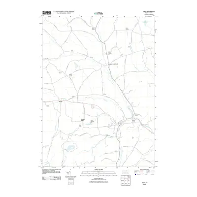
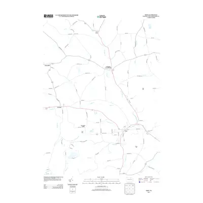
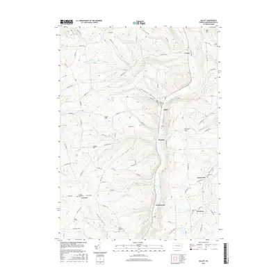
 1954 Millerton1956 Print · USGSTioga County farming communities thrive along the New York border in the mid-fifties, before modern development altered these rural corridors. Researchers can trace family roots at West Jackson Ch or locate vanished homesteads near Pumpkin Hill Cem and Sopertown.4 unique versions available
 - 1954 Map of Gillett, 1956 Print
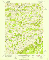
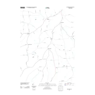
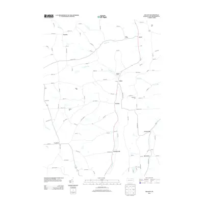
 1954 Gillett1956 Print · USGSNorthern Bradford County's valley farms and rail sidings are frozen in time during the mid-fifties. Researchers can trace family-named landmarks and rural congregations like Baptist Hill Ch, Snedekerville, and the Doty Hill Cem along the PENNSYLVANIA railroad line.4 unique versions available
 - 1957 Map of Troy, 1958 Print
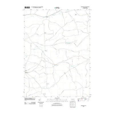
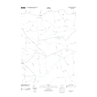
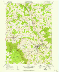 1957 Troy1958 Print · USGSBradford County dairy and rail commerce center on the town of Troy during the mid-fifties. Genealogists can trace family names through numerous rural burial grounds like Sylvania Cem and Hunt Cem, or locate landmarks such as the Lloyd Sch and Austinville.2 unique versions available
 - 1960 Map of Williamsport
 1960 Williamsport1960 Print · USGSNorth-central Pennsylvania in the mid-twentieth century was a vital corridor of rail and river industry stretching from the New York line to the coal regions. Genealogists can trace the rail networks of the Pennsylvania RR and Lehigh Valley RR connecting towns like Williamsport, Towanda, and Lock Haven.
 - 1962 Map of Williamsport, 1966 Print
 1962 Williamsport1966 Print · USGSNorth-central Pennsylvania was a landscape of industrial river hubs and vast state woodlands in the early sixties. Researchers can trace the path of the Pennsylvania Railroad through Williamsport and explore the remote reaches of Bucktail State Park.5 unique versions available
 - 1965 Map of Williamsport
 1965 Williamsport1965 Print · USGSNorth-central Pennsylvania in the mid-1960s is defined by the industrial river towns and vast timberlands of the Allegheny Plateau. Researchers can trace historic rail lines like the Erie Lackawanna and Reading as they thread through Williamsport, Lock Haven, and Jersey Shore.
 - 1966 Map of Williamsport
 1966 Williamsport1966 Print · USGSThe Susquehanna Valley was a hub of transit and industry in the mid-seventies, where the river's West Branch connected major college towns and timberlands. Researchers can trace historical rail lines like the Reading or locate regional landmarks from Jersey Shore to Ricketts Glen State Park.
 - 1981 Map of Towanda, 1982 Print
 1981 Towanda1982 Print · USGSThe Susquehanna Valley at the turn of the 1980s reveals a region of mountain forests and busy river towns along the New York border. Researchers can trace the legacy of the CONRAIL lines through Sayre or locate remote landmarks like Armenia Mountain and Mt Pisgah State Park.
 - 1983 Map of Troy, 1991 Print
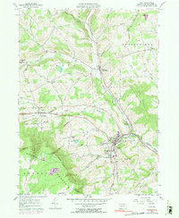 1983 Troy1991 Print · USGSTroy and the surrounding Bradford County uplands are documented here in the early 1980s. Researchers can trace the Penn Central rail line and locate numerous family-named burial sites like Chase-Newbury Cem and Glenwood Cem.
 - 1999 Map of Troy, 2001 Print
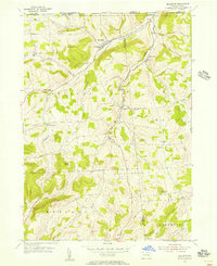
 1999 Troy2001 Print · USGSBradford County at the turn of the millennium reveals a landscape of valley settlements and upland reaches. Genealogists and historians can trace family burial sites like Grover-Hill Cem and old school locations such as Lloyd Sch near Troy.
 - 2010 Map of Millerton, 2010 Print
 2010 Millerton2010 Print · USGSCovers Columbia Township, including Jackson Township, Daggett, and other nearby areas
 - 2010 Map of Gillett, 2010 Print
 2010 Gillett2010 Print · USGSCovers Columbia Township, including Springfield Township, South Creek Township, and other nearby areas
 - 2010 Map of Troy, 2010 Print
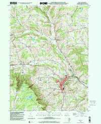
 2010 Troy2010 Print · USGSCovers Columbia Township, including Troy, Springfield Township, and other nearby areas
 - 2010 Map of Roseville, 2010 Print
 2010 Roseville2010 Print · USGSCovers Columbia Township, including Roseville, Sylvania, and other nearby areas
 - 2013 Map of Millerton, 2013 Print
 2013 Millerton2013 Print · USGSCovers Columbia Township, including Jackson Township, Daggett, and other nearby areas
 - 2013 Map of Roseville, 2013 Print
 2013 Roseville2013 Print · USGSCovers Columbia Township, including Roseville, Sylvania, and other nearby areas
 - 2013 Map of Gillett, 2013 Print
 2013 Gillett2013 Print · USGSCovers Columbia Township, including Springfield Township, South Creek Township, and other nearby areas
 - 2013 Map of Troy, 2013 Print
 2013 Troy2013 Print · USGSCovers Columbia Township, including Troy, Springfield Township, and other nearby areas
 - 2016 Map of Gillett, 2016 Print
 2016 Gillett2016 Print · USGSCovers Columbia Township, including Springfield Township, South Creek Township, and other nearby areas
 - 2016 Map of Troy, 2016 Print
 2016 Troy2016 Print · USGSCovers Columbia Township, including Troy, Springfield Township, and other nearby areas
 - 2016 Map of Roseville, 2016 Print
 2016 Roseville2016 Print · USGSCovers Columbia Township, including Roseville, Sylvania, and other nearby areas
Showing maps 1-25 of 34
Top cities near Columbia Township
- Southport historical maps
- Elmira historical maps
- Southport historical maps
- Mansfield historical maps
- Chemung historical maps
- Caton historical maps
See more
Top neighborhoods of Columbia Township
- Sopertown historical maps
- Austinville historical maps
- Columbia Cross Roads historical maps
- Snedekerville historical maps
Frequently asked questions
- What are the different types of historical maps available for Columbia Township?
- What is the oldest map of Columbia Township?
- Where can I purchase historical maps of Columbia Township for my home or office?
- Where can I download high-res historical maps of Columbia Township?
- Are there historical topographic maps available for Columbia Township?
- Is there historical aerial imagery available for Columbia Township?
- Where are historical maps of Columbia Township sourced from?