Old Maps of Herrick Township, Pennsylvania for Hiking & Exploration
Hike through history with 24 historic maps of Herrick Township. Explore old trails, ghost towns, and forgotten backroads — perfect for outdoor adventurers and local explorers.
- Rediscover forgotten places: Map out old mining camps, roads, and footpaths that no longer exist on modern maps.
- Layer with modern tools: Combine with LiDAR or satellite views to plan hikes through historical terrain.
- Made for exploration: Popular among hikers, overlanders, and local history lovers.
Use these maps to find adventure and explore the hidden past of Herrick Township.
Herrick Township, PA maps
(24)- 1923 Map of Towanda
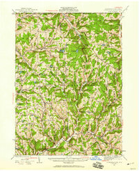
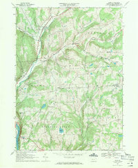
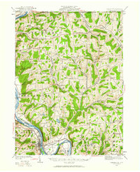 1923 Towanda1923 Print · USGSBradford County in the early twenties shows a bustling river-and-rail landscape centered on the Susquehanna River. Researchers can trace dozens of named schools like Cebu School and Shores Hill School or locate family roots in hamlets like Bumpville and Allis Hollow.
 - 1926 Map of Towanda
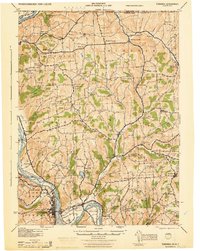
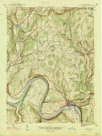
 1926 Towanda1926 Print · USGSBradford County was a landscape of concentrated rural communities and river-valley commerce during the mid-twenties. Genealogists and local historians can trace hundreds of property-level details, from the Cottonhollow School to the banks of Lake Wesauking and Wysox.4 unique versions available
 - 1943 Map of Towanda, 1944 Print
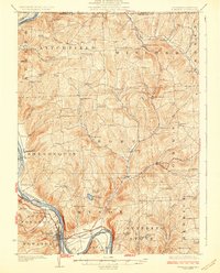
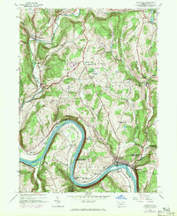
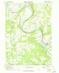
 1943 Towanda1944 Print · USGSTowanda and the Susquehanna River valley are captured here during the mid-1940s, showing a landscape defined by river-rail transit and upland farming. Genealogists can locate dozens of country schools and churches, from Pine Grove Sch to the Bald Eagle Ch.
 - 1943 Map of Monroeton, 1945 Print
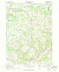
 1943 Monroeton1945 Print · USGSThe Susquehanna River valley and the highlands of Bradford County are captured in detail here during the 1940s. Genealogists and local researchers can trace family landmarks like the French Asylum Church, Homets Ferry, and rural schoolhouses such as Bull Sch.3 unique versions available
 - 1943 Map of Le Raysville, 1960 Print
 1943 Le Raysville1960 Print · USGSNortheastern Pennsylvania hill country is captured here during the mid-forties as it straddled the border of Bradford and Susquehanna counties. Genealogists can trace family names and small-town roots through Little Meadows, Le Raysville, and numerous country burial sites like the Centerville Cem.2 unique versions available
 - 1945 Map of Le Raysville
 1945 Le Raysville1945 Print · USGSThe borderlands of Susquehanna and Bradford counties are captured here in the mid-1940s, showing a landscape of small farming hamlets and upland ridges. Genealogists can trace family roots through numerous remote burial sites and schools like Fowler Hill Cem or Logan Hill Sch.2 unique versions available
 - 1945 Map of Meshoppen, 1952 Print
 1945 Meshoppen1952 Print · USGSNortheastern Pennsylvania hill country and the winding Susquehanna River are captured here in the years following the war. Researchers can trace the legacy of small farming and rail communities through landmarks like Skinners Eddy, Mehoopany Sta, and Golden Hill Sch.4 unique versions available
 - 1945 Map of Laceyville, 1971 Print
 1945 Laceyville1971 Print · USGSThe Susquehanna River loops through Wyoming and Bradford Counties in the 1940s, revealing a landscape of riverside villages and upland farms. Trace the rail-and-river economy through Laceyville, the winding Lehigh Valley railroad, and family-named landmarks like Quicks Bend Cem and Spring Hill Sch.2 unique versions available
 - 1947 Map of Laceyville
 1947 Laceyville1947 Print · USGSThe riverfront communities of Laceyville and Skinners Eddy are captured just after the war as the Lehigh Valley Railroad moved goods along the Susquehanna. Researchers can trace family history through several sites like Merryall Cem and Spring Hill Sch.2 unique versions available
 - 1954 Map of Williamsport
 1954 Williamsport1954 Print · USGSNorth-central Pennsylvania in the mid-fifties is defined by the winding West Branch Susquehanna River and its industrial valley. Local historians can trace the massive Susquehanna Ordnance Depot and the extensive rail networks of the Pennsylvania Railroad.
 - 1960 Map of Williamsport
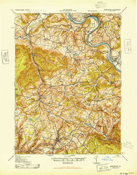
 1960 Williamsport1960 Print · USGSNorth-central Pennsylvania in the mid-twentieth century was a vital corridor of rail and river industry stretching from the New York line to the coal regions. Genealogists can trace the rail networks of the Pennsylvania RR and Lehigh Valley RR connecting towns like Williamsport, Towanda, and Lock Haven.
 - 1962 Map of Williamsport, 1966 Print
 1962 Williamsport1966 Print · USGSNorth-central Pennsylvania was a landscape of industrial river hubs and vast state woodlands in the early sixties. Researchers can trace the path of the Pennsylvania Railroad through Williamsport and explore the remote reaches of Bucktail State Park.5 unique versions available
 - 1965 Map of Williamsport
 1965 Williamsport1965 Print · USGSNorth-central Pennsylvania in the mid-1960s is defined by the industrial river towns and vast timberlands of the Allegheny Plateau. Researchers can trace historic rail lines like the Erie Lackawanna and Reading as they thread through Williamsport, Lock Haven, and Jersey Shore.
 - 1966 Map of Williamsport
 1966 Williamsport1966 Print · USGSThe Susquehanna Valley was a hub of transit and industry in the mid-seventies, where the river's West Branch connected major college towns and timberlands. Researchers can trace historical rail lines like the Reading or locate regional landmarks from Jersey Shore to Ricketts Glen State Park.
 - 1967 Map of Le Raysville, 1971 Print
 1967 Le Raysville1971 Print · USGSThe rolling uplands of Bradford and Susquehanna counties come to life in this late 1960s survey. Genealogists and researchers can trace family landmarks at Stone House Corner, Centerville Cem, and the village of Le Raysville.2 unique versions available
 - 1967 Map of Rome, 1971 Print
 1967 Rome1971 Print · USGSThe uplands of Bradford County are captured in the late sixties, showing the rural network of settlements and cemeteries before modern expansion. You can trace family roots through the Mercur Cem and Keene Summit Ch or follow the Lehigh Valley RR along the Susquehanna River.3 unique versions available
 - 1969 Map of Wyalusing, 1973 Print
 1969 Wyalusing1973 Print · USGSThe Susquehanna River dominates this Bradford County landscape in the 1960s, winding past historic riverfront settlements and railroad lines. You can trace the Lehigh Valley rail route, locate the French Asylum Ch, or explore the river crossing at Homets Ferry.
 - 1981 Map of Towanda, 1982 Print
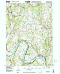
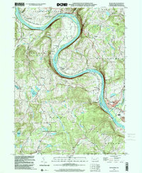
 1981 Towanda1982 Print · USGSThe Susquehanna Valley at the turn of the 1980s reveals a region of mountain forests and busy river towns along the New York border. Researchers can trace the legacy of the CONRAIL lines through Sayre or locate remote landmarks like Armenia Mountain and Mt Pisgah State Park.
 - 1998 Map of Laceyville, 1999 Print
 1998 Laceyville1999 Print · USGSIn the Susquehanna River valley during the late nineties, this area shows the persistent geography of river-bend settlements and mountain gaps. Genealogists can locate family sites at Spring Hill Cem or trace the rural landscape near Spring Hill Sch and Skinners Eddy.
 - 1999 Map of Wyalusing, 2001 Print
 1999 Wyalusing2001 Print · USGSBradford County’s river valley is centered here during the late nineties, where the Susquehanna's dramatic bends shaped local settlement patterns. Genealogists can trace family footprints near French Asylum, Terrytown, and the historic Standing Stone Ch.
 - 2023 Map of Wyalusing, 2023 Print
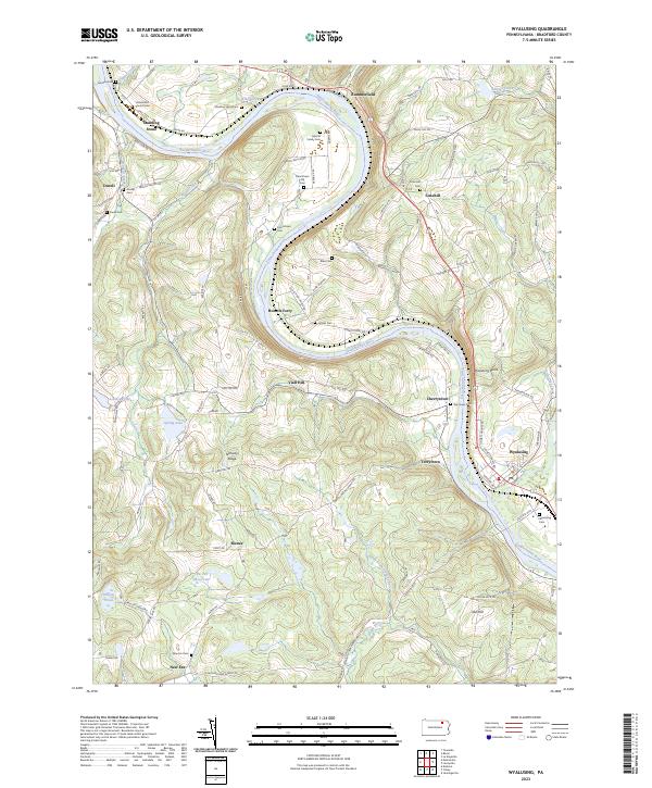 2023 Wyalusing2023 Print · USGSThe winding Susquehanna River defines this Bradford County landscape during the early twenty-first century. Genealogists can trace family names and local history through numerous burial sites like the Laporte Family Cem and the Universalist Church Cem.
 - 2023 Map of Rome, 2023 Print
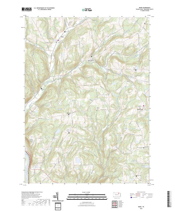 2023 Rome2023 Print · USGSThe Pennsylvania highlands of Bradford County are mapped here in the early twenty-first century, showcasing a rural landscape of winding creek valleys and hilltop settlements. Genealogists can trace family connections at the Ireland Catholic Cem, Rome Cem, and the village of Herrickville.
 - 2023 Map of Laceyville, 2023 Print
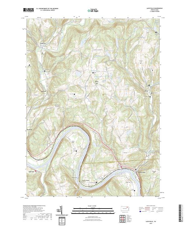 2023 Laceyville2023 Print · USGSThe river bends of the Susquehanna at the Bradford and Wyoming county line come into focus in this detailed topographic view. Researchers can trace numerous family burial sites like Morrow Family Cem and Quimby Cem near settlements like Camptown and Silvara.
 - 2023 Map of Le Raysville, 2023 Print
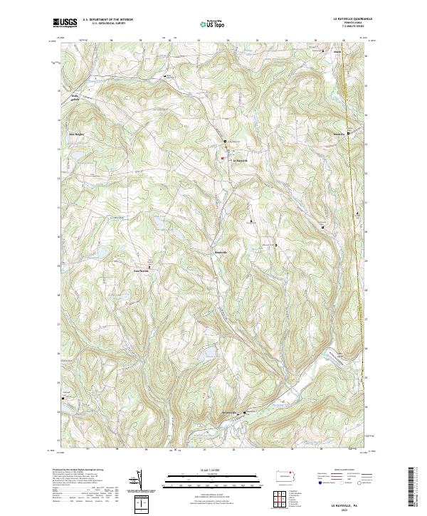 2023 Le Raysville2023 Print · USGSThe northern Pennsylvania highlands near Le Raysville are documented here in detail, showcasing a landscape of family farms and creek-side settlements. Researchers can locate ancestral burial sites like View Cem and Stevensville Cem or trace the winding course of Wyalusing Creek.
End of results
Showing maps 1-24 of 24
Top cities near Herrick Township
- Vestal historical maps
- Owego historical maps
- Barton historical maps
- Towanda historical maps
- Wysox Township historical maps
- Sheshequin Township historical maps
See more
Top neighborhoods of Herrick Township
Frequently asked questions
- What are the different types of historical maps available for Herrick Township?
- What is the oldest map of Herrick Township?
- Where can I purchase historical maps of Herrick Township for my home or office?
- Where can I download high-res historical maps of Herrick Township?
- Are there historical topographic maps available for Herrick Township?
- Is there historical aerial imagery available for Herrick Township?
- Where are historical maps of Herrick Township sourced from?