Old Maps of Bradford County, Pennsylvania for Metal Detecting
Plan your next treasure hunt with 254 historic maps of Bradford County. Find old homesites, ghost towns, trails, and gathering spots that may be lost to time — perfect for identifying promising metal detecting locations.
- Locate forgotten sites: Uncover places like long-lost settlements, abandoned rail lines, or gathering spots.
- Plan better hunts: Use map overlays combined with LiDAR or satellite views to narrow in on historically rich areas.
- Made for detectorists: Thousands of hobbyists use these maps to discover relics, coins, and hidden history.
Use these historic maps to boost your research and find new opportunities beneath the surface of Bradford County.
Bradford County, PA maps
(254)- 1895 Map of Elmira
 1895 Elmira1895 Print · USGSChemung County and the northern Pennsylvania border appear as a thriving rail hub in the 1890s. Genealogists and local historians can trace the early grids of Elmira, the important rail junctions at State Line Junction, and family-named landmarks like Hawley Hill.10 unique versions available
 - 1902 Map of Waverly
 1902 Waverly1902 Print · USGSThe Chemung River valley and the Pennsylvania borderlands come alive in this turn-of-the-century survey of Tioga and Chemung counties. Genealogists and rail historians can trace defunct stations and crossroads like Van Etten Junction, Owens Mills, and the village of Wellsburg.7 unique versions available
 - 1905 Map of Watkins Glen
 1905 Watkins Glen1905 Print · USGSThe Finger Lakes and Southern Tier regions are captured at the start of the century, showing a landscape defined by deep glens and heavy rail. Genealogists and historians can trace the paths of the Northern Central RR through Watkins or locate family sites near Burdett and Horseheads.4 unique versions available
 - 1923 Map of Towanda
 1923 Towanda1923 Print · USGSBradford County in the early twenties shows a bustling river-and-rail landscape centered on the Susquehanna River. Researchers can trace dozens of named schools like Cebu School and Shores Hill School or locate family roots in hamlets like Bumpville and Allis Hollow.
 - 1926 Map of Towanda
 1926 Towanda1926 Print · USGSBradford County was a landscape of concentrated rural communities and river-valley commerce during the mid-twenties. Genealogists and local historians can trace hundreds of property-level details, from the Cottonhollow School to the banks of Lake Wesauking and Wysox.4 unique versions available
 - 1931 Map of Troy
 1931 Troy1931 Print · USGSBradford County’s northern valleys and high ridges appear here in the early 1930s, showing a landscape of small hamlets and cross-country rail lines. Genealogists can locate family landmarks such as Besley Cem, Mitchells Mill, and early schools like Doty Hill Sch.2 unique versions available
 - 1938 Map of Troy
 1938 Troy1938 Print · USGSNorthern Bradford and Tioga Counties are captured here in the late 1930s, showing a landscape of upland farms and railroad hamlets. Genealogists can trace family footprints at Roseville Rutland PO, the Armenia Ch, or the Besley Cem.3 unique versions available
 - 1939 Map of Sayre, 1966 Print
 1939 Sayre1966 Print · USGSBradford County’s river valleys and upland farms are captured here just before the war, when the Lehigh Valley Railroad powered the bustling junction at Sayre. Researchers can trace old family sites at Ayers Crossroads, local landmarks like Luthers Mills, and several rural schools including Harkness Sch.
 - 1942 Map of Sayre
 1942 Sayre1942 Print · USGSThe river confluence at Sayre and Athens stands as a major rail and industrial center in the years before the war. Family historians can trace rural roots through numerous upland landmarks like Harkness Cem, Riggs Ch, and the Doty Hill Sch.2 unique versions available
 - 1942 Map of Canton, 1958 Print
 1942 Canton1958 Print · USGSCanton and the surrounding Bradford County highlands are shown here in the early 1940s as a landscape of small valley towns and mountain schools. Genealogists and historians can trace old homesteads and local landmarks like Minnequa, Cowley Sta, and Ward Sch.2 unique versions available
 - 1943 Map of Towanda, 1944 Print
 1943 Towanda1944 Print · USGSTowanda and the Susquehanna River valley are captured here during the mid-1940s, showing a landscape defined by river-rail transit and upland farming. Genealogists can locate dozens of country schools and churches, from Pine Grove Sch to the Bald Eagle Ch.
 - 1943 Map of Monroeton, 1945 Print
 1943 Monroeton1945 Print · USGSThe Susquehanna River valley and the highlands of Bradford County are captured in detail here during the 1940s. Genealogists and local researchers can trace family landmarks like the French Asylum Church, Homets Ferry, and rural schoolhouses such as Bull Sch.3 unique versions available
 - 1943 Map of Powell, 1955 Print
 1943 Powell1955 Print · USGSIn the early 1940s, the mountainous terrain of Bradford and Sullivan counties supported remote settlements and forest industries along the Schrader Creek corridor. Genealogists and historians can locate legacy sites like the Friends Meeting House, the Sugar Ridge Ch, and the isolated Barclay Station.2 unique versions available
 - 1943 Map of Le Raysville, 1960 Print
 1943 Le Raysville1960 Print · USGSNortheastern Pennsylvania hill country is captured here during the mid-forties as it straddled the border of Bradford and Susquehanna counties. Genealogists can trace family names and small-town roots through Little Meadows, Le Raysville, and numerous country burial sites like the Centerville Cem.2 unique versions available
 - 1944 Map of Canton
 1944 Canton1944 Print · USGSNorth-central Pennsylvania’s rugged creek valleys and rail corridors are captured here just as the mountain economies were shifting in the early 1940s. Genealogists can trace family footprints at Spencertown and Dogtown, or locate rural landmarks like the Joe Hill Sch and Maple Summit Ch.3 unique versions available
 - 1945 Map of Le Raysville
 1945 Le Raysville1945 Print · USGSThe borderlands of Susquehanna and Bradford counties are captured here in the mid-1940s, showing a landscape of small farming hamlets and upland ridges. Genealogists can trace family roots through numerous remote burial sites and schools like Fowler Hill Cem or Logan Hill Sch.2 unique versions available
 - 1945 Map of Powell
 1945 Powell1945 Print · USGSBradford and Sullivan Counties at the end of the Second World War show a landscape of deep valleys and highland settlements. Researchers can locate local landmarks like the Friends Meeting House, the East Sch (abandoned), and old rail stops at Barclay Station.3 unique versions available
 - 1945 Map of Meshoppen, 1952 Print
 1945 Meshoppen1952 Print · USGSNortheastern Pennsylvania hill country and the winding Susquehanna River are captured here in the years following the war. Researchers can trace the legacy of small farming and rail communities through landmarks like Skinners Eddy, Mehoopany Sta, and Golden Hill Sch.4 unique versions available
 - 1945 Map of Auburn Center, 1956 Print
 1945 Auburn Center1956 Print · USGSSusquehanna County farming communities are captured here in the mid-1940s, showing a landscape of small hamlets and family-named hills. Researchers can locate specific homesteads near Auburn Center, Boles Cem., and several rural churches like Shannon Hill Ch.6 unique versions available
 - 1945 Map of Jenningsville, 1956 Print
 1945 Jenningsville1956 Print · USGSWyoming County's rural heartland is captured here just after the war, showing a landscape of upland ridges and creek-side settlements. Genealogists and historians can trace old homesteads and landmarks like Robinson Cem, Golden Hill Sch, and the winding North Branch Mehoopany Creek.4 unique versions available
 - 1945 Map of Laceyville, 1971 Print
 1945 Laceyville1971 Print · USGSThe Susquehanna River loops through Wyoming and Bradford Counties in the 1940s, revealing a landscape of riverside villages and upland farms. Trace the rail-and-river economy through Laceyville, the winding Lehigh Valley railroad, and family-named landmarks like Quicks Bend Cem and Spring Hill Sch.2 unique versions available
 - 1947 Map of Jenningsville
 1947 Jenningsville1947 Print · USGSWyoming County at the close of the 1940s reveals a landscape of river-valley industry and upland farming. Trace the path of the Lehigh Valley Railroad or locate ancestral sites like Sugar Hill Sch and Robinson Cem.2 unique versions available
 - 1947 Map of Auburn Center
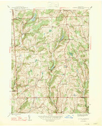 1947 Auburn Center1947 Print · USGSSusquehanna County in the late 1940s is a landscape of high ridges and rural crossroads communities. Genealogists and local historians can trace family locations near Boles Cem. or investigate old community centers like Retta, Rushboro, and South Auburn.2 unique versions available
 - 1947 Map of Laceyville
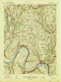 1947 Laceyville1947 Print · USGSThe riverfront communities of Laceyville and Skinners Eddy are captured just after the war as the Lehigh Valley Railroad moved goods along the Susquehanna. Researchers can trace family history through several sites like Merryall Cem and Spring Hill Sch.2 unique versions available
 - 1948 Map of Sayre
 1948 Sayre1948 Print · USGSThe twin rivers of Bradford County meet in the late 1940s, defining a landscape shaped by the Lehigh Valley railroad and valley agriculture. Genealogists can trace early homesteads and landmarks like Harknessburg Cem, Doty Hill Sch, and Ridgebury Chapel.3 unique versions available
Showing maps 1-25 of 254
Top cities of Bradford County
- Sayre historical maps
- Athens historical maps
- Towanda historical maps
- Wysox Township historical maps
- Canton historical maps
- Troy historical maps
See more
Frequently asked questions
- What are the different types of historical maps available for Bradford County?
- What is the oldest map of Bradford County?
- Where can I purchase historical maps of Bradford County for my home or office?
- Where can I download high-res historical maps of Bradford County?
- Are there historical topographic maps available for Bradford County?
- Is there historical aerial imagery available for Bradford County?
- Where are historical maps of Bradford County sourced from?