2020s Maps of Bradford County, Pennsylvania
Explore 34 historic maps of Bradford County from the 2020s. These maps offer a rare glimpse into what life looked like during the 2020s — showing old roads, neighborhoods, homes, and landmarks that have changed or disappeared over time.
Whether you're researching your family's past, planning a metal detecting trip, or studying how Bradford County's landscape evolved across the 2020s, these high-resolution maps are a powerful tool for exploring the history of this region.
- Focus on a specific era: All maps on this page are from the 2020s, giving you a focused view of this time period.
- See what’s changed: Compare century-old streets, trails, and buildings to today's modern landscape using overlays and satellite layers.
- Research with precision: Use these maps for genealogy, historical research, land use analysis, or educational projects.
- View, download, or print: Maps are fully viewable online in high resolution, and can be downloaded or printed for your own records.
Start exploring Bradford County's history through authentic maps from the 2020s. This is your window into the past.
Bradford County, PA maps
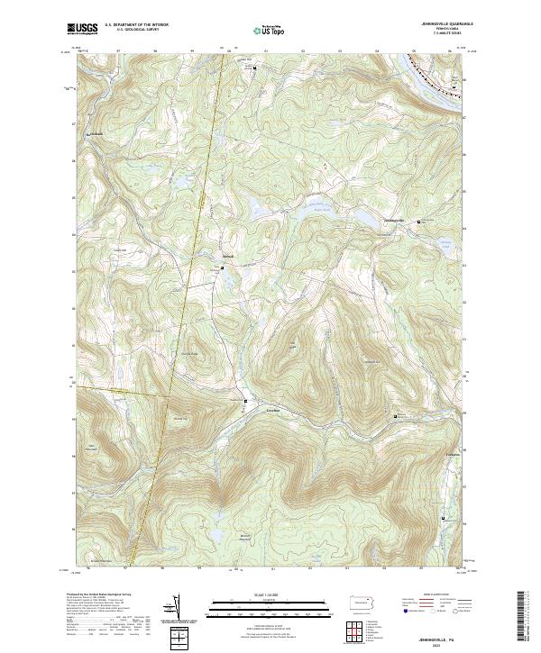
(34)- 2023 Map of Leroy, 2023 Print
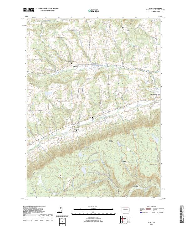 2023 Leroy2023 Print · USGSBradford County’s southern highlands and Towanda Creek valley are shown here in modern detail. Genealogists can locate family sites like the Mott Family Cem and Holcomb Cem, or trace the old industrial footprints at Carbon and Laquin.
 - 2023 Map of Towanda, 2023 Print
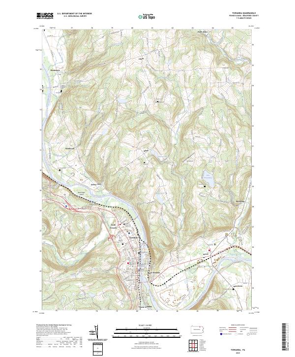 2023 Towanda2023 Print · USGSThe Susquehanna River corridor in Bradford County shows a mature landscape of river towns and upland hamlets in the early twenty-first century. Researchers can trace family history through numerous burial grounds like Wysox Cem or locate the Bradford County Courthouse in the heart of Towanda.
 - 2023 Map of Gillett, 2023 Print
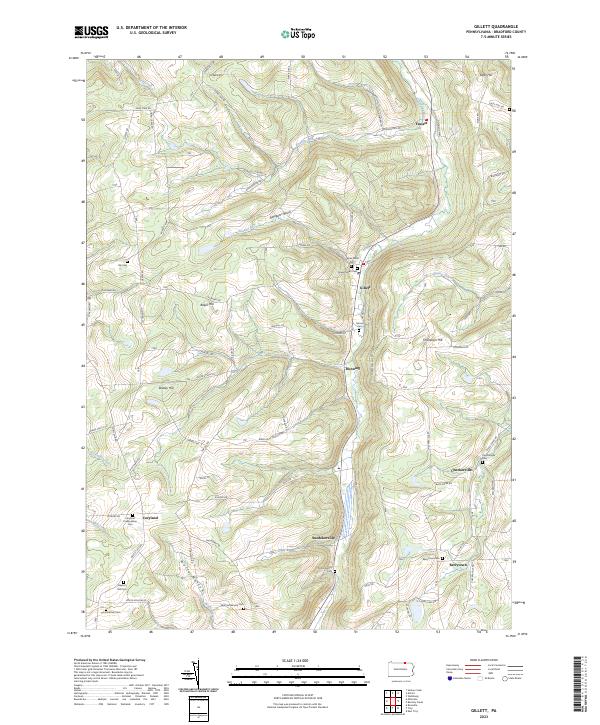 2023 Gillett2023 Print · USGSBradford County's northern highlands come into focus in this contemporary survey of the Pennsylvania borderlands. Genealogists can trace deep family roots through numerous burial grounds including Wolf Settlement Cem, Checkerville Cem, and Baptist Hill Cem.
 - 2023 Map of Monroeton, 2023 Print
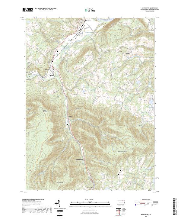 2023 Monroeton2023 Print · USGSThe Towanda Creek valley and surrounding Pennsylvania highlands are captured here in recent years, showing the area's rural character and mountain terrain. Genealogists can locate several burial sites including Kellogg Cem and Scrivens Hollow Cem near the banks of South Branch Towanda Creek.
 - 2023 Map of Gleason, 2023 Print
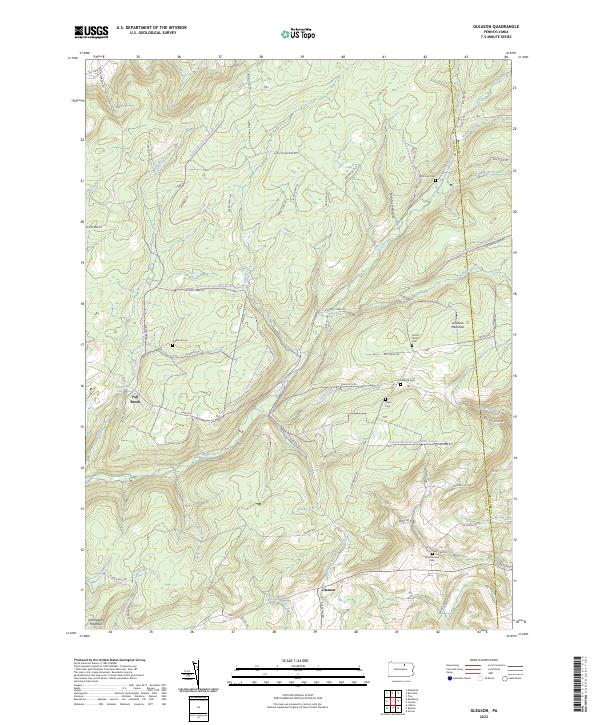 2023 Gleason2023 Print · USGSTioga County is captured in this contemporary survey of the high plateaus and creek valleys along the Bradford County border. Genealogists and local historians can trace family roots through several small burial grounds like North Union Cem, Segur Cem, and Fallbrook Cem.
 - 2023 Map of Powell, 2023 Print
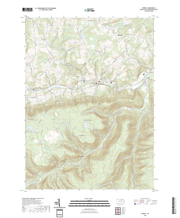 2023 Powell2023 Print · USGSBradford County’s highlands and creek valleys are captured in this recent survey of rural Pennsylvania. Genealogists and local historians can trace family plots like Willey Family Cem and Powell Cem or follow the path of Schrader Creek.
 - 2023 Map of Lawton, 2023 Print
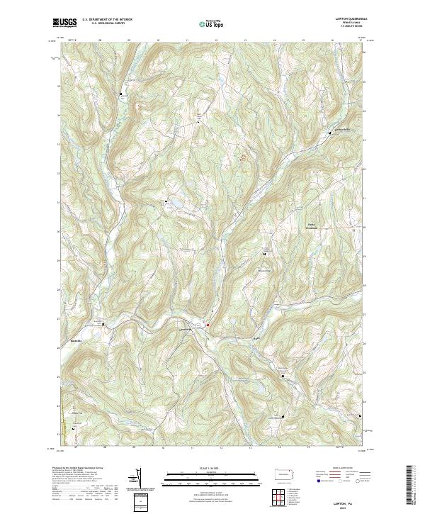 2023 Lawton2023 Print · USGSSusquehanna County at the start of the 2020s shows a landscape deeply rooted in its valley settlements and family heritage. Genealogists can trace local history through numerous sites like County Home Cem, Saint Johns Cem, and the village of Lawton.
 - 2023 Map of Wyalusing, 2023 Print
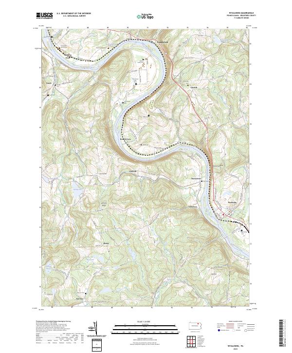 2023 Wyalusing2023 Print · USGSThe winding Susquehanna River defines this Bradford County landscape during the early twenty-first century. Genealogists can trace family names and local history through numerous burial sites like the Laporte Family Cem and the Universalist Church Cem.
 - 2023 Map of Ralston, 2023 Print
 2023 Ralston2023 Print · USGSNorthern Lycoming County settlements follow the path of Lycoming Creek in this contemporary survey of the Pennsylvania mountains. Genealogists can locate numerous burial sites such as Ralston Cem, Mcintyre Cem, and Newelltown Cem.
 - 2023 Map of Shunk, 2023 Print
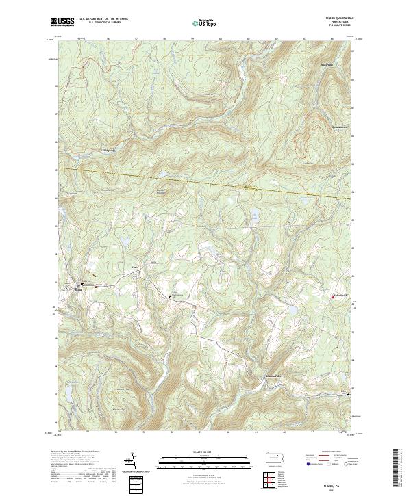 2023 Shunk2023 Print · USGSSullivan and Bradford Counties are shown in the early 2020s, featuring a network of mountain hamlets and old forest trails. Researchers can locate early burial grounds like Quaker Cem, find the Elkland Meetinghouse, and trace local landmarks such as Buttermilk Falls.
 - 2023 Map of Rome, 2023 Print
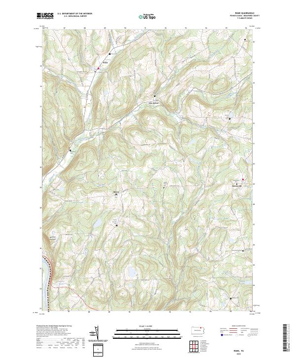 2023 Rome2023 Print · USGSThe Pennsylvania highlands of Bradford County are mapped here in the early twenty-first century, showcasing a rural landscape of winding creek valleys and hilltop settlements. Genealogists can trace family connections at the Ireland Catholic Cem, Rome Cem, and the village of Herrickville.
 - 2023 Map of Sayre, 2023 Print
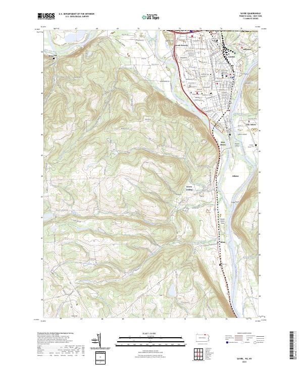 2023 Sayre2023 Print · USGSThe confluence of the Chemung River and Susquehanna River highlights this late-era survey of the Penn-York border. Researchers can trace family history at Tioga Point Cemetery, the Queen Esther Flats, and the older Old Athens Cemetery.
 - 2023 Map of Laceyville, 2023 Print
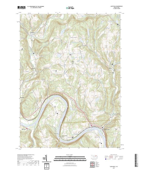 2023 Laceyville2023 Print · USGSThe river bends of the Susquehanna at the Bradford and Wyoming county line come into focus in this detailed topographic view. Researchers can trace numerous family burial sites like Morrow Family Cem and Quimby Cem near settlements like Camptown and Silvara.
 - 2023 Map of Bentley Creek, 2023 Print
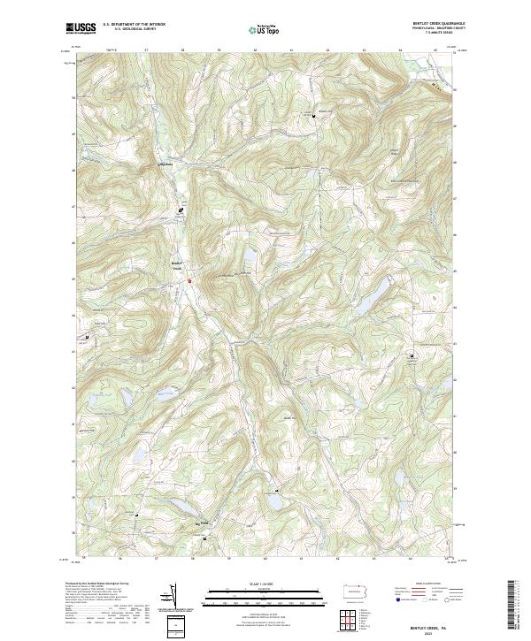 2023 Bentley Creek2023 Print · USGSBradford County's uplands are meticulously detailed here in the 2020s, showing a landscape defined by small hamlets and family farmsteads. Genealogists can locate numerous burial sites like Bentley Creek Cem and Crandal Cem near the shores of Lake Ondawa.
 - 2023 Map of Canton, 2023 Print
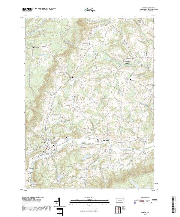 2023 Canton2023 Print · USGSIn this northern Pennsylvania landscape, the valley of Towanda Creek connects a series of traditional Bradford County villages. Researchers can trace family history through a high density of rural burial grounds, including Alba Cem, East Canton Cem, and Spaulding Cem.
 - 2023 Map of Millerton, 2023 Print
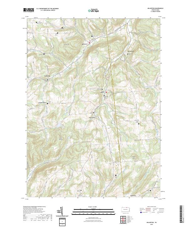 2023 Millerton2023 Print · USGSThe northern Pennsylvania borderlands come into focus in this contemporary survey of the high country between Tioga and Bradford counties. Genealogists can trace family legacies at the Old Daggett Burial Ground, Harris Family Cem, and the small settlement of Jobs Corners.
 - 2023 Map of East Troy, 2023 Print
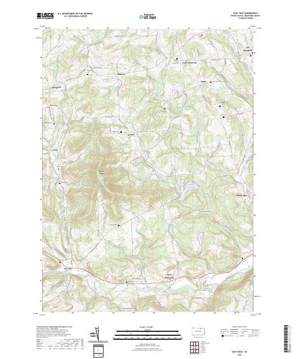 2023 East Troy2023 Print · USGSBradford County's rural highlands are meticulously detailed in this recent survey, showcasing a landscape defined by small family farmsteads and deep valleys. Genealogists can trace ancestral sites at the Old Methodist Church Cem, Rice Family Cem, and the village of Bourne Mills.
 - 2023 Map of Jenningsville, 2023 Print
 2023 Jenningsville2023 Print · USGSWyoming County communities near the Susquehanna River are documented here in recent decades as they maintain their rural heritage. Researchers can locate family burial sites like the Winslow Family Plot and trace old routes through Lovelton and Stowell.
 - 2023 Map of Auburn Center, 2023 Print
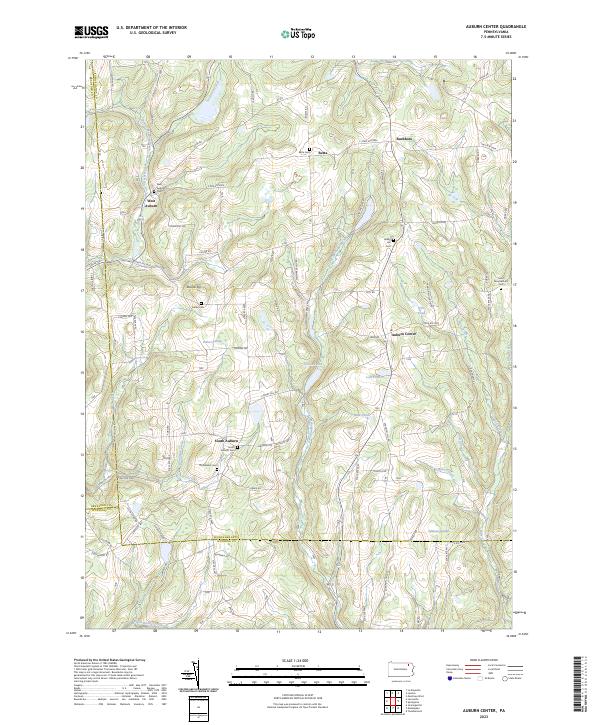 2023 Auburn Center2023 Print · USGSThe rural borderlands of Susquehanna and Wyoming Counties appear in this modern survey of the Auburn highlands. Researchers can trace family history through numerous burial sites like Bolles Cem and the small hamlets of West Auburn and Retta.
 - 2023 Map of Dushore, 2023 Print
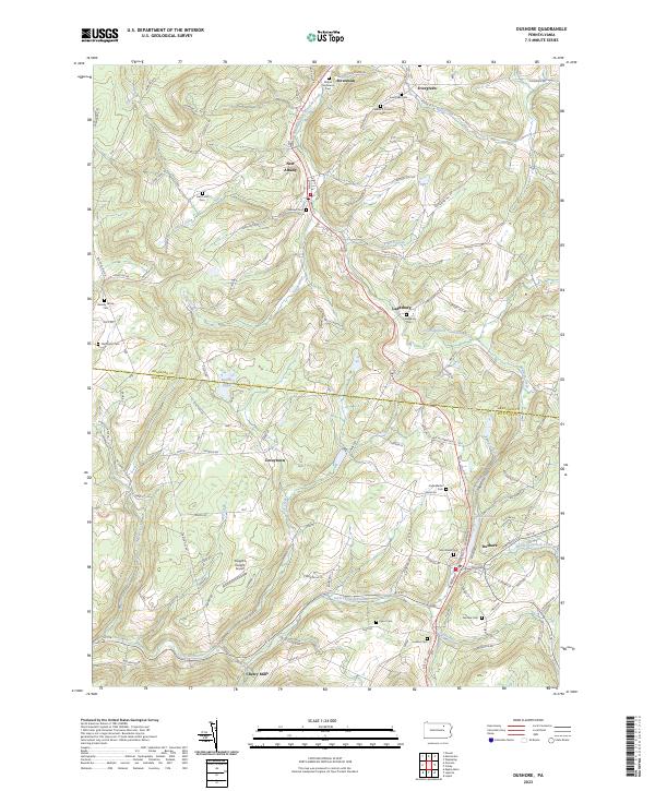 2023 Dushore2023 Print · USGSSullivan and Bradford counties appear in this modern survey of the uplands surrounding the Dushore borough. Genealogists can locate family burial grounds like the Heverly Family Cem and trace the paths of Little Loyalsock Creek through Cherry Mills.
 - 2023 Map of Le Raysville, 2023 Print
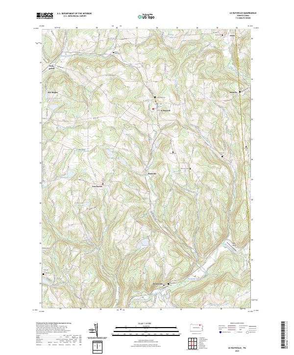 2023 Le Raysville2023 Print · USGSThe northern Pennsylvania highlands near Le Raysville are documented here in detail, showcasing a landscape of family farms and creek-side settlements. Researchers can locate ancestral burial sites like View Cem and Stevensville Cem or trace the winding course of Wyalusing Creek.
 - 2023 Map of Little Meadows, 2023 Print
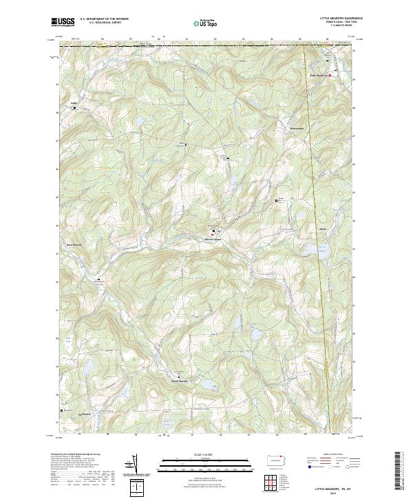 2023 Little Meadows2023 Print · USGSThe rolling hill country of the Pennsylvania-New York border comes into focus in this recent survey. Researchers can trace family history through sites like the Albert Brainard Family Cem, Cadis Cem, and the community of Warren Center.
 - 2023 Map of Litchfield, 2023 Print
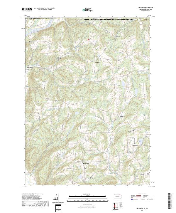 2023 Litchfield2023 Print · USGSThe Pennsylvania-New York borderlands are shown here in recent detail, where the Susquehanna River meets the high ridges of Bradford County. Genealogists can locate family burial sites at the Merrill Family Cem or trace old routes through Bumpville and North Ghent.
 - 2023 Map of Overton, 2023 Print
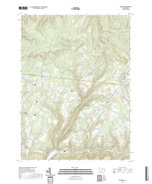 2023 Overton2023 Print · USGSThe Sullivan and Bradford county border region is shown here in the modern era, featuring upland mountain settlements and numerous family cemeteries. Locate local landmarks like Overton, Estella, and the Saint Francis Xavier Cem.
 - 2023 Map of Troy, 2023 Print
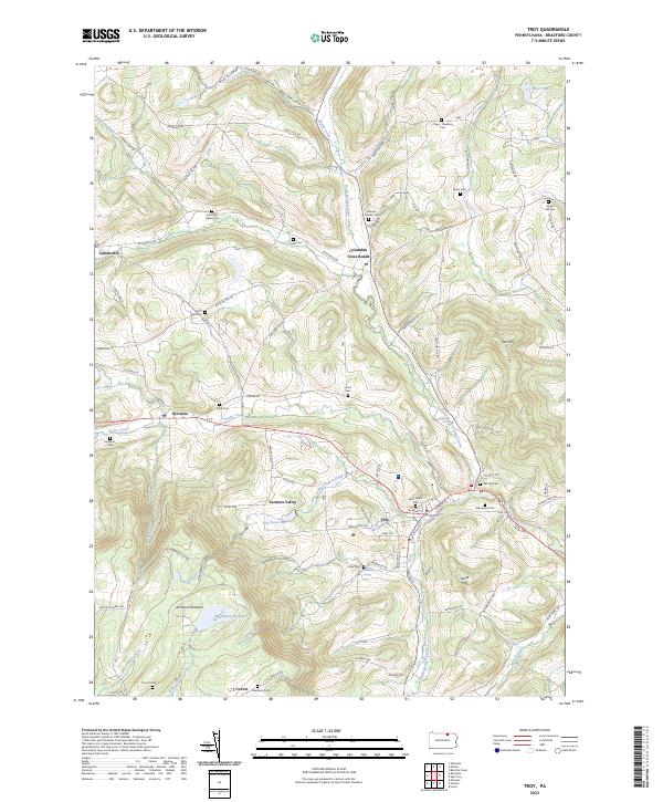 2023 Troy2023 Print · USGSTroy and the surrounding Bradford County valleys are shown here during a period of modern stability. Genealogists can trace family names through numerous burial sites like Grover Hill Cem and Brace Cem or locate old homesteads near Columbia Cross Roads.
Showing maps 1-25 of 34
Top cities of Bradford County
- Sayre historical maps
- Athens historical maps
- Towanda historical maps
- Wysox Township historical maps
- Canton historical maps
- Troy historical maps
See more
Frequently asked questions
- What are the different types of historical maps available for Bradford County?
- What is the oldest map of Bradford County?
- Where can I purchase historical maps of Bradford County for my home or office?
- Where can I download high-res historical maps of Bradford County?
- Are there historical topographic maps available for Bradford County?
- Is there historical aerial imagery available for Bradford County?
- Where are historical maps of Bradford County sourced from?