1900s (20th Century) Maps of Boggs Township, Pennsylvania
Explore 34 historic maps of Boggs Township from the 1900s (20th Century). These maps offer a rare glimpse into what life looked like during the 1900s — showing old roads, neighborhoods, homes, and landmarks that have changed or disappeared over time.
Whether you're researching your family's past, planning a metal detecting trip, or studying how Boggs Township's landscape evolved across the 1900s, these high-resolution maps are a powerful tool for exploring the history of this region.
- Focus on a specific era: All maps on this page are from the 1900s, giving you a focused view of this time period.
- See what’s changed: Compare century-old streets, trails, and buildings to today's modern landscape using overlays and satellite layers.
- Research with precision: Use these maps for genealogy, historical research, land use analysis, or educational projects.
- View, download, or print: Maps are fully viewable online in high resolution, and can be downloaded or printed for your own records.
Start exploring Boggs Township's history through authentic maps from the 1900s. This is your window into the past.
Boggs Township, PA maps
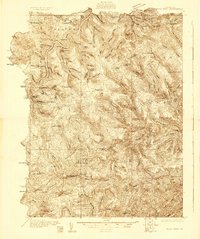
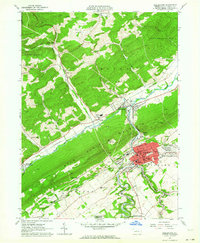
(34)- 1908 Map of Bellefonte, 1956 Print
 1908 Bellefonte1956 Print · USGSCovers Boggs Township, including State College, Bellefonte, and other nearby areas3 unique versions available
 - 1909 Map of Bellefonte
 1909 Bellefonte1909 Print · USGSCovers Boggs Township, including State College, Bellefonte, and other nearby areas7 unique versions available
 - 1921 Map of Howard
 1921 Howard1921 Print · USGSCovers Boggs Township, including Lamar, Beech Creek, and other nearby areas3 unique versions available
 - 1923 Map of Howard
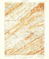
 1923 Howard1923 Print · USGSCovers Boggs Township, including Lamar, Beech Creek, and other nearby areas6 unique versions available
 - 1924 Map of Centre Hall, 1958 Print
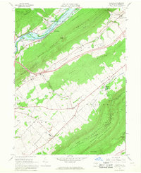
 1924 Centre Hall1958 Print · USGSCovers Boggs Township, including Bellefonte, Pleasant Gap, and other nearby areas2 unique versions available
 - 1928 Map of Snow Shoe
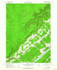
 1928 Snow Shoe1928 Print · USGSCovers Boggs Township, including Snow Shoe, Old Side, and other nearby areas5 unique versions available
 - 1929 Map of Centre Hall
 1929 Centre Hall1929 Print · USGSCovers Boggs Township, including Bellefonte, Pleasant Gap, and other nearby areas4 unique versions available
 - 1931 Map of Show Shoe
 1931 Show Shoe1931 Print · USGSCovers Boggs Township, including Snow Shoe, Old Side, and other nearby areas3 unique versions available
 - 1943 Map of Lewistown
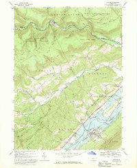
 1943 Lewistown1943 Print · USGSCovers Boggs Township, including State College, Lewistown, and other nearby areas
 - 1950 Map of Harrisburg, 1952 Print
 1950 Harrisburg1952 Print · USGSCovers Boggs Township, including Lancaster, Harrisburg, and other nearby areas
 - 1954 Map of Williamsport
 1954 Williamsport1954 Print · USGSCovers Boggs Township, including Vestal, Williamsport, and other nearby areas
 - 1957 Map of Harrisburg
 1957 Harrisburg1957 Print · USGSCovers Boggs Township, including Lancaster, Harrisburg, and other nearby areas7 unique versions available
 - 1960 Map of Williamsport
 1960 Williamsport1960 Print · USGSCovers Boggs Township, including Vestal, Williamsport, and other nearby areas
 - 1960 Map of Snow Shoe SE, 1962 Print
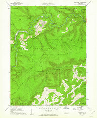 1960 Snow Shoe SE1962 Print · USGSCovers Boggs Township, including Kato, Howard Township, and other nearby areas4 unique versions available
 - 1960 Map of Snow Shoe, 1963 Print
 1960 Snow Shoe1963 Print · USGSCovers Boggs Township, including Snow Shoe, Old Side, and other nearby areas4 unique versions available
 - 1961 Map of Harrisburg
 1961 Harrisburg1961 Print · USGSCovers Boggs Township, including Lancaster, Harrisburg, and other nearby areas2 unique versions available
 - 1962 Map of Bellefonte, 1964 Print
 1962 Bellefonte1964 Print · USGSCovers Boggs Township, including Bellefonte, Pleasant Gap, and other nearby areas2 unique versions available
 - 1962 Map of Bear Knob, 1964 Print
 1962 Bear Knob1964 Print · USGSCovers Boggs Township, including Unionville, Rush Township, and other nearby areas2 unique versions available
 - 1962 Map of Williamsport, 1966 Print
 1962 Williamsport1966 Print · USGSCovers Boggs Township, including Vestal, Williamsport, and other nearby areas5 unique versions available
 - 1964 Map of Harrisburg
 1964 Harrisburg1964 Print · USGSCovers Boggs Township, including Lancaster, Harrisburg, and other nearby areas
 - 1965 Map of Williamsport
 1965 Williamsport1965 Print · USGSCovers Boggs Township, including Vestal, Williamsport, and other nearby areas
 - 1966 Map of Williamsport
 1966 Williamsport1966 Print · USGSCovers Boggs Township, including Vestal, Williamsport, and other nearby areas
 - 1966 Map of Mingoville, 1968 Print
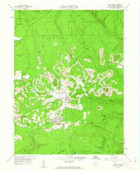
 1966 Mingoville1968 Print · USGSCovers Boggs Township, including Bellefonte, Pleasant Gap, and other nearby areas4 unique versions available
 - 1967 Map of Howard, 1969 Print
 1967 Howard1969 Print · USGSCovers Boggs Township, including Howard, Big Run, and other nearby areas3 unique versions available
 - 1977 Map of Mingoville, 1979 Print
 1977 Mingoville1979 Print · USGSCovers Boggs Township, including Bellefonte, Pleasant Gap, and other nearby areas
Showing maps 1-25 of 34
Top cities near Boggs Township
- State College historical maps
- Bellefonte historical maps
- Pleasant Gap historical maps
- Houserville historical maps
- Milesburg historical maps
- Centre Hall historical maps
See more
Top neighborhoods of Boggs Township
- Rhoads historical maps
- Yarnell historical maps
- Central City historical maps
- Dry Top historical maps
- Fetzertown historical maps
- Gum Stump historical maps
See more
Frequently asked questions
- What are the different types of historical maps available for Boggs Township?
- What is the oldest map of Boggs Township?
- Where can I purchase historical maps of Boggs Township for my home or office?
- Where can I download high-res historical maps of Boggs Township?
- Are there historical topographic maps available for Boggs Township?
- Is there historical aerial imagery available for Boggs Township?
- Where are historical maps of Boggs Township sourced from?