1960s Maps of Boggs Township, Pennsylvania
Explore 12 historic maps of Boggs Township from the 1960s. These maps offer a rare glimpse into what life looked like during the 1960s — showing old roads, neighborhoods, homes, and landmarks that have changed or disappeared over time.
Whether you're researching your family's past, planning a metal detecting trip, or studying how Boggs Township's landscape evolved across the 1960s, these high-resolution maps are a powerful tool for exploring the history of this region.
- Focus on a specific era: All maps on this page are from the 1960s, giving you a focused view of this time period.
- See what’s changed: Compare century-old streets, trails, and buildings to today's modern landscape using overlays and satellite layers.
- Research with precision: Use these maps for genealogy, historical research, land use analysis, or educational projects.
- View, download, or print: Maps are fully viewable online in high resolution, and can be downloaded or printed for your own records.
Start exploring Boggs Township's history through authentic maps from the 1960s. This is your window into the past.
Boggs Township, PA maps
(12)- 1960 Map of Williamsport
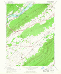
 1960 Williamsport1960 Print · USGSNorth-central Pennsylvania in the mid-twentieth century was a vital corridor of rail and river industry stretching from the New York line to the coal regions. Genealogists can trace the rail networks of the Pennsylvania RR and Lehigh Valley RR connecting towns like Williamsport, Towanda, and Lock Haven.
 - 1960 Map of Snow Shoe SE, 1962 Print
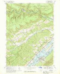
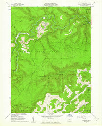 1960 Snow Shoe SE1962 Print · USGSThe industrial and forest landscapes of central Pennsylvania are captured here at the start of the 1960s. Researchers can trace the path of the New York Central and Hudson River RR through the Hogback Tunnel or locate family roots at Summit Hill Cem and Orviston.4 unique versions available
 - 1960 Map of Snow Shoe, 1963 Print
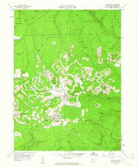 1960 Snow Shoe1963 Print · USGSIn the early sixties, the coal-rich highlands of Centre County were defined by active extraction and small mountain settlements. Genealogists and historians can locate family cemeteries like St Marys Cem and trace the winding paths of the New York Central through Snow Shoe and Clarence.4 unique versions available
 - 1961 Map of Harrisburg
 1961 Harrisburg1961 Print · USGSCentral Pennsylvania is shown at a mid-century peak of industrial and military activity, from the Susquehanna water gaps to the fertile Dutch Country. Genealogists and historians can trace the rail corridors of the Pennsylvania RR and find landmarks like Carlisle Barracks or the Anthracite Coal Fields.2 unique versions available
 - 1962 Map of Bellefonte, 1964 Print
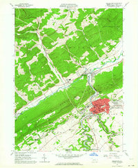 1962 Bellefonte1964 Print · USGSMid-century Centre County reveals a valley shaped by industry and civic institutions, from the bustling streets of Bellefonte to the ridges of Bald Eagle Mountain. Researchers can trace old family names at Fetzertown, locate the Trcziyulny Cem, or follow the Old Railroad Grade near Gum Stump.2 unique versions available
 - 1962 Map of Bear Knob, 1964 Print
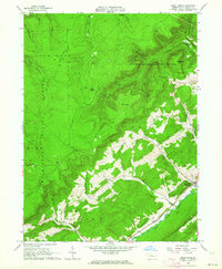 1962 Bear Knob1964 Print · USGSCentre County's rugged ridge-and-valley landscape is documented here in the early sixties, showing the transition from mountain wilderness to valley settlements. Local historians can trace family sites at Unionville, Dicks Run Cem, and the Bush Hollow Ch.2 unique versions available
 - 1962 Map of Williamsport, 1966 Print
 1962 Williamsport1966 Print · USGSNorth-central Pennsylvania was a landscape of industrial river hubs and vast state woodlands in the early sixties. Researchers can trace the path of the Pennsylvania Railroad through Williamsport and explore the remote reaches of Bucktail State Park.5 unique versions available
 - 1964 Map of Harrisburg
 1964 Harrisburg1964 Print · USGSCentral Pennsylvania in the mid-fifties reveals a landscape shaped by ridge-and-valley geology and critical Cold War infrastructure. Researchers can trace the massive Indiantown Gap Military Reservation or the rail corridors of the Pennsylvania RR and Reading RR.
 - 1965 Map of Williamsport
 1965 Williamsport1965 Print · USGSNorth-central Pennsylvania in the mid-1960s is defined by the industrial river towns and vast timberlands of the Allegheny Plateau. Researchers can trace historic rail lines like the Erie Lackawanna and Reading as they thread through Williamsport, Lock Haven, and Jersey Shore.
 - 1966 Map of Williamsport
 1966 Williamsport1966 Print · USGSThe Susquehanna Valley was a hub of transit and industry in the mid-seventies, where the river's West Branch connected major college towns and timberlands. Researchers can trace historical rail lines like the Reading or locate regional landmarks from Jersey Shore to Ricketts Glen State Park.
 - 1966 Map of Mingoville, 1968 Print
 1966 Mingoville1968 Print · USGSNittany Valley and its surrounding ridges appear in the mid-sixties just as the Howard Reservoir was being established. Genealogists and historians can trace family locations near Zion and Jacksonville or locate the Furnace Ruins and Eagle Cem.4 unique versions available
 - 1967 Map of Howard, 1969 Print
 1967 Howard1969 Print · USGSCentral Pennsylvania in the late sixties shows the intersection of the new Eagle Creek Reservoir and old mountain settlements. Local historians can trace the foundations of Howard and Orviston alongside remote sites like Schencks Cem and Highland Ch.3 unique versions available
End of results
Showing maps 1-12 of 12
Top cities near Boggs Township
- State College historical maps
- Bellefonte historical maps
- Pleasant Gap historical maps
- Houserville historical maps
- Milesburg historical maps
- Centre Hall historical maps
See more
Top neighborhoods of Boggs Township
- Rhoads historical maps
- Yarnell historical maps
- Central City historical maps
- Dry Top historical maps
- Fetzertown historical maps
- Gum Stump historical maps
See more
Frequently asked questions
- What are the different types of historical maps available for Boggs Township?
- What is the oldest map of Boggs Township?
- Where can I purchase historical maps of Boggs Township for my home or office?
- Where can I download high-res historical maps of Boggs Township?
- Are there historical topographic maps available for Boggs Township?
- Is there historical aerial imagery available for Boggs Township?
- Where are historical maps of Boggs Township sourced from?