2020s Maps of Ferguson Township, Pennsylvania
Explore 6 historic maps of Ferguson Township from the 2020s. These maps offer a rare glimpse into what life looked like during the 2020s — showing old roads, neighborhoods, homes, and landmarks that have changed or disappeared over time.
Whether you're researching your family's past, planning a metal detecting trip, or studying how Ferguson Township's landscape evolved across the 2020s, these high-resolution maps are a powerful tool for exploring the history of this region.
- Focus on a specific era: All maps on this page are from the 2020s, giving you a focused view of this time period.
- See what’s changed: Compare century-old streets, trails, and buildings to today's modern landscape using overlays and satellite layers.
- Research with precision: Use these maps for genealogy, historical research, land use analysis, or educational projects.
- View, download, or print: Maps are fully viewable online in high resolution, and can be downloaded or printed for your own records.
Start exploring Ferguson Township's history through authentic maps from the 2020s. This is your window into the past.
Ferguson Township, PA maps
(6)- 2023 Map of Franklinville, 2023 Print
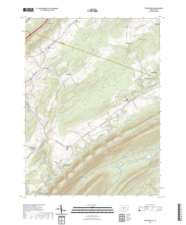 2023 Franklinville2023 Print · USGSHuntingdon County's iron-working past and ridge-and-valley settlement patterns are preserved in this recent survey. Local historians can trace the foundations of Pennsylvania Furnace, locate family plots at Seven Stars Cem, and follow the historical Warriors Mark Path.
 - 2023 Map of Pine Grove Mills, 2023 Print
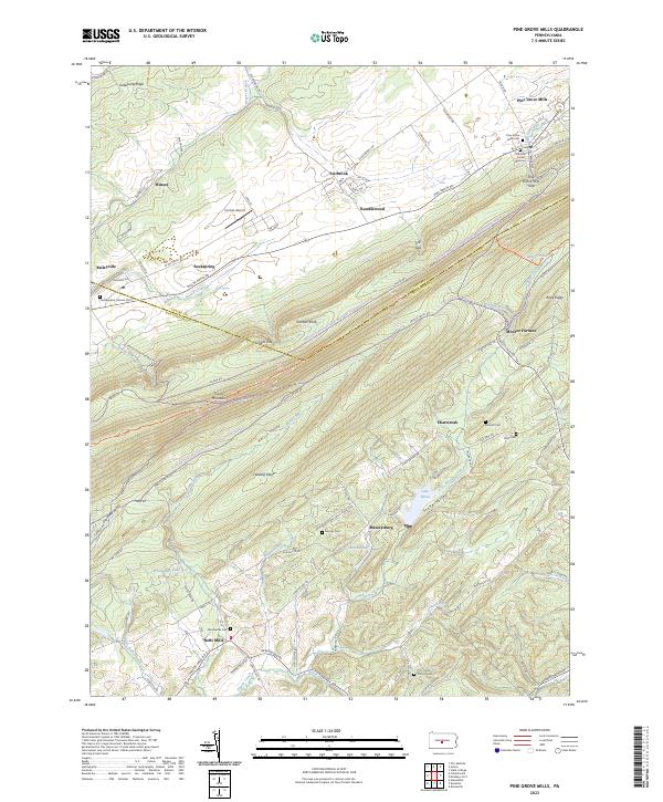 2023 Pine Grove Mills2023 Print · USGSPine Grove Mills and the surrounding ridges of Central Pennsylvania are captured here at the start of the 2020s. Researchers can locate several family burial grounds, such as the Pennsylvania Furnace Cem and Bennett Cem, or trace the rural routes connecting Neffs Mills and Monroe Furnace.
 - 2023 Map of McAlevys Fort, 2023 Print
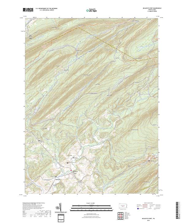 2023 McAlevys Fort2023 Print · USGSThe valleys and ridges of Huntingdon and Centre counties are captured in this modern survey of the Stone Creek headwaters. Genealogists and hikers can trace connections between Mcalevys Fort and historic burial sites like Ennisville Cem and Greenlee Presbyterian Cem.
 - 2023 Map of Julian, 2023 Print
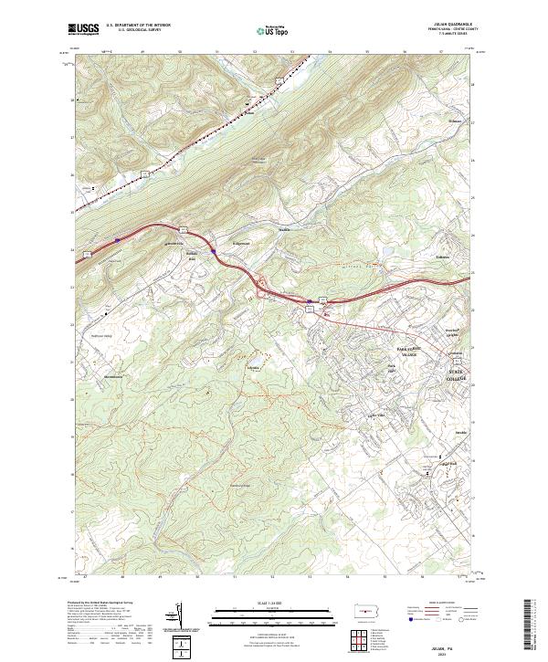 2023 Julian2023 Print · USGSThe outskirts of State College and the rural ridges of the Nittany Valley come together in this modern survey. Genealogists and historians can locate family burial sites at Old Pine Hall Cem and Campbell Cem or trace the old rail bed of the Bellefonte Central Rail Trl.
 - 2023 Map of State College, 2023 Print
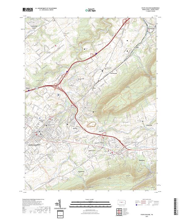 2023 State College2023 Print · USGSCentre County is captured here at a moment of significant academic and suburban growth within the Nittany Valley. Researchers can trace the evolution of local townships through landmarks like Boalsburg, Houserville, and the historic Linden Hall.
 - 2023 Map of Port Matilda, 2023 Print
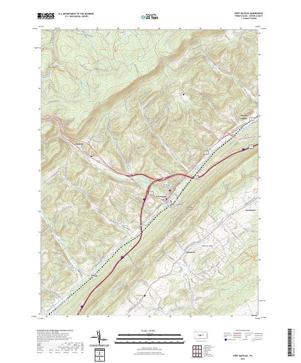 2023 Port Matilda2023 Print · USGSPort Matilda and the Bald Eagle Valley are shown here in the early twenty-first century, anchored by the intersection of major ridge-following highways. Researchers can trace family sites at Martha Furnace, Black Oak Cem, and Friends Cem.
End of results
Showing maps 1-6 of 6
Top cities near Ferguson Township
- State College historical maps
- Bellefonte historical maps
- Boalsburg historical maps
- Pleasant Gap historical maps
- Menno Township historical maps
- Houserville historical maps
See more
Top neighborhoods of Ferguson Township
- Krumrine historical maps
- Bloomsdorf historical maps
- Circleville historical maps
- Struble historical maps
- Fairbrook historical maps
- Tadpole historical maps
See more
Frequently asked questions
- What are the different types of historical maps available for Ferguson Township?
- What is the oldest map of Ferguson Township?
- Where can I purchase historical maps of Ferguson Township for my home or office?
- Where can I download high-res historical maps of Ferguson Township?
- Are there historical topographic maps available for Ferguson Township?
- Is there historical aerial imagery available for Ferguson Township?
- Where are historical maps of Ferguson Township sourced from?