Old Maps of Marion Township, Pennsylvania for Hiking & Exploration
Hike through history with 45 historic maps of Marion Township. Explore old trails, ghost towns, and forgotten backroads — perfect for outdoor adventurers and local explorers.
- Rediscover forgotten places: Map out old mining camps, roads, and footpaths that no longer exist on modern maps.
- Layer with modern tools: Combine with LiDAR or satellite views to plan hikes through historical terrain.
- Made for exploration: Popular among hikers, overlanders, and local history lovers.
Use these maps to find adventure and explore the hidden past of Marion Township.
Marion Township, PA maps
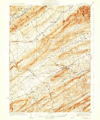
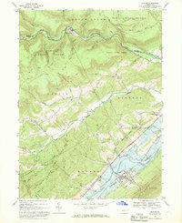
(45)- 1921 Map of Howard
 1921 Howard1921 Print · USGSThe valleys and ridges of Central Pennsylvania are captured here just as the rail-and-river economy was maturing. Researchers can trace family sites among a high density of rural schools and churches like Cedar Spring School, Hunter Run Church, and the town of Lamar.3 unique versions available
 - 1923 Map of Howard
 1923 Howard1923 Print · USGSThe valleys of Clinton and Center counties were bustling with rural life in the 1920s as the rail and river economy matured. Genealogists can locate over a dozen local schoolhouses like Wagner School and trace the paths of the Pennsylvania Railroad and Beech Creek Sta.6 unique versions available
 - 1924 Map of Centre Hall, 1958 Print
 1924 Centre Hall1958 Print · USGSCentral Pennsylvania's ridge-and-valley landscape is captured here in the 1920s, showing a world of limestone springs and mountain gaps. Genealogists can locate family homesteads near Old Fort, Tusseyville, and dozens of rural schoolhouses like Gentzel School.2 unique versions available
 - 1929 Map of Centre Hall
 1929 Centre Hall1929 Print · USGSCentral Pennsylvania's ridge-and-valley country is shown here in the late 1920s as a landscape of rural schools and water mills. Genealogists can trace family footprints at Old Fort, Penn Cave, and dozens of school sites like Gentzel School.4 unique versions available
 - 1943 Map of Lewistown
 1943 Lewistown1943 Print · USGSCentral Pennsylvania's rugged ridge-and-valley landscape is documented here during the mid-forties, showing the deep integration of rail lines and mountain gaps. Genealogists can trace family footprints through numerous rural landmarks like Emma Chapel, Mattern Junction, and the McNitt School.
 - 1950 Map of Harrisburg, 1952 Print
 1950 Harrisburg1952 Print · USGSMid-century Central Pennsylvania comes alive through its dense rail networks and river valley settlements during the post-war industrial era. Genealogists and historians can trace family roots through hubs like Harrisburg, locate Carlisle Barracks, or follow the Pennsylvania RR through the Lebanon Valley.
 - 1954 Map of Williamsport
 1954 Williamsport1954 Print · USGSNorth-central Pennsylvania in the mid-fifties is defined by the winding West Branch Susquehanna River and its industrial valley. Local historians can trace the massive Susquehanna Ordnance Depot and the extensive rail networks of the Pennsylvania Railroad.
 - 1957 Map of Harrisburg
 1957 Harrisburg1957 Print · USGSMid-century Central Pennsylvania comes into focus as a bustling network of rail, river, and mountain ridges. Genealogists and historians can trace the development of the State Capitol and surrounding hubs like Middletown, Columbia, and Pottsville.7 unique versions available
 - 1960 Map of Williamsport
 1960 Williamsport1960 Print · USGSNorth-central Pennsylvania in the mid-twentieth century was a vital corridor of rail and river industry stretching from the New York line to the coal regions. Genealogists can trace the rail networks of the Pennsylvania RR and Lehigh Valley RR connecting towns like Williamsport, Towanda, and Lock Haven.
 - 1961 Map of Harrisburg
 1961 Harrisburg1961 Print · USGSCentral Pennsylvania is shown at a mid-century peak of industrial and military activity, from the Susquehanna water gaps to the fertile Dutch Country. Genealogists and historians can trace the rail corridors of the Pennsylvania RR and find landmarks like Carlisle Barracks or the Anthracite Coal Fields.2 unique versions available
 - 1962 Map of Williamsport, 1966 Print
 1962 Williamsport1966 Print · USGSNorth-central Pennsylvania was a landscape of industrial river hubs and vast state woodlands in the early sixties. Researchers can trace the path of the Pennsylvania Railroad through Williamsport and explore the remote reaches of Bucktail State Park.5 unique versions available
 - 1964 Map of Harrisburg
 1964 Harrisburg1964 Print · USGSCentral Pennsylvania in the mid-fifties reveals a landscape shaped by ridge-and-valley geology and critical Cold War infrastructure. Researchers can trace the massive Indiantown Gap Military Reservation or the rail corridors of the Pennsylvania RR and Reading RR.
 - 1965 Map of Williamsport
 1965 Williamsport1965 Print · USGSNorth-central Pennsylvania in the mid-1960s is defined by the industrial river towns and vast timberlands of the Allegheny Plateau. Researchers can trace historic rail lines like the Erie Lackawanna and Reading as they thread through Williamsport, Lock Haven, and Jersey Shore.
 - 1966 Map of Williamsport
 1966 Williamsport1966 Print · USGSThe Susquehanna Valley was a hub of transit and industry in the mid-seventies, where the river's West Branch connected major college towns and timberlands. Researchers can trace historical rail lines like the Reading or locate regional landmarks from Jersey Shore to Ricketts Glen State Park.
 - 1966 Map of Madisonburg, 1968 Print
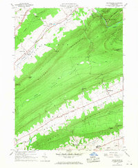 1966 Madisonburg1968 Print · USGSCentre County at the height of the mid-sixties reveals a landscape of high ridges and agricultural valleys. Genealogists and historians can trace family locations near Madisonburg, the site of Penns Cave, and rural landmarks like St Marks Cem Ch.4 unique versions available
 - 1966 Map of Mingoville, 1968 Print
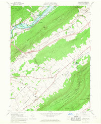 1966 Mingoville1968 Print · USGSNittany Valley and its surrounding ridges appear in the mid-sixties just as the Howard Reservoir was being established. Genealogists and historians can trace family locations near Zion and Jacksonville or locate the Furnace Ruins and Eagle Cem.4 unique versions available
 - 1967 Map of Beech Creek, 1968 Print
 1967 Beech Creek1968 Print · USGSClinton and Centre counties are captured in the late sixties during the creation of the Blanchard Reservoir. Genealogists and historians can trace family plots at Hays-Fearon Cem and explore community landmarks like Beech Creek Station and Liberty Ch.3 unique versions available
 - 1967 Map of Howard, 1969 Print
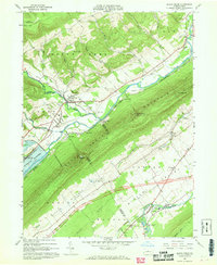
 1967 Howard1969 Print · USGSCentral Pennsylvania in the late sixties shows the intersection of the new Eagle Creek Reservoir and old mountain settlements. Local historians can trace the foundations of Howard and Orviston alongside remote sites like Schencks Cem and Highland Ch.3 unique versions available
 - 1977 Map of Beech Creek, 1979 Print
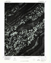
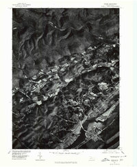
 1977 Beech Creek1979 Print · USGSClinton County land use and valley settlement are captured in this late 1970s aerial survey just as the rural landscape was maturing. Researchers can trace the exact field boundaries and homestead locations near Beech Creek and under the shadow of Bald Eagle Mountain.
 - 1977 Map of Mingoville, 1979 Print
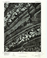
 1977 Mingoville1979 Print · USGSCentre County farmland and the village of Mingoville are shown in high-resolution aerial detail during the late seventies. Researchers can trace the rural landscape between Nittany Mountain and the course of Bald Eagle Creek.
 - 1977 Map of Howard, 1979 Print
 1977 Howard1979 Print · USGSCentre County farmland and ridges come into sharp focus during the late seventies, showing the rural character of the Pennsylvania landscape. Researchers can trace land use patterns near Howard and Romola or study the shoreline of Sayers Lake.
 - 1977 Map of Madisonburg, 1979 Print
 1977 Madisonburg1979 Print · USGSCentre County's ridge-and-valley landscape is captured in this 1970s orthophotograph, showing the rural character of the region. Local researchers can trace field patterns and land use around Madisonburg, Penn s Valley, and Nittany Mountain.
 - 1984 Map of State College, 1985 Print
 1984 State College1985 Print · USGSCentral Pennsylvania’s Ridge-and-Valley province is captured here in the mid-eighties, showing the deep connection between the mountain terrain and the region's historic settlements. Researchers can trace the layout of Pennsylvania State University and follow old rail corridors like the Bellefonte Historical RR and Conrail.
 - 1984 Map of Williamsport West, 1985 Print
 1984 Williamsport West1985 Print · USGSCentral Pennsylvania in the mid-eighties was a landscape of dense state forests and industrious river towns along the West Branch Susquehanna River. Trace the rail lines of Conrail through Renovo or locate the historic grounds of Lock Haven State College.2 unique versions available
 - 1988 Map of State College, 1989 Print
 1988 State College1989 Print · USGSCentral Pennsylvania in the late eighties shows the sprawling influence of Pennsylvania State University against a backdrop of ancient ridges. Genealogists can trace family landmarks like Church Hill Church and the Bellefonte Cemetery across the deep valleys.
Showing maps 1-25 of 45
Top cities near Marion Township
- State College historical maps
- Lock Haven historical maps
- Bellefonte historical maps
- Boalsburg historical maps
- Pleasant Gap historical maps
- Lamar historical maps
See more
Top neighborhoods of Marion Township
Frequently asked questions
- What are the different types of historical maps available for Marion Township?
- What is the oldest map of Marion Township?
- Where can I purchase historical maps of Marion Township for my home or office?
- Where can I download high-res historical maps of Marion Township?
- Are there historical topographic maps available for Marion Township?
- Is there historical aerial imagery available for Marion Township?
- Where are historical maps of Marion Township sourced from?