2020s Maps of Marion Township, Pennsylvania
Explore 4 historic maps of Marion Township from the 2020s. These maps offer a rare glimpse into what life looked like during the 2020s — showing old roads, neighborhoods, homes, and landmarks that have changed or disappeared over time.
Whether you're researching your family's past, planning a metal detecting trip, or studying how Marion Township's landscape evolved across the 2020s, these high-resolution maps are a powerful tool for exploring the history of this region.
- Focus on a specific era: All maps on this page are from the 2020s, giving you a focused view of this time period.
- See what’s changed: Compare century-old streets, trails, and buildings to today's modern landscape using overlays and satellite layers.
- Research with precision: Use these maps for genealogy, historical research, land use analysis, or educational projects.
- View, download, or print: Maps are fully viewable online in high resolution, and can be downloaded or printed for your own records.
Start exploring Marion Township's history through authentic maps from the 2020s. This is your window into the past.
Marion Township, PA maps
(4)- 2023 Map of Madisonburg, 2023 Print
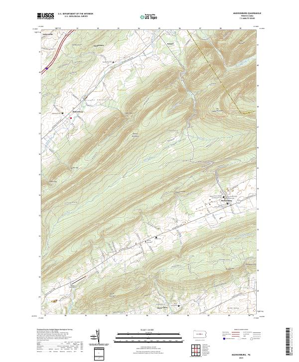 2023 Madisonburg2023 Print · USGSCentre County's valley settlements are captured in this recent survey of the ridges and agricultural corridors east of Jacksonville. Genealogists can trace family sites at the Yearick Cem, Hublersburg Cem, and the unique Penns Cave Spring area.
 - 2023 Map of Mingoville, 2023 Print
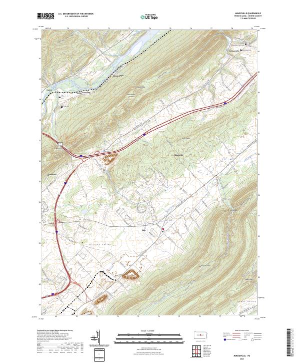 2023 Mingoville2023 Print · USGSCentral Pennsylvania's ridge-and-valley landscape is mapped in this recent survey, featuring the rural settlements of Jacksonville and Zion. Trace family history through burial sites like Presbyterian Church Cem or follow the waters of Bald Eagle Creek and Little Fishing Creek.
 - 2023 Map of Howard, 2023 Print
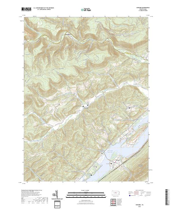 2023 Howard2023 Print · USGSThe northern reaches of Centre County are captured here as the reservoir at Howard meets the steep slopes of Bald Eagle Mountain. Genealogists can trace family heritage through numerous sites like Romola Christian Cem, Lucas Cem, and the William Packer Family Cem.
 - 2023 Map of Beech Creek, 2023 Print
 2023 Beech Creek2023 Print · USGSClinton and Centre counties are shown here as they appeared recently, centered on the gap where Beech Creek meets the Bald Eagle Creek valley. Family historians can locate numerous burial sites like the Bossert Family Cem or trace landmarks such as Washington Furnace Spring.
End of results
Showing maps 1-4 of 4
Top cities near Marion Township
- State College historical maps
- Lock Haven historical maps
- Bellefonte historical maps
- Boalsburg historical maps
- Pleasant Gap historical maps
- Lamar historical maps
See more
Top neighborhoods of Marion Township
Frequently asked questions
- What are the different types of historical maps available for Marion Township?
- What is the oldest map of Marion Township?
- Where can I purchase historical maps of Marion Township for my home or office?
- Where can I download high-res historical maps of Marion Township?
- Are there historical topographic maps available for Marion Township?
- Is there historical aerial imagery available for Marion Township?
- Where are historical maps of Marion Township sourced from?