Old Maps of Chester County, Pennsylvania for Academic Research
Study the evolution of Chester County with 237 high-resolution historic maps. Whether you're teaching, researching, or modeling changes in land use, these maps provide essential visual documentation of urban, environmental, and geographic change.
- Analyze long-term change: Track patterns in development, transportation, and natural features.
- Ideal for environmental or urban studies: Support academic projects with primary historical map data.
- Use in the classroom or lab: Educators and researchers rely on these maps to bring historical context to life.
These maps are a powerful tool for teaching, research, and visualizing how Chester County has changed over the decades.
Chester County, PA maps
(237)- 1894 Map of Chester, 1954 Print
 1894 Chester1954 Print · USGSThe Delaware River corridor near Chester was a hive of rail activity and water-powered industry at the close of the century. Genealogists and historians can trace family-named mills such as Llewellyn Mills or visit the campus of the Williamson School and the borough of Media.2 unique versions available
 - 1894 Map of Norristown, 1959 Print
 1894 Norristown1959 Print · USGSSoutheast Pennsylvania at the end of the nineteenth century reveals a landscape defined by the Schuylkill River and a dense network of early railroads. Researchers can trace ancestral roots through old settlements like Skippack, Lansdale, and the rail junctions of the Perkiomen RR and Stony Creek RR.
 - 1895 Map of Norristown, 1898 Print
 1895 Norristown1898 Print · USGSMontgomery County at the end of the 19th century is a landscape of thriving river towns and bustling rail corridors. Researchers can trace the Victorian-era footprints of Norristown and Lansdale or locate historic landmarks like Valley Forge and Perkiomen Bridge.11 unique versions available
 - 1896 Map of Norristown
 1896 Norristown1896 Print · USGSMontgomery County in the mid-1890s reveals a landscape of growing railroad towns and historic creek-side settlements. Genealogists can trace family footprints near Waterloo Mills, the historic Perkiomen Bridge, and across the townships from Lansdale to Norristown.
 - 1896 Map of Chester
 1896 Chester1896 Print · USGSThe industrial corridor along the Delaware River thrives at the close of the nineteenth century as railroads and mills reshape the landscape. Genealogists can trace early homesteads and institutions like the Williamson School, Sharon Academy, and Sycamore Mills.
 - 1898 Map of Elkton
 1898 Elkton1898 Print · USGSMaryland's Upper Chesapeake shoreline and the Pennsylvania borderlands come alive in this survey of late-Victorian Cecil County. Genealogists and historians can trace the early waterfront at Elkton Landing, find the Pivot Bridge on the canal, and locate vanished rail stops at Singerly and Bacon Hill.
 - 1898 Map of Chester
 1898 Chester1898 Print · USGSThe Delaware River shoreline at the end of the nineteenth century reveals a landscape of industrial riverfronts and emerging mill towns. Genealogists and historians can trace family roots through numerous small settlements and institutions like Village Green, Booth Corner, and the Williamson School.10 unique versions available
 - 1900 Map of Elkton
 1900 Elkton1900 Print · USGSMaryland's tidewater and rail corridors meet at the turn of the century in this detailed survey of Cecil County. Genealogists can trace family roots through old settlements like McClellandville and Singerly or locate ancestors near the Pivot Bridge.7 unique versions available
 - 1900 Map of Havre De Grace
 1900 Havre De Grace1900 Print · USGSThe Susquehanna River valley at the turn of the century shows a landscape transitioning from the canal era to the railroad age. Genealogists and historians can trace defunct transport routes like the Tidewater Canal alongside active hubs like Rising Sun and Port Deposit.7 unique versions available
 - 1901 Map of Camden
 1901 Camden1901 Print · USGSThe Delaware River valley at the turn of the century shows a bustling corridor of early industrial growth and established mill towns. Researchers can trace the heritage of local industry at Sycamore Mills or locate early settlements like Penns Grove and Village Green.3 unique versions available
 - 1901 Map of West Chester, 1958 Print
 1901 West Chester1958 Print · USGSSettled hills and river valleys between Pennsylvania and Delaware are captured here in the early twentieth century. Trace the industrial landscape from West Chester down to Wilmington, finding landmarks like the Henry Clay Factory and Dutton Mill.
 - 1904 Map of West Chester
 1904 West Chester1904 Print · USGSChester County at the dawn of the 1900s reveals a thriving network of rail-connected villages and early industrial sites along the Brandywine Creek. Researchers can trace old family lands near Dutton Mill, the House of Refuge, and the vanished stops of the West Chester Br. railroad.8 unique versions available
 - 1904 Map of Coatesville, 1960 Print
 1904 Coatesville1960 Print · USGSChester County at the turn of the century shows a bustling corridor of industry and education nestled between the Valley Hills and Mine Ridge. Trace the early development of Lincoln University, the rail hubs at Coatesville, and rural landmarks like Faggs Manor Ch.
 - 1905 Map of Honey Brook, 1962 Print
 1905 Honey Brook1962 Print · USGSSoutheastern Pennsylvania at the start of the twentieth century shows a landscape shaped by iron furnaces and a dense rail network. Genealogists can trace family footprints at Joanna Furnace, Hummels Store, and numerous rural sites like Silver Hill School.
 - 1906 Map of Phoenixville
 1906 Phoenixville1906 Print · USGSThe industrial corridor along the Schuylkill River thrives in the early 1900s as rail networks expand through Chester and Montgomery counties. Genealogists and historians can trace old community centers like Seven Stars, Limerick, and the Paoli Monument.8 unique versions available
 - 1906 Map of Coatesville
 1906 Coatesville1906 Print · USGSChester County during the first decade of the 1900s reveals a landscape defined by industrial expansion and established rural hamlets. Researchers can trace the early footprint of Lincoln University and follow historic turnpikes through settlements like Faggs Manor, Parkesburg, and Ercildoun.8 unique versions available
 - 1907 Map of Honeybrook
 1907 Honeybrook1907 Print · USGSSoutheast Pennsylvania at the start of the twentieth century shows a landscape defined by small hamlets and early rail lines. Genealogists can trace family names and local hubs from Honeybrook and Churchtown to rural landmarks like Spoketown School and Harmony Church.7 unique versions available
 - 1912 Map of Quarryville
 1912 Quarryville1912 Print · USGSLancaster County's agrarian and industrial character is frozen in time here, shortly after the 1910 survey. Researchers can trace the heavy influence of the rail network through Nickel Mines or locate rural landmarks like Wheatland Mills and Mechanic Grove.6 unique versions available
 - 1917 Map of Elkton
 1917 Elkton1917 Print · USGSNorthern Cecil County and the Delaware borderlands appear here in the era of rail and canal dominance. Genealogists can trace family names across Back Creek Neck or locate early settlements like Lewisville and Mechanic Valley.
 - 1918 Map of Coatesville, 1921 Print
 1918 Coatesville1921 Print · USGSChester County and the Lancaster border are captured in the late First World War era as industrial and academic centers thrived. Trace the early layout of Lincoln University, the busy Pennsylvania R.R. corridor, and old post offices like Springdell Derbydown PO.
 - 1941 Map of Honeybrook
 1941 Honeybrook1941 Print · USGSSoutheastern Pennsylvania at the onset of the Second World War shows a landscape of established farm communities and the newly cut path of the Pennsylvania Turnpike. Researchers can locate numerous local landmarks such as Silver Hill School, Stone Church, and the rail stops along the Reading Lines.
 - 1942 Map of Norristown
 1942 Norristown1942 Print · USGSSoutheastern Pennsylvania at the onset of World War II shows a landscape of busy industrial river towns and expanding rail suburbs. Genealogists and historians can trace the early transit networks connecting Norristown, Doylestown, and the riverfront at New Hope.
 - 1942 Map of Camden
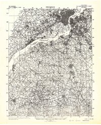 1942 Camden1942 Print · USGSThe Philadelphia and Camden metropolitan corridor is captured here at the height of the Second World War. Genealogists and historians can trace rail networks like the Reading R.R. and locate communities from Swedesboro to Merchantville.
 - 1942 Map of Havre De Grace
 1942 Havre De Grace1942 Print · USGSThe Susquehanna riverfront and Mason-Dixon borderlands are captured here in the early 1940s, just as modern infrastructure began to reshape the region. Genealogists can trace family roots through landmarks like Smith Chapel, Lees Mill, and the Brookview Cem near Rising Sun.4 unique versions available
 - 1942 Map of Elkton
 1942 Elkton1942 Print · USGSElkton and the tristate borderlands of Maryland, Delaware, and Pennsylvania are captured here just before the mid-century expansion. Genealogists can trace family names and landmarks like Old Frenchtown Wharf, St Johns Ch, and the historic Tangent Stone.4 unique versions available
Showing maps 1-25 of 237
Top cities of Chester County
- West Goshen Township historical maps
- West Chester historical maps
- Phoenixville historical maps
- Coatesville historical maps
- Caln Township historical maps
- New Garden Township historical maps
See more
Frequently asked questions
- What are the different types of historical maps available for Chester County?
- What is the oldest map of Chester County?
- Where can I purchase historical maps of Chester County for my home or office?
- Where can I download high-res historical maps of Chester County?
- Are there historical topographic maps available for Chester County?
- Is there historical aerial imagery available for Chester County?
- Where are historical maps of Chester County sourced from?