2020s Maps of Clarion County, Pennsylvania
Explore 21 historic maps of Clarion County from the 2020s. These maps offer a rare glimpse into what life looked like during the 2020s — showing old roads, neighborhoods, homes, and landmarks that have changed or disappeared over time.
Whether you're researching your family's past, planning a metal detecting trip, or studying how Clarion County's landscape evolved across the 2020s, these high-resolution maps are a powerful tool for exploring the history of this region.
- Focus on a specific era: All maps on this page are from the 2020s, giving you a focused view of this time period.
- See what’s changed: Compare century-old streets, trails, and buildings to today's modern landscape using overlays and satellite layers.
- Research with precision: Use these maps for genealogy, historical research, land use analysis, or educational projects.
- View, download, or print: Maps are fully viewable online in high resolution, and can be downloaded or printed for your own records.
Start exploring Clarion County's history through authentic maps from the 2020s. This is your window into the past.
Clarion County, PA maps
(21)- 2023 Map of Corsica, 2023 Print
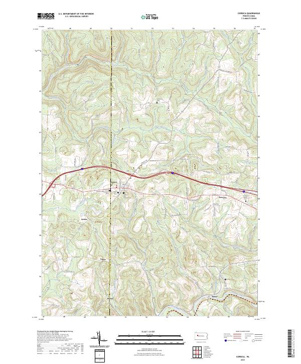 2023 Corsica2023 Print · USGSJefferson and Clarion counties appear here in the early twenty-first century, showing a landscape of ridge-top towns and deep creek valleys. Genealogists can trace family names and burial sites like Roseville Bethel Cem, Pisgah Cem, and the settlement of Harlan.
 - 2023 Map of Lucinda, 2023 Print
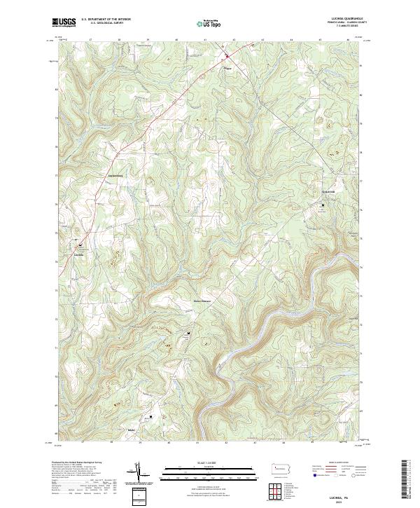 2023 Lucinda2023 Print · USGSClarion County’s rural highlands come into focus in this recent survey of the settlements along the Clarion River. You can trace local family history through landmarks like Saint Joseph Cem, the hamlet of Helen Furnace, and the old crossroads at Scotch Hill.
 - 2023 Map of Tylersburg, 2023 Print
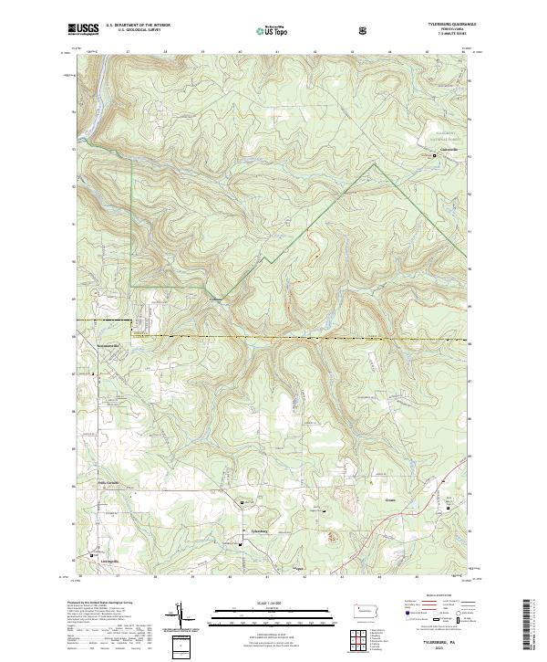 2023 Tylersburg2023 Print · USGSClarion County settlements and the southern edge of the woods define this region in the early twenty-first century. Researchers can trace family roots through numerous local burial sites like Tylersburg Cem and Lickingville Cem or explore old hamlets such as Golinza.
 - 2023 Map of Knox, 2023 Print
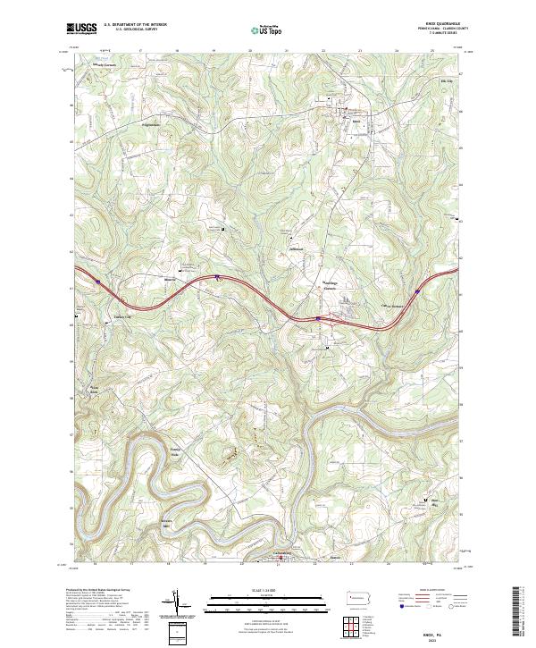 2023 Knox2023 Print · USGSClarion County's landscape is defined by the winding Clarion River and a network of early crossroads settlements. Trace family history through Knox Union Cem or explore the sites of Stovers Mill and the old iron works at Canoe Furnace.
 - 2023 Map of Clarion, 2023 Print
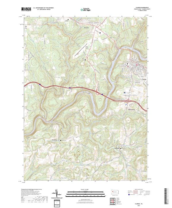 2023 Clarion2023 Print · USGSThe Clarion River valley comes into sharp focus in this 2023 survey of the county seat and its surrounding highlands. Researchers can locate family landmarks like the Immaculate Conception Cem, trace the North Country National Scenic Trl, or explore small communities such as Reidsburg and Shamburg.
 - 2023 Map of Sligo, 2023 Print
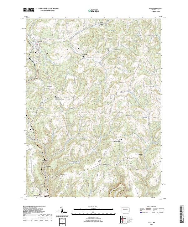 2023 Sligo2023 Print · USGSClarion County’s upland settlements and rural cemeteries are preserved in this recent topographic survey. Researchers can trace family history at the Clarion County Poorhouse Cem and explore old rail corridors like the Sligo Branch Line Trl.
 - 2023 Map of Strattanville, 2023 Print
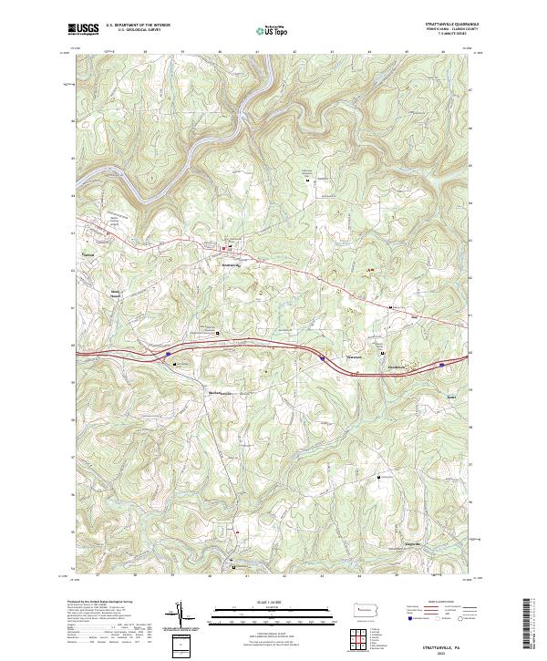 2023 Strattanville2023 Print · USGSThe rural uplands of Clarion County are captured here in the early twenty-first century, showing the enduring layout of the Pennsylvania countryside. Researchers can trace family sites at the Old Seceder Cem or explore the settlements of Mechanicsville and Kingsville.
 - 2023 Map of Kossuth, 2023 Print
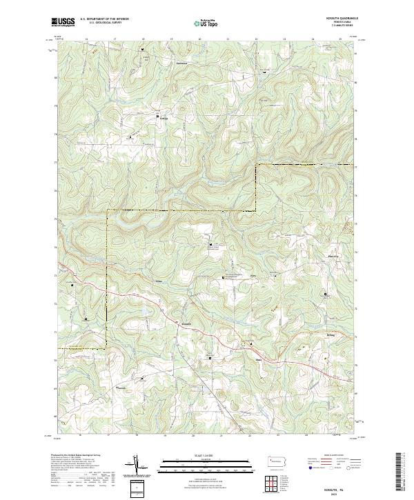 2023 Kossuth2023 Print · USGSClarion and Venango counties meet in this rural landscape at the dawn of the 2020s. Genealogists can trace family names across a high density of burial sites including Ashland United Methodist Cem, Fertigs Cem, and the Phipps Cem.
 - 2023 Map of Fryburg, 2023 Print
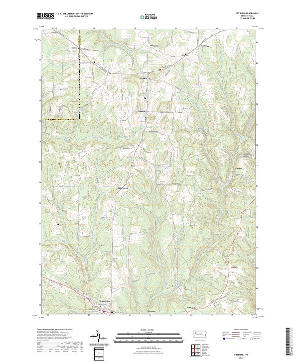 2023 Fryburg2023 Print · USGSClarion County at the start of the 2020s shows a landscape of enduring rural hamlets and deep creek valleys. Genealogists can trace family names through numerous burial sites like Old Methodist Cem and Venus Cem near the borough of Shippenville.
 - 2023 Map of Parker, 2023 Print
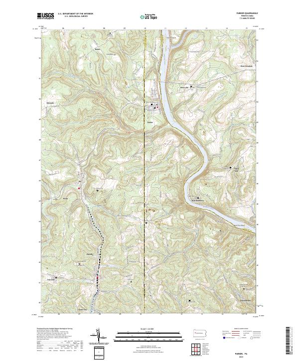 2023 Parker2023 Print · USGSThe confluence of the Allegheny and Clarion rivers defines this Pennsylvania landscape near the turn of the millennium. Trace family history at the Grand Army of the Republic Cem or explore the river-bend settlements of Parker and West Monterey.
 - 2023 Map of Marienville West, 2023 Print
 2023 Marienville West2023 Print · USGSThe wooded plateaus of Forest and Clarion Counties are captured here in the early twenty-first century, showing a landscape defined by forestry and small settlements. Researchers can locate family sites at Roses Cem, Gilfoyle Methodist Church, and the rural crossroads of Vowinckel.
 - 2023 Map of Cooksburg, 2023 Print
 2023 Cooksburg2023 Print · USGSThe Clarion River corridor in the 2020s remains a landscape of deep timbered valleys and remote family homesteads. Genealogists and local historians can locate several secluded burial grounds, including Cook Tomb, Daniels Cem, and the Fisher Presbyterian Cem.
 - 2023 Map of New Bethlehem, 2023 Print
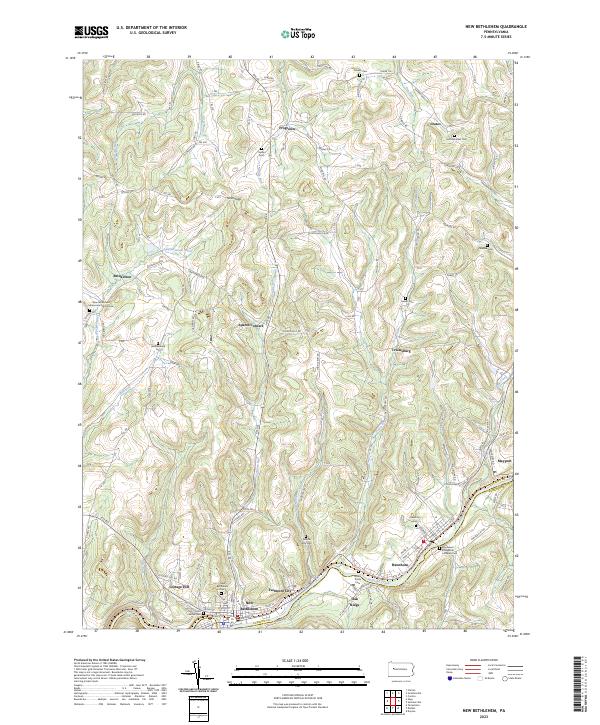 2023 New Bethlehem2023 Print · USGSThe hill country of western Pennsylvania comes into focus here, showing the river-bound settlements and upland hamlets of the early twenty-first century. Genealogists can locate family-named landmarks and several rural burial sites, including Salem Cem and Frazier Cem.
 - 2023 Map of Rimersburg, 2023 Print
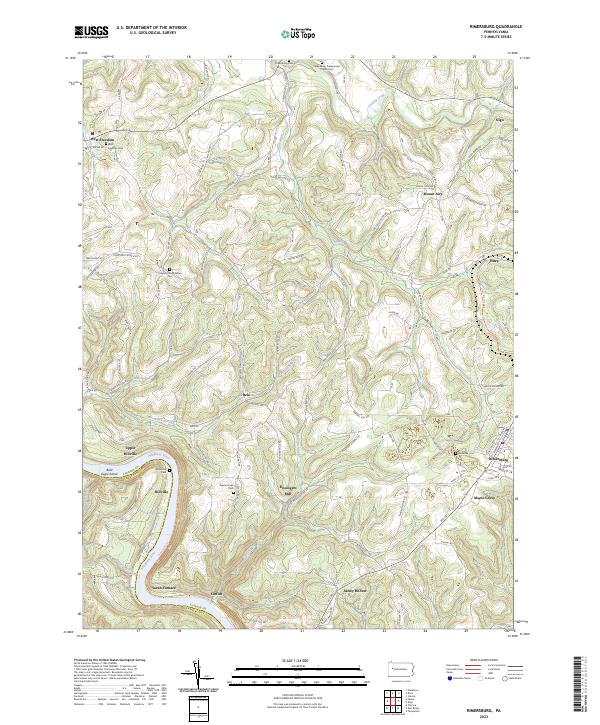 2023 Rimersburg2023 Print · USGSThe Allegheny River and Clarion County highlands come alive in this recent survey. Genealogists and local historians can trace family ties through Sarah Furnace, Kissingers Mill, and the Concord Presbyterian Cem.
 - 2023 Map of Cranberry, 2023 Print
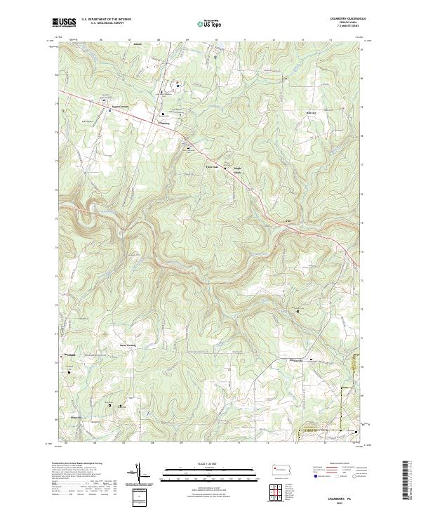 2023 Cranberry2023 Print · USGSThe ridges of Venango County come alive in this modern survey of the uplands south of Oil City. Genealogists and local historians can trace family plots at Saint Catherines Cem and Bickle Cem, or locate landmarks like Eakin Airport and Barrs Corners.
 - 2023 Map of Tionesta, 2023 Print
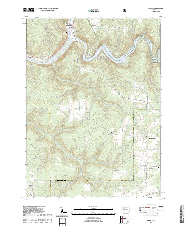 2023 Tionesta2023 Print · USGSThe Allegheny River valley and the protected forests of Forest County are captured here in the early twenty-first century. Researchers can trace local history through the Forest County Courthouse and rural burial sites like Wolfs Corners Cem and Washington Cem.
 - 2023 Map of Summerville, 2023 Print
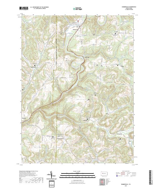 2023 Summerville2023 Print · USGSThis Jefferson County landscape is defined by the winding waters of Redbank Creek and its many tributaries during the early twenty-first century. Genealogists can trace family heritage through numerous rural burial grounds like Smith Cem, Zion Cem, and Shannondale Union Cem.
 - 2023 Map of Emlenton, 2023 Print
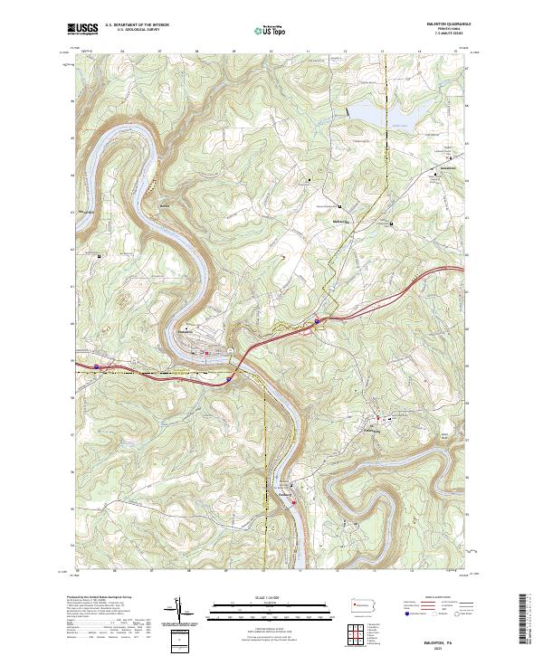 2023 Emlenton2023 Print · USGSThe Allegheny and Clarion rivers meet in this riverside landscape during the early 2020s. Genealogists can trace family roots through numerous burial grounds like Richland Presbyterian Cem and Saint Petersburg Cem or the riverfront borough of Emlenton.
 - 2023 Map of Templeton, 2023 Print
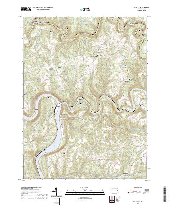 2023 Templeton2023 Print · USGSThe river valleys of Armstrong County come into focus in the 2020s, showing the enduring layout of the Pennsylvania countryside. Researchers can trace family history through a dense network of burial sites, including Stewardson Furnace Cem, Tidal Cem, and Walthour Cem.
 - 2023 Map of East Brady, 2023 Print
 2023 East Brady2023 Print · USGSThe Allegheny River valley in western Pennsylvania is shown here in its modern rural character, bridging the Clarion and Armstrong county line. Genealogists can locate numerous family burial sites such as Crissman Family Cem and Croyle Cem near Adrian and Cowansville.
 - 2023 Map of Distant, 2023 Print
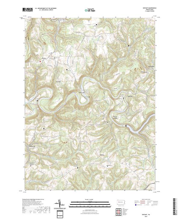 2023 Distant2023 Print · USGSThe rural border of Armstrong and Clarion counties is captured here in the contemporary era, showing a landscape of small crossroads settlements and creek-side villages. Genealogists and historians can locate numerous family and church burial sites, including the Milliron Family Cem, McCrea Furnace, and Putneyville.
End of results
Showing maps 1-21 of 21
Top cities of Clarion County
- Clarion historical maps
- Limestone Township historical maps
- Toby Township historical maps
- Knox historical maps
- Rimersburg historical maps
- New Bethlehem historical maps
See more
Frequently asked questions
- What are the different types of historical maps available for Clarion County?
- What is the oldest map of Clarion County?
- Where can I purchase historical maps of Clarion County for my home or office?
- Where can I download high-res historical maps of Clarion County?
- Are there historical topographic maps available for Clarion County?
- Is there historical aerial imagery available for Clarion County?
- Where are historical maps of Clarion County sourced from?