2020s Maps of Jordan Township, Pennsylvania
Explore 3 historic maps of Jordan Township from the 2020s. These maps offer a rare glimpse into what life looked like during the 2020s — showing old roads, neighborhoods, homes, and landmarks that have changed or disappeared over time.
Whether you're researching your family's past, planning a metal detecting trip, or studying how Jordan Township's landscape evolved across the 2020s, these high-resolution maps are a powerful tool for exploring the history of this region.
- Focus on a specific era: All maps on this page are from the 2020s, giving you a focused view of this time period.
- See what’s changed: Compare century-old streets, trails, and buildings to today's modern landscape using overlays and satellite layers.
- Research with precision: Use these maps for genealogy, historical research, land use analysis, or educational projects.
- View, download, or print: Maps are fully viewable online in high resolution, and can be downloaded or printed for your own records.
Start exploring Jordan Township's history through authentic maps from the 2020s. This is your window into the past.
Jordan Township, PA maps
(3)- 2023 Map of Westover, 2023 Print
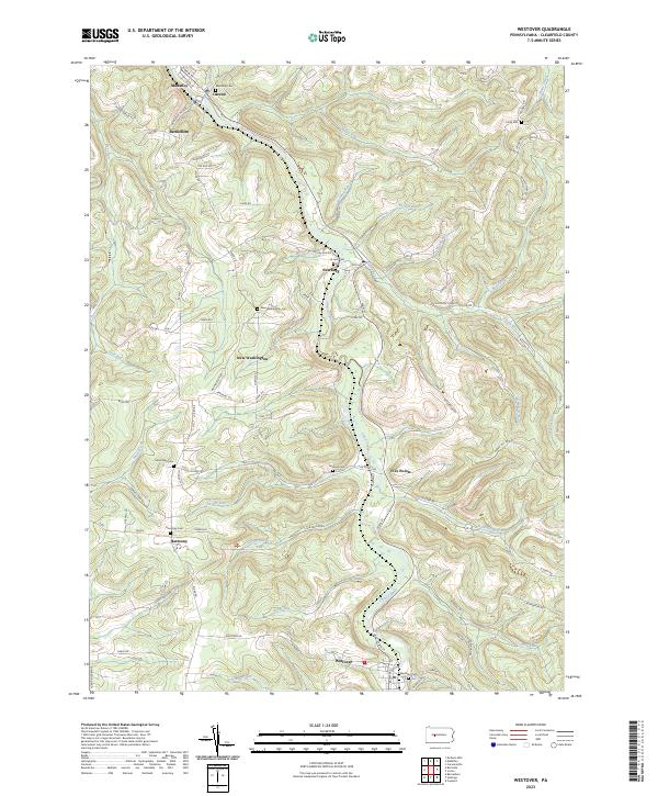 2023 Westover2023 Print · USGSClearfield County's rural character is preserved in this study of the upper Chest Creek valley in the twenty-first century. Genealogists can locate family burial sites at Westover Cem, Harmony Cem, and New Washington Cem.
 - 2023 Map of Curwensville, 2023 Print
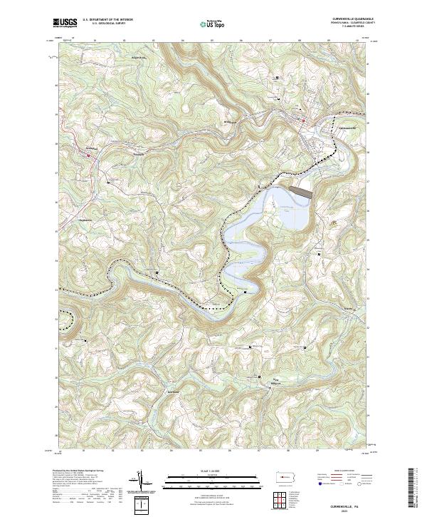 2023 Curwensville2023 Print · USGSClearfield County's river-cut valleys and upland ridges are captured in this recent survey of the West Branch Susquehanna. Genealogists can trace family heritage through numerous burial sites including Oak Hill Cem, Lumber City Cem, and McClure Cem.
 - 2023 Map of Irvona, 2023 Print
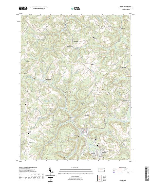 2023 Irvona2023 Print · USGSIrvona and the surrounding coal settlements of Clearfield County are documented here in the early 2020s. Genealogists can trace family heritage at Saint Michaels Cem, Saint Pauls Cem, and along the banks of Clearfield Creek.
End of results
Showing maps 1-3 of 3
Top cities near Jordan Township
- Clearfield historical maps
- Northern Cambria historical maps
- Curwensville historical maps
- Patton historical maps
- Beccaria Township historical maps
- Hastings historical maps
See more
Top neighborhoods of Jordan Township
- Ansonville historical maps
- Berwinsdale historical maps
- Bretonville historical maps
- Gazzam historical maps
- Mayes historical maps
- Morgans Land historical maps
See more
Frequently asked questions
- What are the different types of historical maps available for Jordan Township?
- What is the oldest map of Jordan Township?
- Where can I purchase historical maps of Jordan Township for my home or office?
- Where can I download high-res historical maps of Jordan Township?
- Are there historical topographic maps available for Jordan Township?
- Is there historical aerial imagery available for Jordan Township?
- Where are historical maps of Jordan Township sourced from?