Old Maps of Jordan Township, Pennsylvania for Genealogy
Trace your family roots with 28 historic maps of Jordan Township. These high-res maps reveal old neighborhoods, homesites, landmarks, and streets — helping you uncover where your ancestors lived and how the area evolved over time.
- Explore historic neighborhoods: Identify where your relatives may have lived in the 1800s or 1900s.
- Compare maps over time: Trace the changes in streets, buildings, and landmarks for multi-generational research.
- Perfect for genealogy & ancestry research: Used by family historians and researchers to map out lineage and migration.
These maps are an incredible resource for exploring your personal connection to Jordan Township's past.
Jordan Township, PA maps
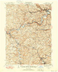
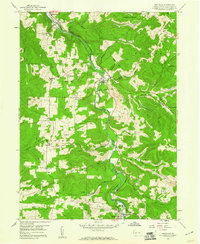
(28)- 1903 Map of Curwensville
 1903 Curwensville1903 Print · USGSThe West Branch Susquehanna River region was a hub of timber and rail activity in the early twentieth century. Researchers can trace the development of riverside towns like Lumber City, locate the Wister Mine near Irvona, and follow the winding routes of the New York Central and Hudson River RR.4 unique versions available
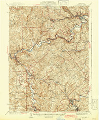
 - 1939 Map of Curwensville, 1952 Print
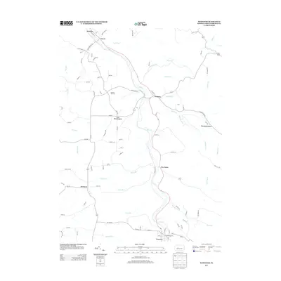
 1939 Curwensville1952 Print · USGSClearfield County in the late 1930s is defined by a dense rail-and-river network where the West Branch of the Susquehanna meets Curwensville. Local historians can trace dozens of rural schoolhouses and family burial sites like Friends Cem and Glendale Sch.2 unique versions available
 - 1942 Map of Curwensville
 1942 Curwensville1942 Print · USGSClearfield County settlements and river-side industries are documented here in the early years of the war. Genealogists and historians can trace family roots through landmarks like Fruit Hill Ch, Friends Cem, and the Oakland Sch in the hills above the Susquehanna River.
 - 1943 Map of Punxsutawney
 1943 Punxsutawney1943 Print · USGSThe Pennsylvania coal country around the turn of the century and through the war years is captured in this detailed survey of Jefferson, Indiana, and Clearfield counties. Researchers can trace the rail-reliant economy through Findley Mills, Rossiter Junction, and landmarks like the St Lawrence Fire Tower.
 - 1953 Map of Pittsburgh
 1953 Pittsburgh1953 Print · USGSWestern Pennsylvania's industrial landscape at the start of the fifties shows the steel and rail corridors between Pittsburgh and Altoona. Trace family roots in river towns like Tarentum or follow the Pennsylvania Turnpike across Laurel Hill.
 - 1954 Map of Pittsburgh
 1954 Pittsburgh1954 Print · USGSWestern Pennsylvania in the early fifties remains a powerhouse of heavy industry and vital transit corridors. Genealogists and historians can trace the rail-and-river network connecting Pittsburgh, Johnstown, and Altoona via the Pennsylvania RR and the Lincoln Highway.2 unique versions available
 - 1958 Map of Pittsburgh
 1958 Pittsburgh1958 Print · USGSWestern Pennsylvania in the late fifties shows an industrial heartland defined by the confluence of the Allegheny River and Monongahela River. Researchers can trace the sprawling rail networks of the Pennsylvania RR and find established towns like Butler, Latrobe, and Windber.5 unique versions available
 - 1959 Map of Pittsburgh
 1959 Pittsburgh1959 Print · USGSWestern Pennsylvania in the late fifties is captured here at the height of its industrial era. Genealogists and historians can trace the riverfront growth of Pittsburgh, the rail works at Altoona, and the mountain gaps of Laurel Hill.
 - 1959 Map of Irvona, 1960 Print
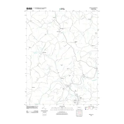
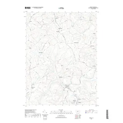
 1959 Irvona1960 Print · USGSClearfield County's industrial and rural landscape is shown in the late fifties as coal mining and rail transport defined local life. Genealogists and historians can trace the foundations of Irvona, Coalport, and Ansonville, or locate family sites like Zion Ch and St Michaels Ch.5 unique versions available
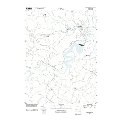
 - 1959 Map of Curwensville, 1960 Print
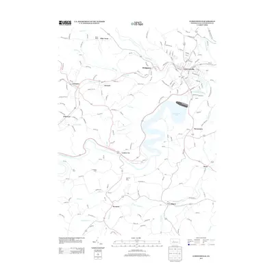
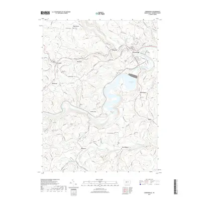
 1959 Curwensville1960 Print · USGSThe West Branch Susquehanna River region in the late 1950s shows a landscape of deep valleys and coal mining. Genealogists and historians can trace rail lines to settlements like Lumber City and Grampian, or locate sites like Zion Ch and Oak Hill Cemetery.5 unique versions available
 - 1959 Map of Westover, 1960 Print
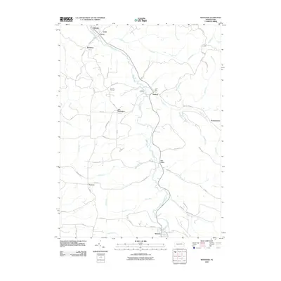
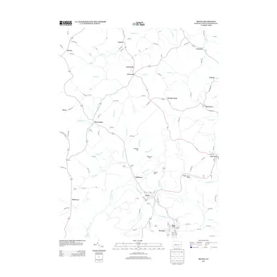
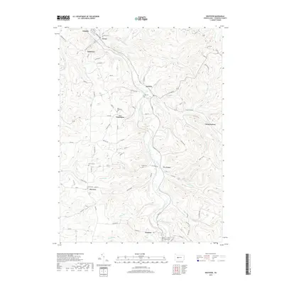
 1959 Westover1960 Print · USGSClearfield County's coal and rail corridor comes into sharp focus during the late fifties along the winding Chest Creek. Researchers can trace the industrial landscape of strip mines and tipples near Mahaffey, Westover, and the Mahaffey Racetrack.3 unique versions available
 - 1964 Map of Pittsburgh
 1964 Pittsburgh1964 Print · USGSWestern Pennsylvania in the late fifties and early sixties shows a landscape of powerful river industries and expanding highways. Genealogists and historians can trace the rail corridors of the Pennsylvania RR through industrial hubs like Johnstown, Altoona, and Nanty Glo.
 - 1984 Map of Tyrone, 1985 Print
 1984 Tyrone1985 Print · USGSCentral Pennsylvania in the mid-eighties shows a rugged landscape defined by the industry of Altoona and the ridges of the Appalachians. Genealogists and historians can trace the rail corridors of CONRAIL and locate vanished family homes near Glendale Lake or within Sinking Valley.
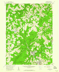
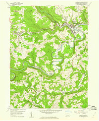
 - 2010 Map of Curwensville, 2010 Print
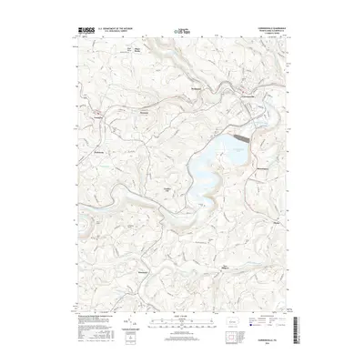
 2010 Curwensville2010 Print · USGSCovers Jordan Township, including Curwensville, Grampian, and other nearby areas
 - 2010 Map of Westover, 2010 Print
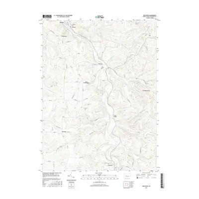
 2010 Westover2010 Print · USGSCovers Jordan Township, including Westover, Mahaffey, and other nearby areas
 - 2010 Map of Irvona, 2010 Print
 2010 Irvona2010 Print · USGSCovers Jordan Township, including Beccaria Township, Irvona, and other nearby areas
 - 2013 Map of Curwensville, 2013 Print
 2013 Curwensville2013 Print · USGSCovers Jordan Township, including Curwensville, Grampian, and other nearby areas
 - 2013 Map of Westover, 2013 Print
 2013 Westover2013 Print · USGSCovers Jordan Township, including Westover, Mahaffey, and other nearby areas
 - 2013 Map of Irvona, 2013 Print
 2013 Irvona2013 Print · USGSCovers Jordan Township, including Beccaria Township, Irvona, and other nearby areas
 - 2016 Map of Irvona, 2016 Print
 2016 Irvona2016 Print · USGSCovers Jordan Township, including Beccaria Township, Irvona, and other nearby areas
 - 2016 Map of Westover, 2016 Print
 2016 Westover2016 Print · USGSCovers Jordan Township, including Westover, Mahaffey, and other nearby areas
 - 2016 Map of Curwensville, 2016 Print
 2016 Curwensville2016 Print · USGSCovers Jordan Township, including Curwensville, Grampian, and other nearby areas
 - 2019 Map of Curwensville, 2019 Print
 2019 Curwensville2019 Print · USGSCovers Jordan Township, including Curwensville, Grampian, and other nearby areas
 - 2019 Map of Irvona, 2019 Print
 2019 Irvona2019 Print · USGSCovers Jordan Township, including Beccaria Township, Irvona, and other nearby areas
 - 2019 Map of Westover, 2019 Print
 2019 Westover2019 Print · USGSCovers Jordan Township, including Westover, Mahaffey, and other nearby areas
Showing maps 1-25 of 28
Top cities near Jordan Township
- Clearfield historical maps
- Northern Cambria historical maps
- Curwensville historical maps
- Patton historical maps
- Beccaria Township historical maps
- Hastings historical maps
See more
Top neighborhoods of Jordan Township
- Ansonville historical maps
- Berwinsdale historical maps
- Bretonville historical maps
- Gazzam historical maps
- Mayes historical maps
- Morgans Land historical maps
See more
Frequently asked questions
- What are the different types of historical maps available for Jordan Township?
- What is the oldest map of Jordan Township?
- Where can I purchase historical maps of Jordan Township for my home or office?
- Where can I download high-res historical maps of Jordan Township?
- Are there historical topographic maps available for Jordan Township?
- Is there historical aerial imagery available for Jordan Township?
- Where are historical maps of Jordan Township sourced from?