2020s Maps of Beech Creek Township, Pennsylvania
Explore 8 historic maps of Beech Creek Township from the 2020s. These maps offer a rare glimpse into what life looked like during the 2020s — showing old roads, neighborhoods, homes, and landmarks that have changed or disappeared over time.
Whether you're researching your family's past, planning a metal detecting trip, or studying how Beech Creek Township's landscape evolved across the 2020s, these high-resolution maps are a powerful tool for exploring the history of this region.
- Focus on a specific era: All maps on this page are from the 2020s, giving you a focused view of this time period.
- See what’s changed: Compare century-old streets, trails, and buildings to today's modern landscape using overlays and satellite layers.
- Research with precision: Use these maps for genealogy, historical research, land use analysis, or educational projects.
- View, download, or print: Maps are fully viewable online in high resolution, and can be downloaded or printed for your own records.
Start exploring Beech Creek Township's history through authentic maps from the 2020s. This is your window into the past.
Beech Creek Township, PA maps
(8)- 2023 Map of Keating, 2023 Print
 2023 Keating2023 Print · USGSSettled at the confluence of Sinnemahoning Creek and the Susquehanna, this area was a vital waterway hub. Genealogists can trace family names at Bitumen and Saint Marys Catholic Cem or explore the terrain of Keating.
 - 2023 Map of Snow Shoe NW, 2023 Print
 2023 Snow Shoe NW2023 Print · USGSThe West Branch Susquehanna River divides Clinton and Centre counties in the early twenty-first century, shaping a landscape defined by deep hollows and high ridges. Researchers can trace local landmarks like Nelsonville Cem, the settlement of Birch, and the winding Chuck Keiper Trl.
 - 2023 Map of Howard NW, 2023 Print
 2023 Howard NW2023 Print · USGSClinton County’s high plateau is documented here in the early twenty-first century, showing a landscape defined by deep hollows and vast trail networks. Researchers can trace historic paths and landmarks like Eagleton Fields, the Chuck Keiper Trl, and Bear Swamp.
 - 2023 Map of Snow Shoe NE, 2023 Print
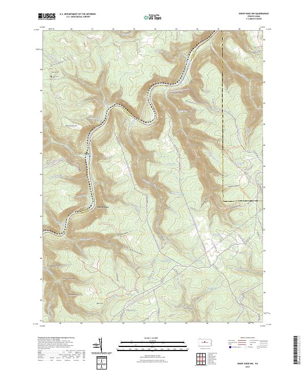
 2023 Snow Shoe NE2023 Print · USGSClinton and Centre counties are shown in this recent survey, highlighting the deeply dissected plateau of the Pennsylvania wilds. Researchers can trace the extensive trail networks and remote drainages like Chuck Keiper Trl, Clemson Island, and Splash Dam Hollow.
 - 2023 Map of Snow Shoe SE, 2023 Print
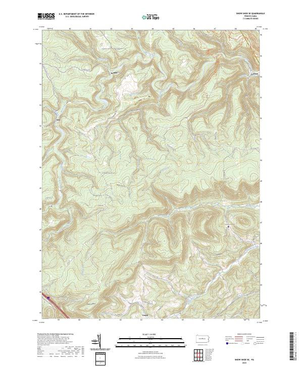 2023 Snow Shoe SE2023 Print · USGSThe northern reaches of Centre County are captured here in the 2020s, showing a landscape defined by steep ridges and small creek-side settlements. Researchers can trace family sites near Orviston or locate the Summit Hill Cem above the Little Marsh Creek valley.
 - 2023 Map of Howard, 2023 Print
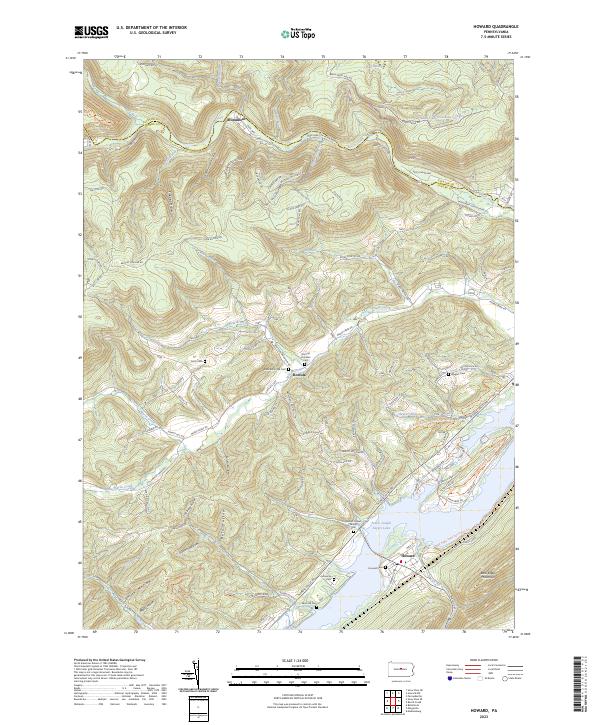 2023 Howard2023 Print · USGSThe northern reaches of Centre County are captured here as the reservoir at Howard meets the steep slopes of Bald Eagle Mountain. Genealogists can trace family heritage through numerous sites like Romola Christian Cem, Lucas Cem, and the William Packer Family Cem.
 - 2023 Map of Farrandsville, 2023 Print
 2023 Farrandsville2023 Print · USGSClinton County's river-and-rail corridor is documented here in the early twenty-first century as it evolves into a mountain recreation hub. Trace the riverfront hamlets of Farrandsville and Riverview, or explore ridge-top routes like Hyner Mountain Snowmobile Trails Trl and Beech Creek Snowmobile Trails Trl.
 - 2023 Map of Beech Creek, 2023 Print
 2023 Beech Creek2023 Print · USGSClinton and Centre counties are shown here as they appeared recently, centered on the gap where Beech Creek meets the Bald Eagle Creek valley. Family historians can locate numerous burial sites like the Bossert Family Cem or trace landmarks such as Washington Furnace Spring.
End of results
Showing maps 1-8 of 8
Top cities near Beech Creek Township
- Lamar historical maps
- Mill Hall historical maps
- Milesburg historical maps
- Beech Creek historical maps
- Howard historical maps
- Curtin historical maps
See more
Top neighborhoods of Beech Creek Township
Frequently asked questions
- What are the different types of historical maps available for Beech Creek Township?
- What is the oldest map of Beech Creek Township?
- Where can I purchase historical maps of Beech Creek Township for my home or office?
- Where can I download high-res historical maps of Beech Creek Township?
- Are there historical topographic maps available for Beech Creek Township?
- Is there historical aerial imagery available for Beech Creek Township?
- Where are historical maps of Beech Creek Township sourced from?