Old Maps of Saint Marys, Pennsylvania for Hiking & Exploration
Hike through history with 26 historic maps of Saint Marys. Explore old trails, ghost towns, and forgotten backroads — perfect for outdoor adventurers and local explorers.
- Rediscover forgotten places: Map out old mining camps, roads, and footpaths that no longer exist on modern maps.
- Layer with modern tools: Combine with LiDAR or satellite views to plan hikes through historical terrain.
- Made for exploration: Popular among hikers, overlanders, and local history lovers.
Use these maps to find adventure and explore the hidden past of Saint Marys.
Saint Marys, PA maps
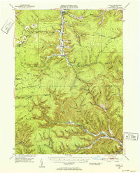
(26)- 1935 Map of Mt. Jewett
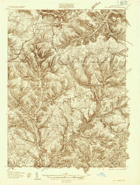 1935 Mt. Jewett1935 Print · USGSElk and McKean counties at the height of the Great Depression reveal a landscape shaped by competing timber and rail interests. Researchers can trace the junction of three major railroads and find vanished operations at Burning Well and Instanter.3 unique versions available
 - 1940 Map of Mt. Jewett
 1940 Mt. Jewett1940 Print · USGSNorthern Pennsylvania’s timber and rail country is captured here during the mid-1930s, showing a landscape defined by industrial development. Researchers can locate vanished rural infrastructure like the Stenstrom Sch, the CCC Camp, and specific rail stops at Dahoga and Instanter.3 unique versions available
 - 1941 Map of Benezette, 1952 Print
 1941 Benezette1952 Print · USGSElk County at the start of the 1940s reveals a network of valley settlements defined by the Pennsylvania RR and Sinnemahoning Creek. Researchers can trace rural life through scattered landmarks like Mt Zion Ch, Rathbun Sch, and the high point at Winslow Hill.3 unique versions available
 - 1941 Map of Ridgway, 1956 Print
 1941 Ridgway1956 Print · USGSElk County at the start of the 1940s reveals a landscape shaped by coal mining and heavy rail industry. Genealogists can locate family homes near Dagus Mines or trace the early foundations of Ridgway and St. Marys.2 unique versions available
 - 1943 Map of Benezette
 1943 Benezette1943 Print · USGSElk and Cameron counties are captured during the early 1940s, showing a landscape of deep timber-run hollows and active rail corridors. Local historians can locate vanished schoolhouses like Rathbun Sch, mountain churches such as Mt Zion Ch, and the winding tracks of the Pennsylvania railroad.2 unique versions available
 - 1944 Map of Ridgway
 1944 Ridgway1944 Print · USGSElk County at the height of its industrial rail era reveals a landscape of coal mines and mountain settlements. Trace the operations of the Toby Mine and Kyler Mine or find family roots at Decker Chapel and Gardner Hill Sch.3 unique versions available
 - 1948 Map of Crosby, 1952 Print
 1948 Crosby1952 Print · USGSPost-war McKean and Cameron counties appear here as a landscape of mountain rail lines and valley settlements. Trace the Pennsylvania Railroad through Hamlin Sta, locate the Sweets Sch, or find family names near Clermont Cem.3 unique versions available
 - 1948 Map of Wildwood Fire Tower, 1958 Print
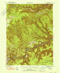
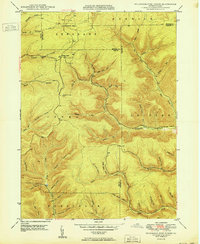
 1948 Wildwood Fire Tower1958 Print · USGSThe Pennsylvania high country of Elk and McKean counties comes into focus in the years just after the war, showing a landscape of deep hollows and forest runs. Genealogists and hikers can trace the remote reaches of Wellendorf Station, Devils Hole, and Boy Scout Hollow.5 unique versions available
 - 1950 Map of Wildwood Fire Tower
 1950 Wildwood Fire Tower1950 Print · USGSThe Elk and McKean county line runs through this mid-century survey of the Pennsylvania highlands, featuring rugged drainage networks and early timbering hubs. Genealogists can trace family-named hollows and sites like Wellendorf Station, Dead Mans Lick, and Wildwood Fire Tower.2 unique versions available
 - 1957 Map of Warren, 1964 Print
 1957 Warren1964 Print · USGSThe northern Pennsylvania oil and timber country comes into focus in the mid-fifties, showing the region before modern highway expansions. Trace the industrial rail networks of the Pennsylvania RR and the early Allegheny River Reservoir near Warren and Oil City.4 unique versions available
 - 1958 Map of Warren
 1958 Warren1958 Print · USGSNorthern Pennsylvania’s timber and oil country is captured here during the late fifties, showing the interplay of industrial valleys and vast state forests. Genealogists can trace family connections across the Cornplanter Indian Reservation or through rail hubs like Oil City and Saint Marys.
 - 1959 Map of Warren
 1959 Warren1959 Print · USGSNorthern Pennsylvania's oil and timber country comes alive in this late-fifties study of the forest-clad plateaus. Trace the historic Cornplanter (Indian Reservation), the sprawling Oil Field, and the rail lines of the Pennsylvania RR.2 unique versions available
 - 1969 Map of Glen Hazel, 1972 Print
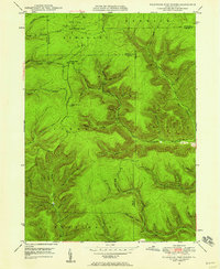
 1969 Glen Hazel1972 Print · USGSElk County's deep hollows and high ridges are shown here in the late sixties as the region balanced heavy industry with new recreation. Genealogists and historians can trace the Baltimore and Ohio rail lines, find Holy Cross Cem, and locate the old settlement at Rasselas.2 unique versions available
 - 1969 Map of Wilcox, 1972 Print
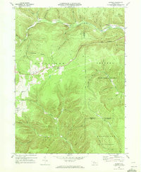
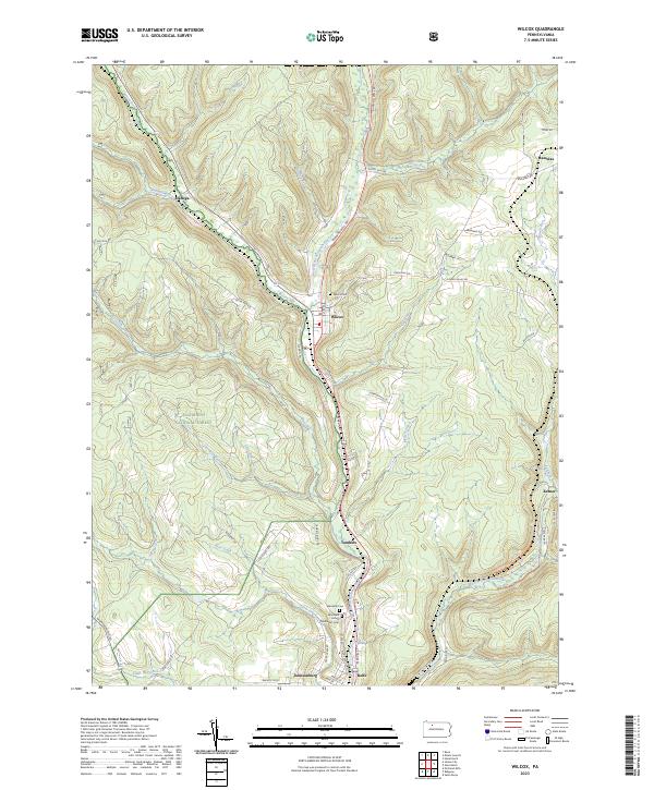
 1969 Wilcox1972 Print · USGSElk County's river valleys and oil fields are captured here in the late sixties as industrial extraction and public lands coexisted. You can trace the Penn Central rail line through Wilcox, find the Wardville Cem, and locate the Strip Mine near Rasselas.3 unique versions available
 - 1969 Map of Rathbun, 1972 Print
 1969 Rathbun1972 Print · USGSElk and Cameron counties are shown here in the late sixties as a landscape of remote mountain rail stops and state-managed timberlands. Genealogists can trace family footprints near Rathbun and Beechwood or locate the Cem and Strip Mine works near Goetz Summit.3 unique versions available
 - 1969 Map of Saint Marys, 1972 Print
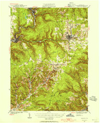
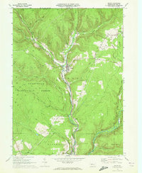
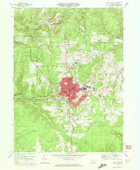 1969 Saint Marys1972 Print · USGSElk County at the close of the 1960s shows a thriving mountain community defined by its Catholic heritage and coal-country industry. Genealogists and local historians can trace landmarks like Decker Chapel, Sacred Heart Ch, and the Strip Mines around Grandview.3 unique versions available
 - 1969 Map of Ridgway, 1972 Print
 1969 Ridgway1972 Print · USGSElk County’s river valleys and industrial corridors are meticulously documented in the late sixties as the region balanced heavy industry with sprawling conservation lands. Researchers can trace family roots at Oakmont Cem, locate the old St Leos Sch, and follow the Penn Central rail line through Dagusca-honda.3 unique versions available
 - 1971 Map of Warren
 1971 Warren1971 Print · USGSNorth Central Pennsylvania is captured here in the early seventies, showing a landscape defined by industrial centers and massive state forests. Genealogists and historians can trace the rail lines of the Penn Central and Erie Lackawanna connecting towns like Warren, Kane, and Du Bois.
 - 1980 Map of Bradford, 1982 Print
 1980 Bradford1982 Print · USGSNorthern Pennsylvania's oil country and deep forests are captured here during the 1980s. Genealogists and researchers can trace rail-side settlements like Kushequa, Gifford, and Lewis Run or locate specific Oil and Gas Field sites across the plateau.
 - 1983 Map of Clearfield, 1984 Print
 1983 Clearfield1984 Print · USGSPennsylvania's coal and timber heartland is captured in the early eighties as industrial hubs like Du Bois and Saint Marys thrived among the state forests. Genealogists can locate family landmarks like Morningside Cemetery, the old works at Dagus Mines, and the rural community of Byrnedale.
 - 2023 Map of Wilcox, 2023 Print
 2023 Wilcox2023 Print · USGSElk County’s river valleys and forested uplands are captured in this modern survey of the Wilcox area. Researchers can trace family history through the Wilcox Cem and Wardville Cem or locate old settlements like Dahoga, Tambine, and Ketner.
 - 2023 Map of Saint Marys, 2023 Print
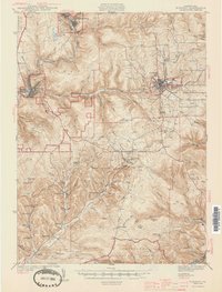
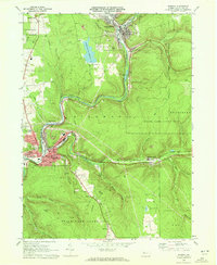
 2023 Saint Marys2023 Print · USGSSt. Marys and the surrounding Elk County hills appear in detail in the 2020s, showing a landscape defined by industry and faith. Genealogists can locate several key burial sites including Saint Michael's Cem and the Saint Joseph Convent Cem.
 - 2023 Map of Glen Hazel, 2023 Print
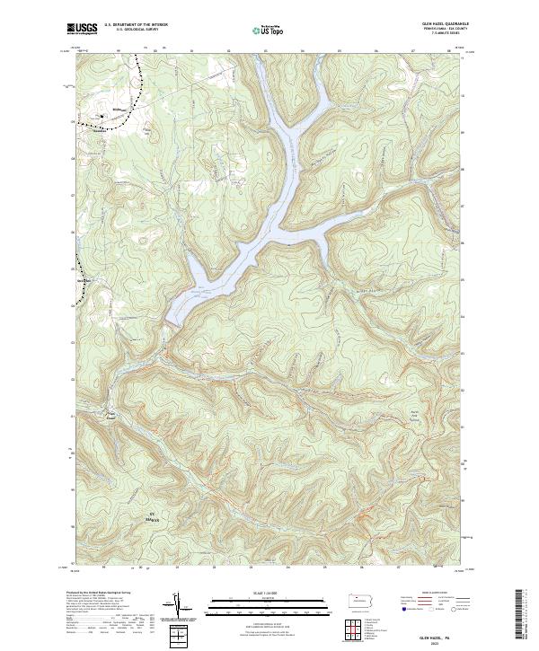 2023 Glen Hazel2023 Print · USGSElk County's high ridges and river valleys are shown in detail as they appeared recently, centered on the East Branch Clarion River Lake. Genealogists and hikers can trace old roads and cemeteries like Holy Cross Cem or follow the Shawmut Grade Rd Trl through Glen Hazel.
 - 2023 Map of Wildwood Fire Tower, 2023 Print
 2023 Wildwood Fire Tower2023 Print · USGSThe Elk and Cameron County borderlands appear here in the 2020s, showing a terrain defined by deep hollows and high ridges. Trace family history and land use through St. Marys, the remote settlement of Straight Creek, and landmarks like Jarrets Summit.
 - 2023 Map of Rathbun, 2023 Print
 2023 Rathbun2023 Print · USGSThe borderlands of Elk and Cameron counties come into focus in the 2020s, showing the deep valley of West Creek. Trace local history through the Market Cem and the small settlements of Rathbun, Beechwood, and Swissmont.
Showing maps 1-25 of 26
Top cities near Saint Marys
- Ridgway historical maps
- Johnsonburg historical maps
- Liberty Township historical maps
- Norwich Township historical maps
- Goshen Township historical maps
- Wilcox historical maps
See more
Top neighborhoods of Saint Marys
- Rathbun historical maps
- Kaulmont historical maps
- Lynchville historical maps
- Swissmont historical maps
- Downtown Saint Marys historical maps
Frequently asked questions
- What are the different types of historical maps available for Saint Marys?
- What is the oldest map of Saint Marys?
- Where can I purchase historical maps of Saint Marys for my home or office?
- Where can I download high-res historical maps of Saint Marys?
- Are there historical topographic maps available for Saint Marys?
- Is there historical aerial imagery available for Saint Marys?
- Where are historical maps of Saint Marys sourced from?