Old Maps of Hopewell Township, Pennsylvania for Hiking & Exploration
Hike through history with 30 historic maps of Hopewell Township. Explore old trails, ghost towns, and forgotten backroads — perfect for outdoor adventurers and local explorers.
- Rediscover forgotten places: Map out old mining camps, roads, and footpaths that no longer exist on modern maps.
- Layer with modern tools: Combine with LiDAR or satellite views to plan hikes through historical terrain.
- Made for exploration: Popular among hikers, overlanders, and local history lovers.
Use these maps to find adventure and explore the hidden past of Hopewell Township.
Hopewell Township, PA maps
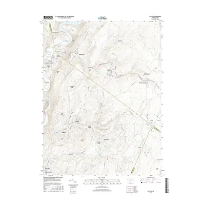
(30)- 1901 Map of Huntingdon, 1960 Print
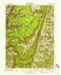
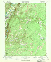
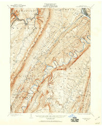 1901 Huntingdon1960 Print · USGSCentral Pennsylvania's ridge-and-valley landscape is documented here at the turn of the century, showing a network of river-bound iron fords and rail junctions. Genealogists and historians can trace family-named locations from Cove Forge to settlements like Cassville and Marklesburg.
 - 1902 Map of Hollidaysburg, 1957 Print
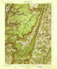
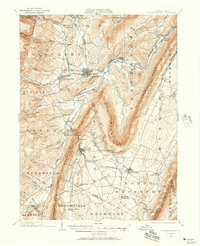 1902 Hollidaysburg1957 Print · USGSCentral Pennsylvania at the opening of the twentieth century shows a landscape defined by the iron and rail industries. Genealogists and historians can trace the early footprints of Hollidaysburg, locate the Ore Hill mine, and follow the Pennsylvania R. R. through the steep gaps of the Allegheny Mountain.2 unique versions available
 - 1903 Map of Hollidaysburg
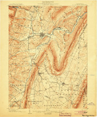 1903 Hollidaysburg1903 Print · USGSBlair County was a hub of Appalachian industry and transit at the opening of the twentieth century. Genealogists and historians can trace the early rail networks of the Pennsylvania RR and locate vanished mining activity near Orehill and Henrietta.7 unique versions available
 - 1904 Map of Huntingdon
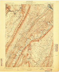 1904 Huntingdon1904 Print · USGSHuntingdon and the Raystown Branch of the Juniata River are captured in the early 1900s as the region's rail and iron industries thrived. Trace the routes of the P. R. R. and find local landmarks like Eagle Foundry, Cassville, and the historic Fink Bridge.6 unique versions available
 - 1930 Map of Broad Top, 1958 Print
 1930 Broad Top1958 Print · USGSThe Broad Top coalfields of the 1930s come alive through this survey of the region's mining towns and mountain ridges. Genealogists can trace family footprints at Bills Place, Miller Sch, and the Garlick Mine along the Huntingdon and Broad Top Mountain RR.2 unique versions available
 - 1933 Map of Broad Top
 1933 Broad Top1933 Print · USGSBroad Top Mountain and its surrounding coalfields were at a peak of rail-driven activity in the early thirties. Local historians can trace the precise routes of the Huntingdon and Broad Top Mountain RR and locate community landmarks like Wells Tannery and Eagle Foundry Ch.3 unique versions available
 - 1953 Map of Pittsburgh
 1953 Pittsburgh1953 Print · USGSWestern Pennsylvania's industrial landscape at the start of the fifties shows the steel and rail corridors between Pittsburgh and Altoona. Trace family roots in river towns like Tarentum or follow the Pennsylvania Turnpike across Laurel Hill.
 - 1954 Map of Pittsburgh
 1954 Pittsburgh1954 Print · USGSWestern Pennsylvania in the early fifties remains a powerhouse of heavy industry and vital transit corridors. Genealogists and historians can trace the rail-and-river network connecting Pittsburgh, Johnstown, and Altoona via the Pennsylvania RR and the Lincoln Highway.2 unique versions available
 - 1958 Map of Pittsburgh
 1958 Pittsburgh1958 Print · USGSWestern Pennsylvania in the late fifties shows an industrial heartland defined by the confluence of the Allegheny River and Monongahela River. Researchers can trace the sprawling rail networks of the Pennsylvania RR and find established towns like Butler, Latrobe, and Windber.5 unique versions available
 - 1959 Map of Pittsburgh
 1959 Pittsburgh1959 Print · USGSWestern Pennsylvania in the late fifties is captured here at the height of its industrial era. Genealogists and historians can trace the riverfront growth of Pittsburgh, the rail works at Altoona, and the mountain gaps of Laurel Hill.
 - 1963 Map of Martinsburg, 1964 Print
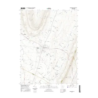
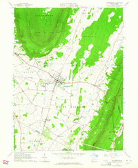 1963 Martinsburg1964 Print · USGSThe valleys and ridges of Blair County are captured here in the early sixties, showing a landscape of small farms and crossroads settlements. Genealogists can trace family names at the Detwiler Cem or Nicodemus Cem and locate landmarks like Central High Sch.3 unique versions available
 - 1963 Map of Entriken, 1964 Print
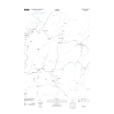
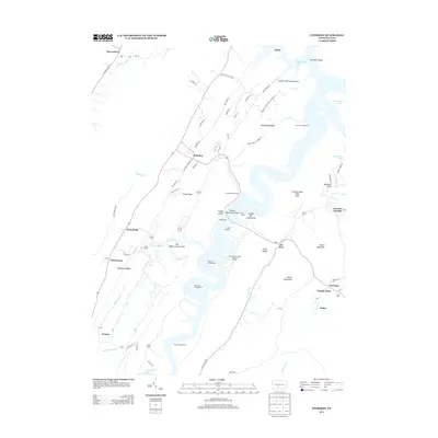
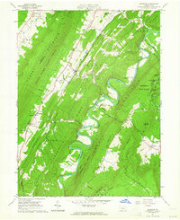 1963 Entriken1964 Print · USGSHuntsville's river valleys and ridgelines are captured here in the early sixties, showing the Raystown Branch Juniata River before major reservoir changes. Genealogists can locate family names at Brumbaugh Cem and community hubs like Salems Ch and Lincoln Grange Hall.5 unique versions available
 - 1964 Map of Pittsburgh
 1964 Pittsburgh1964 Print · USGSWestern Pennsylvania in the late fifties and early sixties shows a landscape of powerful river industries and expanding highways. Genealogists and historians can trace the rail corridors of the Pennsylvania RR through industrial hubs like Johnstown, Altoona, and Nanty Glo.
 - 1968 Map of Saxton, 1970 Print
 1968 Saxton1970 Print · USGSThe mining country of central Pennsylvania is documented here in the late sixties, where the Raystown Branch Juniata River meets a landscape of industry. Genealogists can trace family roots through settlements like Dudley and Broad Top City or find local burials at Grandview Cem.5 unique versions available
 - 1981 Map of Johnstown, 1983 Print
 1981 Johnstown1983 Print · USGSSouth Central Pennsylvania is captured here in the early eighties, from the industrial heart of the Conemaugh Valley to the ridges of the Allegheny Front. Local historians can trace the rail corridors of Conrail and the growth of mountain communities like Ebensburg, Nanty Glo, and Windber.
 - 2010 Map of Saxton, 2010 Print
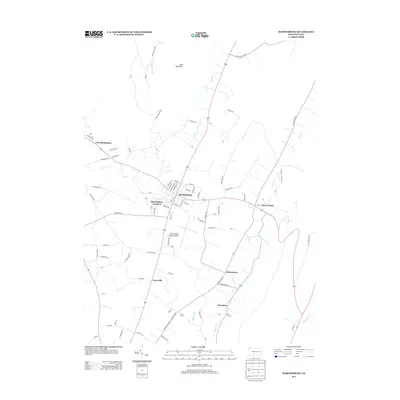
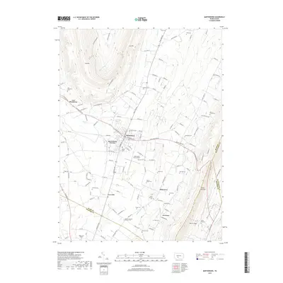
 2010 Saxton2010 Print · USGSCovers Hopewell Township, including Todd Township, Saxton, and other nearby areas
 - 2010 Map of Martinsburg, 2010 Print
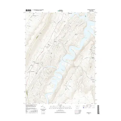
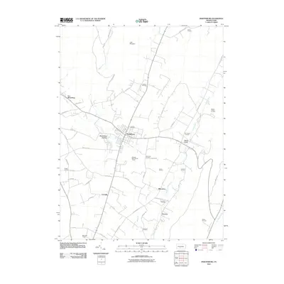 2010 Martinsburg2010 Print · USGSCovers Hopewell Township, including Frankstown Township, Martinsburg, and other nearby areas
 - 2010 Map of Entriken, 2010 Print
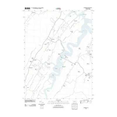 2010 Entriken2010 Print · USGSCovers Hopewell Township, including Todd Township, Marklesburg, and other nearby areas
 - 2013 Map of Saxton, 2013 Print
 2013 Saxton2013 Print · USGSCovers Hopewell Township, including Todd Township, Saxton, and other nearby areas
 - 2013 Map of Martinsburg, 2013 Print
 2013 Martinsburg2013 Print · USGSCovers Hopewell Township, including Frankstown Township, Martinsburg, and other nearby areas
 - 2013 Map of Entriken, 2013 Print
 2013 Entriken2013 Print · USGSCovers Hopewell Township, including Todd Township, Marklesburg, and other nearby areas
 - 2016 Map of Entriken, 2016 Print
 2016 Entriken2016 Print · USGSCovers Hopewell Township, including Todd Township, Marklesburg, and other nearby areas
 - 2016 Map of Martinsburg, 2016 Print
 2016 Martinsburg2016 Print · USGSCovers Hopewell Township, including Frankstown Township, Martinsburg, and other nearby areas
 - 2016 Map of Saxton, 2016 Print
 2016 Saxton2016 Print · USGSCovers Hopewell Township, including Todd Township, Saxton, and other nearby areas
 - 2019 Map of Martinsburg, 2019 Print
 2019 Martinsburg2019 Print · USGSCovers Hopewell Township, including Frankstown Township, Martinsburg, and other nearby areas
Showing maps 1-25 of 30
Top cities near Hopewell Township
- Altoona historical maps
- Frankstown Township historical maps
- Huntingdon historical maps
- Hollidaysburg historical maps
- Roaring Spring historical maps
- Martinsburg historical maps
See more
Top neighborhoods of Hopewell Township
- Russellville historical maps
- Puttstown historical maps
- Cherrytown historical maps
- Foxton historical maps
Frequently asked questions
- What are the different types of historical maps available for Hopewell Township?
- What is the oldest map of Hopewell Township?
- Where can I purchase historical maps of Hopewell Township for my home or office?
- Where can I download high-res historical maps of Hopewell Township?
- Are there historical topographic maps available for Hopewell Township?
- Is there historical aerial imagery available for Hopewell Township?
- Where are historical maps of Hopewell Township sourced from?