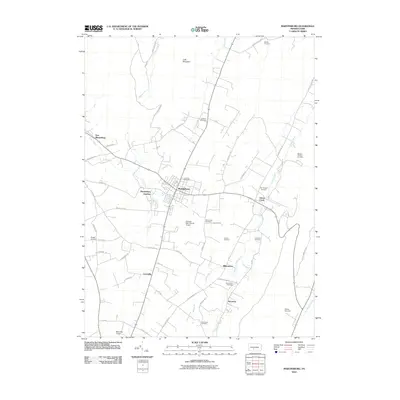
2010 Map of Martinsburg
USGS Topo · Published 2010About this map
Martinsburg serves as the central hub for this portion of Blair County, situated in a valley framed by Lock Mountain to the north. The landscape is defined by a dense network of local roads such as Rebecca Furnace Rd and Hickory Bottom Rd, which connect small agricultural settlements and rural industry points. For genealogists, the map is remarkably dense with family-named burial grounds, including the Dilling Cemetery, Kensinger Cemetery, and Shriver Cemetery, offering a detailed spatial record of the area's early residents and religious communities like the Mennonite Cemetery. The proximity of Martinsburg Junction to the main town and the expansive Altoona-Blair County Airport highlights the area's evolution from a purely agrarian society to a regional transportation center, while watercourses like Clover Creek and Piney Creek continue to dictate the placement of farms and historic mills.
Find a feature on this map
54 named features on this map. Tap any name to fly to it.
Don’t see what you’re looking for? This feature index may not catch every label — zoom into the map to look around manually.
Map Details
Editions of this 2010 Martinsburg Map
This is the sole edition of this map. No revisions or reprints were ever made.
Other maps of this area

1900 · Everett
USGS Topo · 1:62,500

1901 · Huntingdon
USGS Topo · 1:62,500

1902 · Everett
USGS Topo · 1:62,500

1902 · Hollidaysburg
USGS Topo · 1:62,500

1903 · Hollidaysburg
USGS Topo · 1:62,500

1904 · Huntingdon
USGS Topo · 1:62,500

1930 · Broad Top
USGS Topo · 1:62,500

1933 · Broad Top
USGS Topo · 1:62,500

1953 · Pittsburgh
USGS Topo · 1:250,000

1954 · Pittsburgh
USGS Topo · 1:250,000
Featured Places
- Frankstown Township, PA
- Martinsburg, PA
- Martinsburg Junction, North Woodbury Township
- Woodbury Township, PA
- Taylor Township, PA