2020s Maps of West Township, Pennsylvania
Explore 4 historic maps of West Township from the 2020s. These maps offer a rare glimpse into what life looked like during the 2020s — showing old roads, neighborhoods, homes, and landmarks that have changed or disappeared over time.
Whether you're researching your family's past, planning a metal detecting trip, or studying how West Township's landscape evolved across the 2020s, these high-resolution maps are a powerful tool for exploring the history of this region.
- Focus on a specific era: All maps on this page are from the 2020s, giving you a focused view of this time period.
- See what’s changed: Compare century-old streets, trails, and buildings to today's modern landscape using overlays and satellite layers.
- Research with precision: Use these maps for genealogy, historical research, land use analysis, or educational projects.
- View, download, or print: Maps are fully viewable online in high resolution, and can be downloaded or printed for your own records.
Start exploring West Township's history through authentic maps from the 2020s. This is your window into the past.
West Township, PA maps
(4)- 2023 Map of Alexandria, 2023 Print
 2023 Alexandria2023 Print · USGSThe river forks and ridge gaps of Huntingdon County are shown here in modern detail. Genealogists can trace family names across numerous sites like Old Hartslog Cem and Huyett Cem, while hikers can follow the Mid State Trail.
 - 2023 Map of Franklinville, 2023 Print
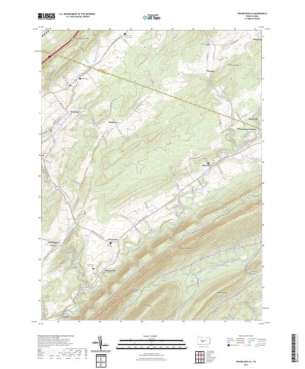 2023 Franklinville2023 Print · USGSHuntingdon County's iron-working past and ridge-and-valley settlement patterns are preserved in this recent survey. Local historians can trace the foundations of Pennsylvania Furnace, locate family plots at Seven Stars Cem, and follow the historical Warriors Mark Path.
 - 2023 Map of Donation, 2023 Print
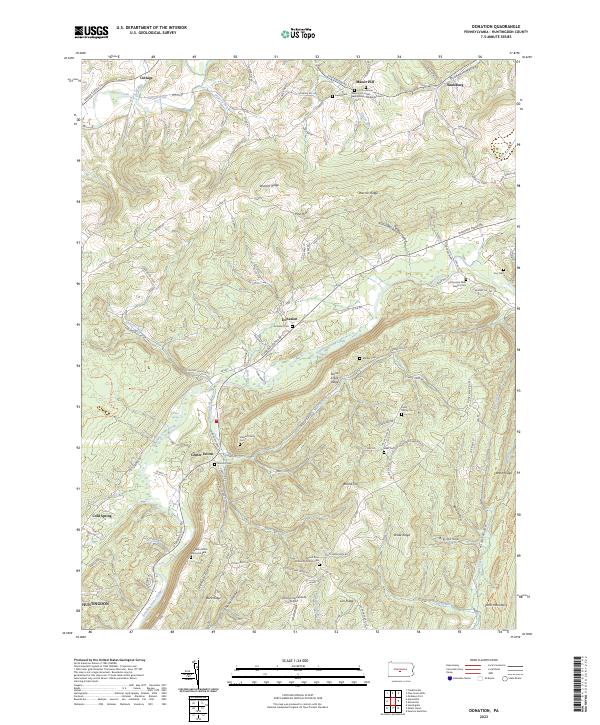 2023 Donation2023 Print · USGSHuntingdon County high country is documented here in the early twenty-first century, showing the rural crossroads and ridge-and-valley landscape. Researchers can trace family sites at Donation Cem, Coy Cem, and the Agudath Achim Memorial Park.
 - 2023 Map of Pine Grove Mills, 2023 Print
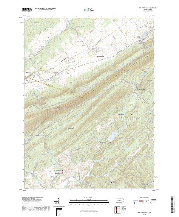 2023 Pine Grove Mills2023 Print · USGSPine Grove Mills and the surrounding ridges of Central Pennsylvania are captured here at the start of the 2020s. Researchers can locate several family burial grounds, such as the Pennsylvania Furnace Cem and Bennett Cem, or trace the rural routes connecting Neffs Mills and Monroe Furnace.
End of results
Showing maps 1-4 of 4
Top cities near West Township
- State College historical maps
- Huntingdon historical maps
- Boalsburg historical maps
- Menno Township historical maps
- Houserville historical maps
- Warriors Mark Township historical maps
See more
Top neighborhoods of West Township
Frequently asked questions
- What are the different types of historical maps available for West Township?
- What is the oldest map of West Township?
- Where can I purchase historical maps of West Township for my home or office?
- Where can I download high-res historical maps of West Township?
- Are there historical topographic maps available for West Township?
- Is there historical aerial imagery available for West Township?
- Where are historical maps of West Township sourced from?