2020s Maps of Madison Township, Pennsylvania
Explore 4 historic maps of Madison Township from the 2020s. These maps offer a rare glimpse into what life looked like during the 2020s — showing old roads, neighborhoods, homes, and landmarks that have changed or disappeared over time.
Whether you're researching your family's past, planning a metal detecting trip, or studying how Madison Township's landscape evolved across the 2020s, these high-resolution maps are a powerful tool for exploring the history of this region.
- Focus on a specific era: All maps on this page are from the 2020s, giving you a focused view of this time period.
- See what’s changed: Compare century-old streets, trails, and buildings to today's modern landscape using overlays and satellite layers.
- Research with precision: Use these maps for genealogy, historical research, land use analysis, or educational projects.
- View, download, or print: Maps are fully viewable online in high resolution, and can be downloaded or printed for your own records.
Start exploring Madison Township's history through authentic maps from the 2020s. This is your window into the past.
Madison Township, PA maps
(4)- 2023 Map of Sterling, 2023 Print
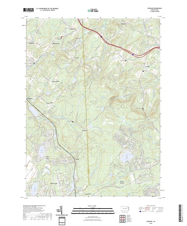 2023 Sterling2023 Print · USGSWayne County and the Pocono plateau are shown here during a period of residential growth and long-standing rural tradition. Researchers can trace family history through sites like Madisonville Union Cem and Sterling Cem while exploring the headwaters of the Lehigh River.
 - 2023 Map of Moscow, 2023 Print
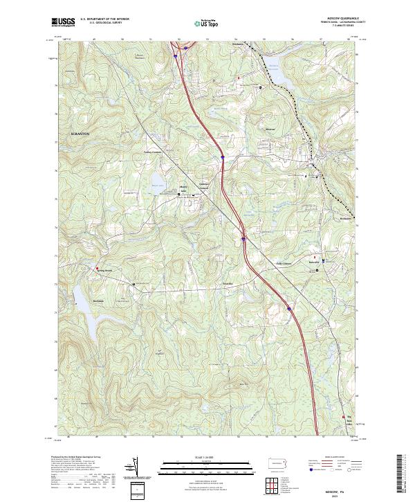 2023 Moscow2023 Print · USGSThe Lackawanna County countryside near the Moosic Mountains is captured here in recent years, showing a landscape of high ridges and valley settlements. Researchers can locate numerous family and community burial grounds, such as Saint Catherines Cem, or trace landmarks like the Lazy J Ranch Airport and Maple Lake.
 - 2023 Map of Olyphant, 2023 Print
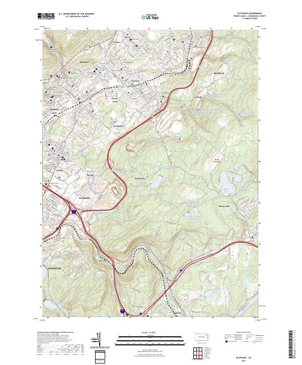 2023 Olyphant2023 Print · USGSThe Lackawanna River valley's industrial heritage is on full display in this modern survey of the coal region. Genealogists can trace family sites at Saint Patrick's Cem or Holy Family Cem while exploring the ridgelines of the Moosic Mountains.
 - 2023 Map of Lake Ariel, 2023 Print
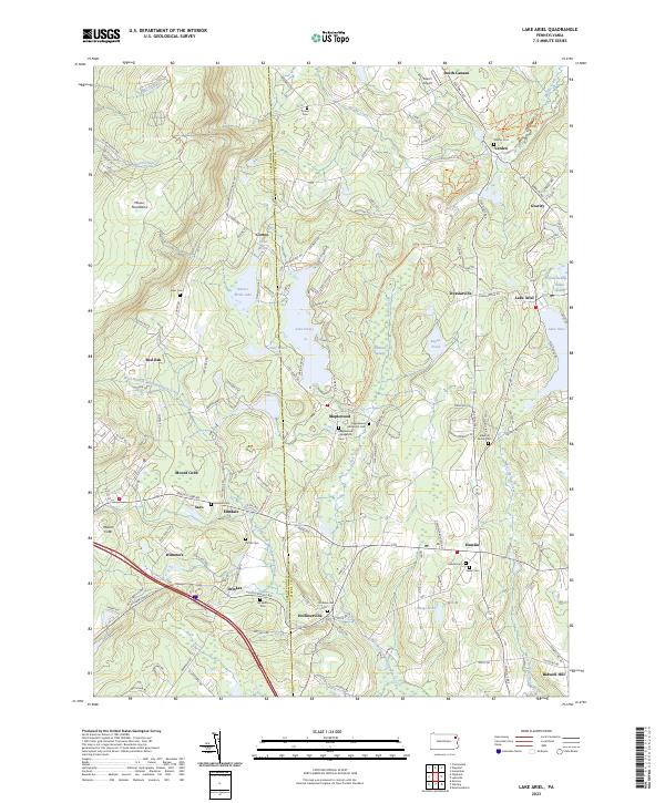 2023 Lake Ariel2023 Print · USGSWayne County’s high country comes to life in this modern view of the Poconos, where glacial lakes and the Moosic Mountains shape the terrain. Researchers can locate historic rural burial grounds like Simon Cem or trace the drainage of Middle Creek near the old South-Canaan settlement.
End of results
Showing maps 1-4 of 4
Top cities near Madison Township
- Scranton historical maps
- Dunmore historical maps
- Carbondale historical maps
- Tobyhanna historical maps
- Blakely historical maps
- Archbald historical maps
See more
Top neighborhoods of Madison Township
- Dawn Acres historical maps
- Madisonville historical maps
- Quicktown historical maps
- Aberdeen historical maps
Frequently asked questions
- What are the different types of historical maps available for Madison Township?
- What is the oldest map of Madison Township?
- Where can I purchase historical maps of Madison Township for my home or office?
- Where can I download high-res historical maps of Madison Township?
- Are there historical topographic maps available for Madison Township?
- Is there historical aerial imagery available for Madison Township?
- Where are historical maps of Madison Township sourced from?