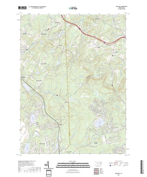
2023 Map of Sterling
USGS Topo · Published 2023About this map
The Lehigh River and its West Fork Lehigh River carve through this landscape at the boundary of Wayne and Lackawanna counties. The area is defined by a dense network of water bodies and wetlands, including Thousand Acre Swamp and Big Sampson Swamp, interspersed with established settlements like Madisonville and Sterling. Genealogical interest is high here, with numerous burial sites such as Madisonville Union Cem, Hornbaker Cem, and Sterling Cem marking the early community footprints.
Find a feature on this map
180 named features on this map. Tap any name to fly to it.
Don’t see what you’re looking for? This feature index may not catch every label — zoom into the map to look around manually.
Map Details
Editions of this 2023 Sterling Map
This is the sole edition of this map. No revisions or reprints were ever made.
Other maps of this area

1889 · Scranton
USGS Topo · 1:62,500

1891 · Scranton
USGS Topo · 1:62,500

1893 · Scranton
USGS Topo · 1:62,500

1919 · Pocono
USGS Topo · 1:62,500

1921 · Pocono
USGS Topo · 1:62,500

1922 · Stoddartsville
USGS Topo · 1:62,500

1923 · Pocono
USGS Topo · 1:62,500

1924 · Stoddartsville
USGS Topo · 1:62,500

1928 · Ariel
USGS Topo · 1:62,500

1932 · Ariel
USGS Topo · 1:62,500