Old Maps of Madison Township, Pennsylvania for Genealogy
Trace your family roots with 44 historic maps of Madison Township. These high-res maps reveal old neighborhoods, homesites, landmarks, and streets — helping you uncover where your ancestors lived and how the area evolved over time.
- Explore historic neighborhoods: Identify where your relatives may have lived in the 1800s or 1900s.
- Compare maps over time: Trace the changes in streets, buildings, and landmarks for multi-generational research.
- Perfect for genealogy & ancestry research: Used by family historians and researchers to map out lineage and migration.
These maps are an incredible resource for exploring your personal connection to Madison Township's past.
Madison Township, PA maps
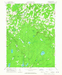
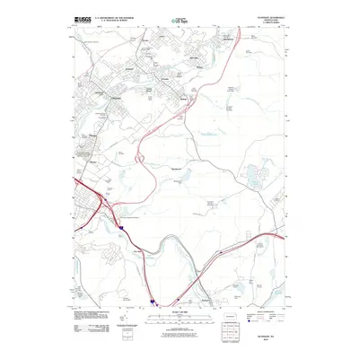
(44)- 1889 Map of Scranton, 1954 Print
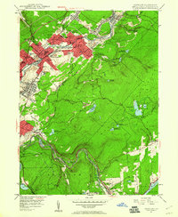
 1889 Scranton1954 Print · USGSThe industrial heart of the Lackawanna Valley is captured here during its late 19th-century boom, showing the dense rail networks and coal towns of the era. Genealogists can trace family roots through early street grids in Scranton and Dunmore or smaller settlements like Barberstown and Priceburg.
 - 1891 Map of Scranton
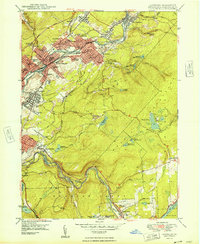
 1891 Scranton1891 Print · USGSThe Lackawanna Valley thrived at the peak of the coal era when rail lines and mine patches crowded the riverbanks. Genealogists and industrial historians can trace the early footprints of Scranton, Dunmore, and Old Forge alongside the Delaware and Hudson Canal Co R R.
 - 1893 Map of Scranton
 1893 Scranton1893 Print · USGSLackawanna County's anthracite heartland is shown in detail during the late nineteenth-century industrial boom. Genealogists and historians can trace the early street grids of Scranton and Dunmore or locate smaller settlements like Old Forge and Barber Town.7 unique versions available
 - 1928 Map of Ariel, 1953 Print
 1928 Ariel1953 Print · USGSWayne County was undergoing a significant transformation in the late twenties as the waters of Lake Wallenpaupack rose. Genealogists and historians can trace local family roots through sites like Haags Mill, German Valley Sch, and the Erie RR corridor.4 unique versions available
 - 1932 Map of Ariel
 1932 Ariel1932 Print · USGSWayne and Pike counties are seen here in the early 1930s as the regional landscape adjusted to the presence of Lake Wallenpaupack. Trace family roots at Ammerman Sch or follow the Erie RR past Gravity and Lake Ariel.3 unique versions available
 - 1943 Map of Scranton
 1943 Scranton1943 Print · USGSNortheastern Pennsylvania’s coal and rail corridor comes to life in the 1940s, showcasing the dense urban industrial centers of the Wyoming Valley. Genealogists can locate family landmarks like the Fayette School and Locust Ridge School or trace the early paths of the DL & W and Erie railroads.
 - 1946 Map of Olyphant, 1960 Print
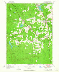
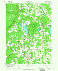
 1946 Olyphant1960 Print · USGSThe Lackawanna Valley at the end of the 1940s reveals a landscape defined by coal and rail connectivity. Genealogists and historians can trace the foundations of local life through the St Nicholas Orphanage, Jessup High Sch, and various family cemeteries.6 unique versions available
 - 1946 Map of Moscow, 1964 Print
 1946 Moscow1964 Print · USGSThe Moosic Mountains and industrial rail corridors define the Lackawanna County landscape shortly after the war. Researchers can trace rural settlement patterns through family-named junctions like Quinlan Corners, local institutions like Covington Sch, and the winding path of the Erie RR.5 unique versions available
 - 1948 Map of Olyphant
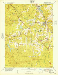
 1948 Olyphant1948 Print · USGSThe Lackawanna Valley at the height of its industrial era shows a landscape shaped by coal and rail. Genealogists and historians can trace neighborhood schools and parish cemeteries like St Marys Cem or locate the St Nicholas Orphanage and Sturgis.2 unique versions available
 - 1949 Map of Moscow
 1949 Moscow1949 Print · USGSThe Moosic Mountains and the busy rail corridors of Lackawanna County are captured here in the late 1940s. Genealogists can trace family names and sites through Spring Brook Corners, the Welch Ch, and St Catherines Cem.
 - 1950 Map of Scranton, 1952 Print
 1950 Scranton1952 Print · USGSMid-century Northeast Pennsylvania and the Hudson Valley come alive in this survey of the tri-state region. Genealogists and historians can trace the dense rail networks of the Erie RR and DL&W RR between industrial hubs like Scranton and Wilkes-Barre.
 - 1953 Map of Scranton
 1953 Scranton1953 Print · USGSNortheastern Pennsylvania and the Catskills are shown in great detail during the early fifties, a time when rail lines and river valleys dictated the region's growth. Genealogists and historians can trace the industrial hearts of Scranton and Wilkes-Barre or locate remote landmarks like High Point and Lake Wallenpaupack.
 - 1959 Map of Scranton
 1959 Scranton1959 Print · USGSThe northern coalfields and the Hudson Valley meet in this mid-century survey of the Pennsylvania and New York borderlands. Genealogists and historians can trace the intricate rail networks of the Erie Railroad and the vast waters of Lake Wallenpaupack.2 unique versions available
 - 1959 Map of Pocono
 1959 Pocono1959 Print · USGSThe Pocono Mountains region is captured here in the late fifties, showcasing its evolution from a railway-dependent timber and ice landscape to a premier resort destination. Researchers can locate dozens of country schoolhouses like Maplewood Sch and trace the paths of the Erie RR through Hawley and Kimbles.
 - 1962 Map of Scranton, 1977 Print
 1962 Scranton1977 Print · USGSThe industrial heart of eastern Pennsylvania and the New York Catskills are captured here in the early sixties. Genealogists and historians can trace the dense valley settlements from Scranton to Wilkes-Barre and the rail lines of the Erie Lackawanna Railroad.2 unique versions available
 - 1965 Map of Scranton
 1965 Scranton1965 Print · USGSThe tri-state highlands of Pennsylvania, New York, and New Jersey come alive in the mid-sixties as industry and recreation converge. Trace the intricate rail lines of the Erie Lackawanna RR or locate landmarks like the U S Military Academy.2 unique versions available
 - 1965 Map of Sterling, 1967 Print
 1965 Sterling1967 Print · USGSWayne and Lackawanna Counties are seen here in the mid-sixties as the ERIE-LACKAWANNA railroad still shaped the rural landscape. Genealogists can locate family sites near Freytown Cem, Madisonville, and the small settlement of Jericho.3 unique versions available
 - 1966 Map of Lake Ariel, 1967 Print
 1966 Lake Ariel1967 Print · USGSIn the mid-1960s, the Wayne and Lackawanna county line was a landscape of mountain ridges and thriving lakeside communities connected by the Erie-Lackawanna rail line. Researchers can locate vanished landmarks and family sites like Kizer Cem, Hollisterville, and the Jefferson Sch.3 unique versions available
 - 1986 Map of Scranton
 1986 Scranton1986 Print · USGSNortheastern Pennsylvania in the mid-eighties shows an era of transition between its deep-rooted mining history and modern transit growth. Researchers can trace the industrial footprint of a Strip Mine, locate the Tobyhanna Army Depot, or find family sites near St Marys Cem and Wilkes College.2 unique versions available
 - 1994 Map of Sterling, 1995 Print
 1994 Sterling1995 Print · USGSWayne and Lackawanna counties transitioned from traditional farming and mining to recreational residential hubs by the mid-1990s. Researchers can trace old family landmarks and local institutions like Peoples Ch, Drinker Sch, and the quiet Jericho Cem.
 - 1994 Map of Lake Ariel, 1995 Print
 1994 Lake Ariel1995 Print · USGSThe Lake Ariel region of Wayne County is captured here in the mid-1990s, showing a landscape defined by glacial ponds and small mountain hamlets. Researchers can trace family history through sites like Salem Cem, Wallenpaupack Mills, and the old rail paths of the Old RR Grade.
 - 1994 Map of Olyphant, 1996 Print
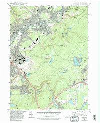 1994 Olyphant1996 Print · USGSThe Lackawanna Valley boroughs show a dense 1990s landscape of industry and community institutions just north of Scranton. Researchers can trace local heritage through numerous religious sites and landmarks like Mt Carmel Cem, Bishop O'Hara High School, and Grassy Island.
 - 1997 Map of Sterling, 2000 Print
 1997 Sterling2000 Print · USGSWayne and Lackawanna counties appear here in the late twentieth century, showing a landscape of upland swamps and growing lakeside communities. Local researchers can locate family landmarks like Drinker Sch Cem, the Spring Hill Airpark, and the rural settlement at Madisonville.
 - 1999 Map of Olyphant, 2001 Print
 1999 Olyphant2001 Print · USGSLackawanna County's coal-valley communities and upland reservoirs are captured here in the late twentieth century. Genealogists and local historians can trace family roots through numerous sites like St Michaels Cem, Mt Carmel Cem, and the neighborhoods of Smoketown or Jessup.
 - 2010 Map of Olyphant, 2010 Print
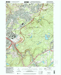
 2010 Olyphant2010 Print · USGSCovers Madison Township, including Scranton, Blakely, and other nearby areas
Showing maps 1-25 of 44
Top cities near Madison Township
- Scranton historical maps
- Dunmore historical maps
- Carbondale historical maps
- Tobyhanna historical maps
- Blakely historical maps
- Archbald historical maps
See more
Top neighborhoods of Madison Township
- Dawn Acres historical maps
- Madisonville historical maps
- Quicktown historical maps
- Aberdeen historical maps
Frequently asked questions
- What are the different types of historical maps available for Madison Township?
- What is the oldest map of Madison Township?
- Where can I purchase historical maps of Madison Township for my home or office?
- Where can I download high-res historical maps of Madison Township?
- Are there historical topographic maps available for Madison Township?
- Is there historical aerial imagery available for Madison Township?
- Where are historical maps of Madison Township sourced from?