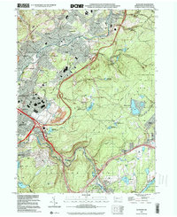
1999 Map of Olyphant
USGS Topo · Published 2001About this map
The Lackawanna River corridor defines the industrial and residential heart of this region, where the contiguous settlements of Olyphant, Blakely, and Dickson City follow the valley floor. Evidence of the area's industrial past is visible in an extensive Old RR Grade and several quarries, while the high ground to the east and south is dominated by an intricate system of water management. Numerous reservoirs, including Marshwood Reservoir, Dunmore Reservoir No 4, and the Olyphant Reservoir No 3 series, are tucked into the hills. The map reveals a high density of religious and educational institutions, from St Marys Sch to the Pennsylvania State University Worthington Scranton Campus, reflecting the well-established social fabric of these Lackawanna County communities at the close of the twentieth century.
Find a feature on this map
73 named features on this map. Tap any name to fly to it.
Don’t see what you’re looking for? This feature index may not catch every label — zoom into the map to look around manually.
Map Details
Editions of this 1999 Olyphant Map
This is the sole edition of this map. No revisions or reprints were ever made.
Other maps of this area

1889 · Scranton
USGS Topo · 1:62,500

1891 · Scranton
USGS Topo · 1:62,500

1892 · Honesdale
USGS Topo · 1:62,500

1892 · Dundaff
USGS Topo · 1:62,500

1893 · Scranton
USGS Topo · 1:62,500

1928 · Ariel
USGS Topo · 1:62,500

1932 · Ariel
USGS Topo · 1:62,500

1943 · Scranton
USGS Topo · 1:125,000

1943 · Honesdale
USGS Topo · 1:125,000

1946 · Dalton
USGS Topo · 1:24,000