1950s Maps of Caernarvon Township, Pennsylvania
Explore 9 historic maps of Caernarvon Township from the 1950s. These maps offer a rare glimpse into what life looked like during the 1950s — showing old roads, neighborhoods, homes, and landmarks that have changed or disappeared over time.
Whether you're researching your family's past, planning a metal detecting trip, or studying how Caernarvon Township's landscape evolved across the 1950s, these high-resolution maps are a powerful tool for exploring the history of this region.
- Focus on a specific era: All maps on this page are from the 1950s, giving you a focused view of this time period.
- See what’s changed: Compare century-old streets, trails, and buildings to today's modern landscape using overlays and satellite layers.
- Research with precision: Use these maps for genealogy, historical research, land use analysis, or educational projects.
- View, download, or print: Maps are fully viewable online in high resolution, and can be downloaded or printed for your own records.
Start exploring Caernarvon Township's history through authentic maps from the 1950s. This is your window into the past.
Caernarvon Township, PA maps
(9)- 1950 Map of Harrisburg, 1952 Print
 1950 Harrisburg1952 Print · USGSMid-century Central Pennsylvania comes alive through its dense rail networks and river valley settlements during the post-war industrial era. Genealogists and historians can trace family roots through hubs like Harrisburg, locate Carlisle Barracks, or follow the Pennsylvania RR through the Lebanon Valley.
 - 1954 Map of Elverson, 1970 Print
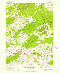
 1954 Elverson1970 Print · USGSBerks and Chester counties are captured here in the mid-fifties, showing the intersection of colonial history and modern transit. Trace old family sites near Geigertown, Joanna Heights, and churches like Bethesda Ch or Ebenezer Ch.
 - 1955 Map of Honey Brook, 1957 Print
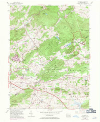
 1955 Honey Brook1957 Print · USGSChester and Lancaster counties are captured here in the mid-fifties, showing a landscape shaped by historic turnpikes and the wooded heights of Welsh Mountain. Researchers can trace old family-named landmarks and institutions like St Johns Church, Bridgeville Ch, and the Kings Highway Sch.6 unique versions available
 - 1956 Map of Newark
 1956 Newark1956 Print · USGSThe industrial heart of the Mid-Atlantic is captured here at the dawn of the highway era, tracing the dense corridors between Newark and Philadelphia. Genealogists and local historians can map the rail networks of the Reading RR or locate mid-century military life at Fort Dix Military Reservation.2 unique versions available
 - 1956 Map of Terre Hill, 1957 Print
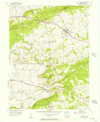
 1956 Terre Hill1957 Print · USGSMid-century Lancaster County is captured here at the meeting of tradition and transit, just as the turnpike began reshaping the countryside. Genealogists can trace family roots through numerous local landmarks like Wide Hollow Sch, Red Run Ch, and the many small crossroads settlements like Fivepointville.6 unique versions available
 - 1956 Map of Elverson, 1957 Print
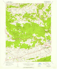
 1956 Elverson1957 Print · USGSThe Berks and Chester County borderlands come into focus in the mid-fifties, balancing industrial rail history with emerging state parklands. Researchers can trace family roots at Springfield Cem, locate Hause Sch, and explore the grounds of Hopewell Village.6 unique versions available
 - 1956 Map of Morgantown, 1957 Print
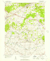
 1956 Morgantown1957 Print · USGSMid-century southeastern Pennsylvania is captured here at a crossroads of industry and agriculture. Genealogists and historians can trace family locations near Joanna Furnace, find old rural schools like Smoketown Sch, and locate the Grace Mine operations.6 unique versions available
 - 1957 Map of Harrisburg
 1957 Harrisburg1957 Print · USGSMid-century Central Pennsylvania comes into focus as a bustling network of rail, river, and mountain ridges. Genealogists and historians can trace the development of the State Capitol and surrounding hubs like Middletown, Columbia, and Pottsville.7 unique versions available
 - 1957 Map of Newark
 1957 Newark1957 Print · USGSThe industrial and military heart of the Mid-Atlantic is mapped during its post-war suburban boom. Genealogists and historians can trace the intricate rail corridors of the Reading Railroad and locate key landmarks from Princeton University to Fort Hancock.
End of results
Showing maps 1-9 of 9
Top cities near Caernarvon Township
- Reading historical maps
- Coatesville historical maps
- Ephrata historical maps
- Caln Township historical maps
- Wyomissing historical maps
- East Earl Township historical maps
See more
Top neighborhoods of Caernarvon Township
Frequently asked questions
- What are the different types of historical maps available for Caernarvon Township?
- What is the oldest map of Caernarvon Township?
- Where can I purchase historical maps of Caernarvon Township for my home or office?
- Where can I download high-res historical maps of Caernarvon Township?
- Are there historical topographic maps available for Caernarvon Township?
- Is there historical aerial imagery available for Caernarvon Township?
- Where are historical maps of Caernarvon Township sourced from?