2020s Maps of Caernarvon Township, Pennsylvania
Explore 4 historic maps of Caernarvon Township from the 2020s. These maps offer a rare glimpse into what life looked like during the 2020s — showing old roads, neighborhoods, homes, and landmarks that have changed or disappeared over time.
Whether you're researching your family's past, planning a metal detecting trip, or studying how Caernarvon Township's landscape evolved across the 2020s, these high-resolution maps are a powerful tool for exploring the history of this region.
- Focus on a specific era: All maps on this page are from the 2020s, giving you a focused view of this time period.
- See what’s changed: Compare century-old streets, trails, and buildings to today's modern landscape using overlays and satellite layers.
- Research with precision: Use these maps for genealogy, historical research, land use analysis, or educational projects.
- View, download, or print: Maps are fully viewable online in high resolution, and can be downloaded or printed for your own records.
Start exploring Caernarvon Township's history through authentic maps from the 2020s. This is your window into the past.
Caernarvon Township, PA maps
(4)- 2023 Map of Morgantown, 2023 Print
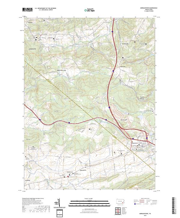 2023 Morgantown2023 Print · USGSMorgantown and the Conestoga River headwaters are captured here in a landscape defined by deep religious and industrial roots. Genealogists can trace family burial sites like Mast Cem and Bangor Episcopal Cem near Churchtown.
 - 2023 Map of Honey Brook, 2023 Print
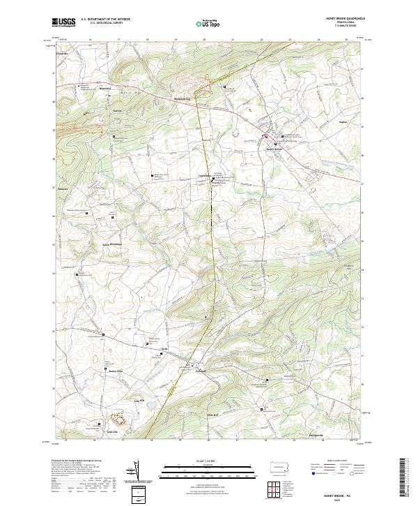 2023 Honey Brook2023 Print · USGSThe Pequea Valley and the ridges of the Welsh Mountains appear here in modern detail along the Lancaster and Chester county line. Genealogists can trace decades of local heritage through sites like Gault Graveyard, Amish Cem, and Saint Johns Episcopal Church Cem.
 - 2023 Map of Elverson, 2023 Print
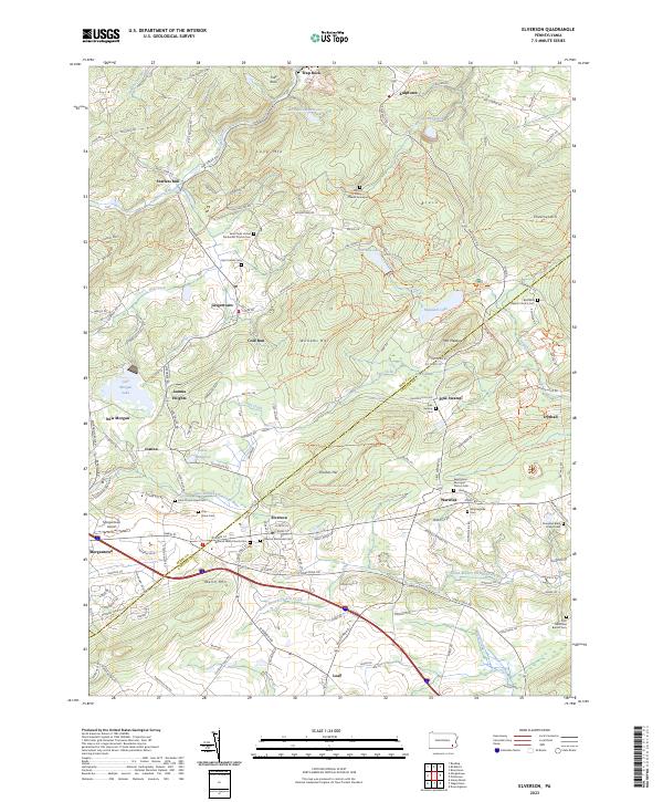 2023 Elverson2023 Print · USGSElverson and the Berks-Chester county line are captured here in the early twenty-first century, showing the intersection of industrial heritage and rural growth. Genealogists can locate family burial sites at Mount Frisby Church Graveyard and Saint James Cem while tracing the waters of Hay Creek.
 - 2023 Map of Terre Hill, 2023 Print
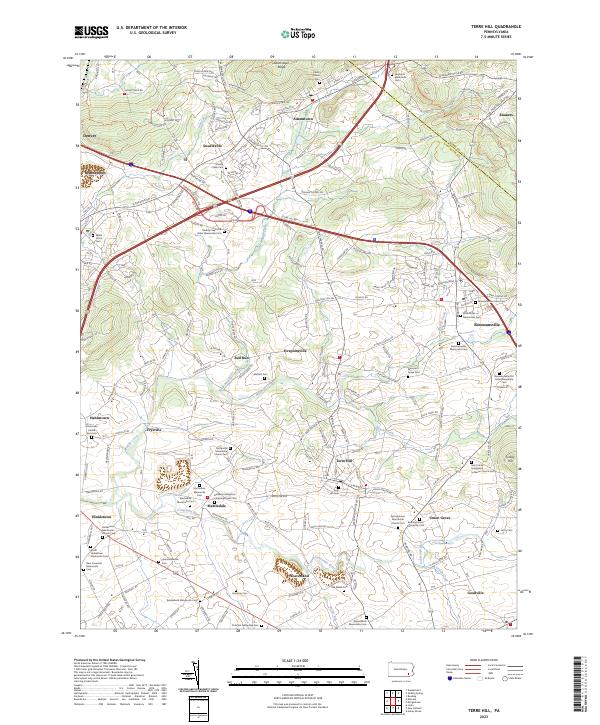 2023 Terre Hill2023 Print · USGSLancaster County's sectarian heartland comes into focus in this recent study of the area between the Conestoga River and Adamstown Ridge. Genealogists can trace family lineages through a remarkable density of local burial sites, including Messner's Grave Yard, Old Welsh Cem, and the Hahnstown United Zion Cem.
End of results
Showing maps 1-4 of 4
Top cities near Caernarvon Township
- Reading historical maps
- Coatesville historical maps
- Ephrata historical maps
- Caln Township historical maps
- Wyomissing historical maps
- East Earl Township historical maps
See more
Top neighborhoods of Caernarvon Township
Frequently asked questions
- What are the different types of historical maps available for Caernarvon Township?
- What is the oldest map of Caernarvon Township?
- Where can I purchase historical maps of Caernarvon Township for my home or office?
- Where can I download high-res historical maps of Caernarvon Township?
- Are there historical topographic maps available for Caernarvon Township?
- Is there historical aerial imagery available for Caernarvon Township?
- Where are historical maps of Caernarvon Township sourced from?