2020s Maps of Bethel Township, Pennsylvania
Explore 5 historic maps of Bethel Township from the 2020s. These maps offer a rare glimpse into what life looked like during the 2020s — showing old roads, neighborhoods, homes, and landmarks that have changed or disappeared over time.
Whether you're researching your family's past, planning a metal detecting trip, or studying how Bethel Township's landscape evolved across the 2020s, these high-resolution maps are a powerful tool for exploring the history of this region.
- Focus on a specific era: All maps on this page are from the 2020s, giving you a focused view of this time period.
- See what’s changed: Compare century-old streets, trails, and buildings to today's modern landscape using overlays and satellite layers.
- Research with precision: Use these maps for genealogy, historical research, land use analysis, or educational projects.
- View, download, or print: Maps are fully viewable online in high resolution, and can be downloaded or printed for your own records.
Start exploring Bethel Township's history through authentic maps from the 2020s. This is your window into the past.
Bethel Township, PA maps
(5)- 2023 Map of Pine Grove, 2023 Print
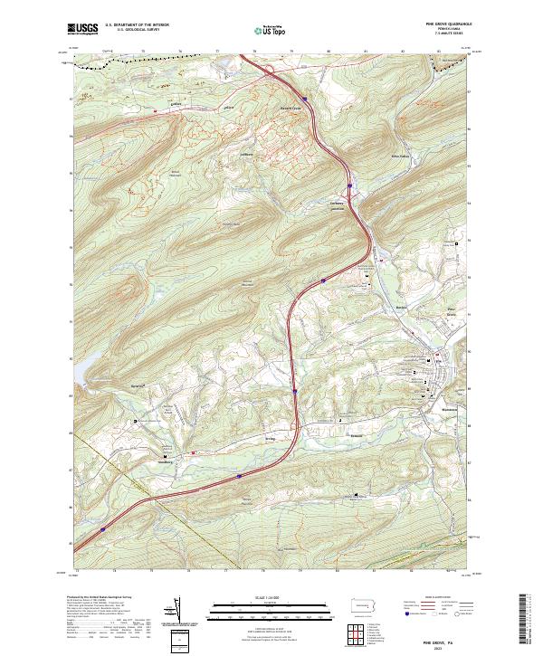 2023 Pine Grove2023 Print · USGSThe Swatara Creek valley comes alive in this contemporary look at Schuylkill County's ridges and rural crossroads. Local historians can trace family names at the Haldeman Family Cem or locate the old landing at Fairview Farm Airfield.
 - 2023 Map of Indiantown Gap, 2023 Print
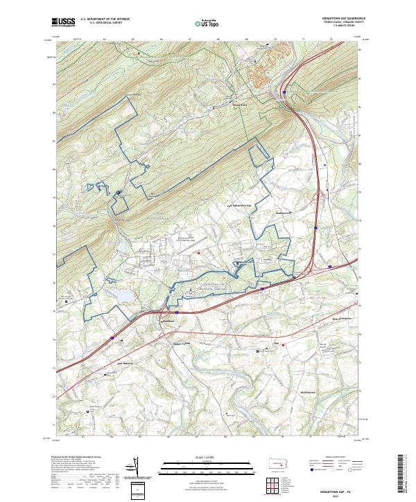 2023 Indiantown Gap2023 Print · USGSThe military installations and historic gaps of Lebanon County come into focus in the early 2020s, revealing a landscape shaped by the Union Canal and the Appalachian National Scenic Trail. Genealogists can locate family sites at Moonshine Cemetery or trace the old roads connecting Harper Tavern and Bordnersville.
 - 2023 Map of Bethel, 2023 Print
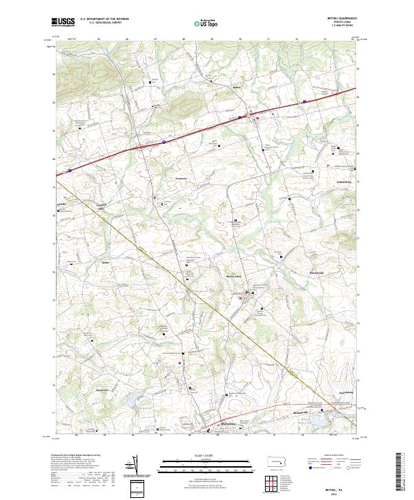 2023 Bethel2023 Print · USGSThe Berks and Lebanon County borderlands are captured here in a detailed survey of Pennsylvania’s Dutch Country. Genealogists can locate numerous family-named landmarks and churchyards, including Schmehl Farm Cem, Ziegler Family Cem, and the historic Union Canal.
 - 2023 Map of Tower City, 2023 Print
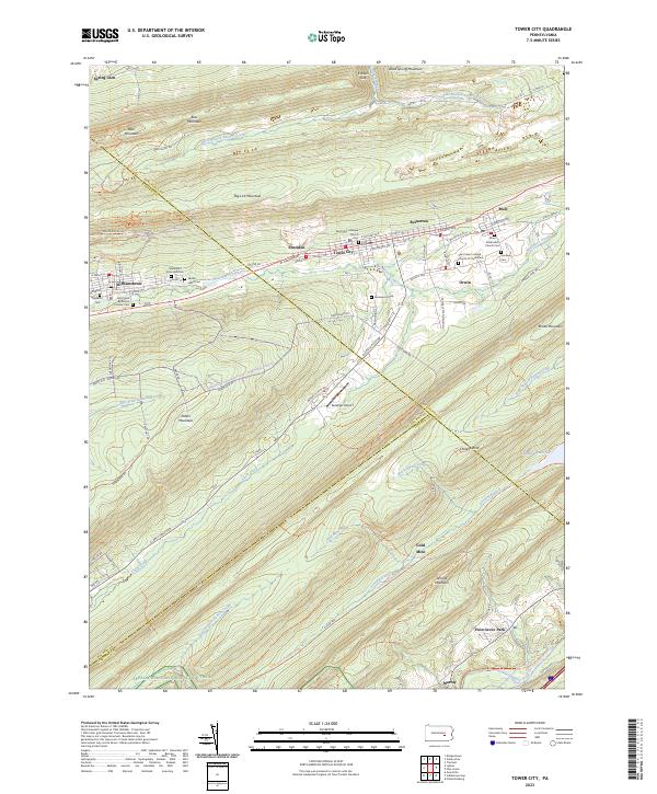 2023 Tower City2023 Print · USGSThe northern anthracite region comes to life in this detailed survey of the valley between Big Lick Mountain and Peters Mountain. Genealogists and local historians can trace the foundations of Tower City and Williamstown, locating local landmarks like the Sacred Heart Cem and the Gold Mine.
 - 2023 Map of Fredericksburg, 2023 Print
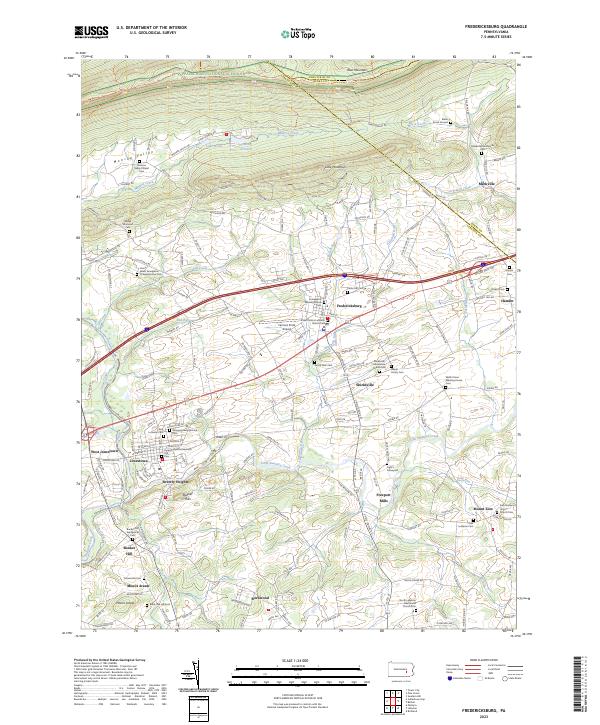 2023 Fredericksburg2023 Print · USGSLebanon County is depicted here in recent years, showing the enduring agricultural and religious landscape between Blue Mountain and Swatara Creek. Researchers can trace family sites at Grove Farm Cem or explore the route of the historic Union Canal.
End of results
Showing maps 1-5 of 5
Top cities near Bethel Township
- Lebanon historical maps
- Pottsville historical maps
- Hershey historical maps
- Palmyra historical maps
- North Cornwall historical maps
- Campbelltown historical maps
See more
Top neighborhoods of Bethel Township
- Fredericksburg historical maps
- Mount Zion historical maps
- Shirksville historical maps
- Hamlin historical maps
- Greble historical maps
- Freeport Mills historical maps
Frequently asked questions
- What are the different types of historical maps available for Bethel Township?
- What is the oldest map of Bethel Township?
- Where can I purchase historical maps of Bethel Township for my home or office?
- Where can I download high-res historical maps of Bethel Township?
- Are there historical topographic maps available for Bethel Township?
- Is there historical aerial imagery available for Bethel Township?
- Where are historical maps of Bethel Township sourced from?