1990s Maps of Lowhill Township, Pennsylvania
Explore 5 historic maps of Lowhill Township from the 1990s. These maps offer a rare glimpse into what life looked like during the 1990s — showing old roads, neighborhoods, homes, and landmarks that have changed or disappeared over time.
Whether you're researching your family's past, planning a metal detecting trip, or studying how Lowhill Township's landscape evolved across the 1990s, these high-resolution maps are a powerful tool for exploring the history of this region.
- Focus on a specific era: All maps on this page are from the 1990s, giving you a focused view of this time period.
- See what’s changed: Compare century-old streets, trails, and buildings to today's modern landscape using overlays and satellite layers.
- Research with precision: Use these maps for genealogy, historical research, land use analysis, or educational projects.
- View, download, or print: Maps are fully viewable online in high resolution, and can be downloaded or printed for your own records.
Start exploring Lowhill Township's history through authentic maps from the 1990s. This is your window into the past.
Lowhill Township, PA maps
(5)- 1992 Map of Cementon, 1995 Print
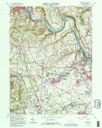 1992 Cementon1995 Print · USGSThe Lehigh Valley corridor shows its industrial character in the 1990s as quarries and suburban growth meet historic settlements. Trace local family roots and early industry near Cementon, the Dewey Heights Quarry, and the Old Union Cem.
 - 1999 Map of Topton, 2001 Print
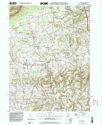
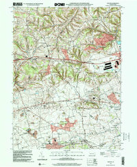 1999 Topton2001 Print · USGSThe Berks and Lehigh county line comes alive in the late nineties, documenting a landscape of established farmsteads and rural boroughs. Genealogists can trace family roots through historic sites like Shamrock Station, St Pauls Church, and Leather Corner Post.
 - 1999 Map of Cementon, 2001 Print
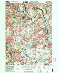 1999 Cementon2001 Print · USGSLehigh Valley industry and residential growth are captured here at the turn of the millennium. Genealogists can trace family roots through historic settlements like Egypt, Balliettsville, and Laurys Station, or locate ancestors at Union Cem.
 - 1999 Map of Allentown West, 2001 Print
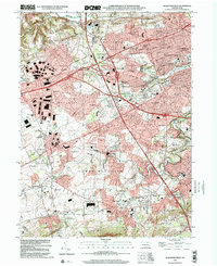 1999 Allentown West2001 Print · USGSThe Lehigh Valley at the turn of the millennium shows a blend of suburban growth and industrial heritage. Genealogists can trace old family sites near St Josephs Ch, while historians can locate the Lock Ridge Park and Furnace Museum or Dorney Park.
 - 1999 Map of Slatedale, 2002 Print
 1999 Slatedale2002 Print · USGSLehigh County township life at the end of the century is defined by rural crossroads and the ridge of Blue Mountain. Genealogists and local historians can trace family locations near Heidelberg Ch, Millers Cem, or the early settlements of Lehigh Furnace and Slatedale.
End of results
Showing maps 1-5 of 5
Top cities near Lowhill Township
- Allentown historical maps
- Fullerton historical maps
- Emmaus historical maps
- Northampton historical maps
- Maxatawny Township historical maps
- Tamaqua historical maps
See more
Top neighborhoods of Lowhill Township
- Claussville historical maps
- Weidasville historical maps
- Leather Corner Post historical maps
- Bittners Corner historical maps
- Lyon Valley historical maps
Frequently asked questions
- What are the different types of historical maps available for Lowhill Township?
- What is the oldest map of Lowhill Township?
- Where can I purchase historical maps of Lowhill Township for my home or office?
- Where can I download high-res historical maps of Lowhill Township?
- Are there historical topographic maps available for Lowhill Township?
- Is there historical aerial imagery available for Lowhill Township?
- Where are historical maps of Lowhill Township sourced from?