2020s Maps of Brown Township, Pennsylvania
Explore 6 historic maps of Brown Township from the 2020s. These maps offer a rare glimpse into what life looked like during the 2020s — showing old roads, neighborhoods, homes, and landmarks that have changed or disappeared over time.
Whether you're researching your family's past, planning a metal detecting trip, or studying how Brown Township's landscape evolved across the 2020s, these high-resolution maps are a powerful tool for exploring the history of this region.
- Focus on a specific era: All maps on this page are from the 2020s, giving you a focused view of this time period.
- See what’s changed: Compare century-old streets, trails, and buildings to today's modern landscape using overlays and satellite layers.
- Research with precision: Use these maps for genealogy, historical research, land use analysis, or educational projects.
- View, download, or print: Maps are fully viewable online in high resolution, and can be downloaded or printed for your own records.
Start exploring Brown Township's history through authentic maps from the 2020s. This is your window into the past.
Brown Township, PA maps
(6)- 2023 Map of Slate Run, 2023 Print
 2023 Slate Run2023 Print · USGSLycoming and Potter counties are shown here in the 2020s, centered on the historic village of Slate Run. Researchers can trace old timber-era footprints along the Pine Creek Rail Trl and locate local family sites at the Slate Run Methodist Cem or Slate Run Baptist Cem.
 - 2023 Map of English Center, 2023 Print
 2023 English Center2023 Print · USGSLittle Pine Creek flows through this Lycoming County valley, where the small communities of English Center and Carsontown remain nestled in the hills. Researchers can locate several burial grounds including English Center Cem and Hill Cem while tracing names like Stahlneckers Pond.
 - 2023 Map of Cedar Run, 2023 Print
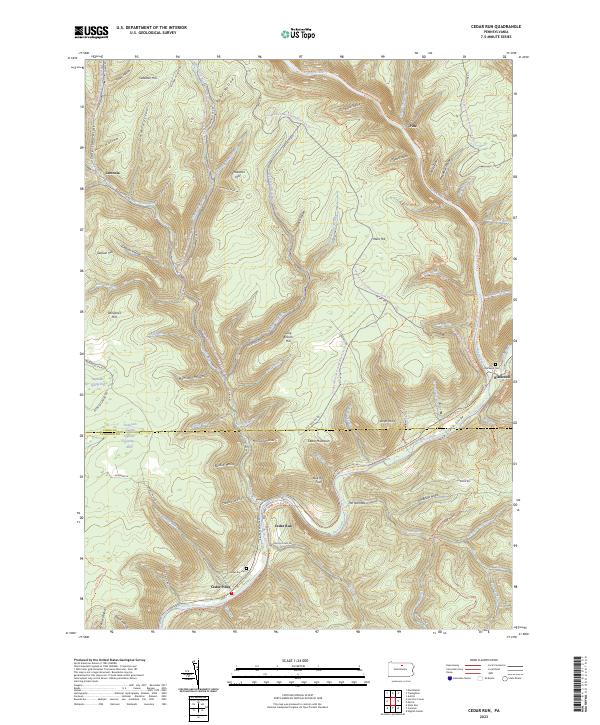 2023 Cedar Run2023 Print · USGSTioga and Lycoming Counties are shown here in the 2020s, centered on the dramatic incision of the Pine Creek Gorge. Modern researchers can trace the historic village sites of Cedar Run and Leetonia alongside the expansive Pine Creek Rail Trl.
 - 2023 Map of Morris, 2023 Print
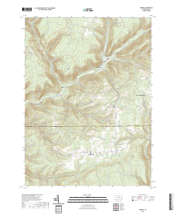 2023 Morris2023 Print · USGSTioga County highlands meet the Lycoming border in the early 2020s, showing the enduring valley settlements along Babb Creek. Genealogists can trace family footprints at Antrim Cem, Mount Pleasant Cem, and the historic crossroads of Oregon Hill.
 - 2023 Map of Lee Fire Tower, 2023 Print
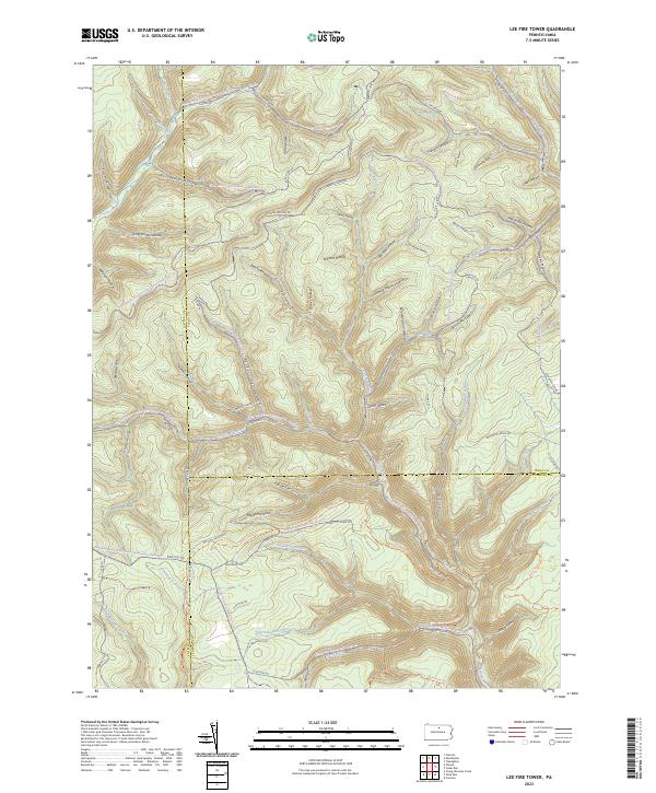 2023 Lee Fire Tower2023 Print · USGSNorthern Pennsylvania’s high forest country is captured here where three counties meet. Trace historic industrial paths through Gas Well Hollow, follow the winding Slate Run Rd, or locate the remote crossing at Francis-Leetonia.
 - 2023 Map of Cammal, 2023 Print
 2023 Cammal2023 Print · USGSPine Creek and its historic rail corridor define this Lycoming County landscape as it appears today. Genealogists and local historians can locate remote burial sites like Okome Cemetery and trace the footprints of old communities at Cammal and Bluestone.
End of results
Showing maps 1-6 of 6
Top cities near Brown Township
- Morris Township historical maps
- Gaines Township historical maps
- Gallagher Township historical maps
- Abbott Township historical maps
- Duncan Township historical maps
- Stony Fork historical maps
Top neighborhoods of Brown Township
- Hilborn historical maps
- Beulah Land historical maps
- Slate Run historical maps
- Cedar Pines historical maps
- Cedar Run historical maps
Frequently asked questions
- What are the different types of historical maps available for Brown Township?
- What is the oldest map of Brown Township?
- Where can I purchase historical maps of Brown Township for my home or office?
- Where can I download high-res historical maps of Brown Township?
- Are there historical topographic maps available for Brown Township?
- Is there historical aerial imagery available for Brown Township?
- Where are historical maps of Brown Township sourced from?