1900s (20th Century) Maps of Brown Township, Pennsylvania
Explore 32 historic maps of Brown Township from the 1900s (20th Century). These maps offer a rare glimpse into what life looked like during the 1900s — showing old roads, neighborhoods, homes, and landmarks that have changed or disappeared over time.
Whether you're researching your family's past, planning a metal detecting trip, or studying how Brown Township's landscape evolved across the 1900s, these high-resolution maps are a powerful tool for exploring the history of this region.
- Focus on a specific era: All maps on this page are from the 1900s, giving you a focused view of this time period.
- See what’s changed: Compare century-old streets, trails, and buildings to today's modern landscape using overlays and satellite layers.
- Research with precision: Use these maps for genealogy, historical research, land use analysis, or educational projects.
- View, download, or print: Maps are fully viewable online in high resolution, and can be downloaded or printed for your own records.
Start exploring Brown Township's history through authentic maps from the 1900s. This is your window into the past.
Brown Township, PA maps
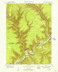
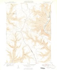
(32)- 1937 Map of Waterville
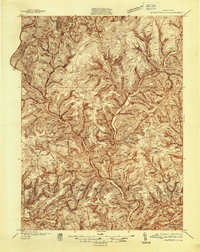 1937 Waterville1937 Print · USGSCovers Brown Township, including Gallagher Township, Brookside, and other nearby areas5 unique versions available
 - 1943 Map of Hyner
 1943 Hyner1943 Print · USGSCovers Brown Township, including South Renovo, Gallagher Township, and other nearby areas
 - 1943 Map of Waterville
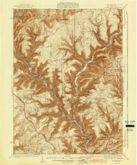 1943 Waterville1943 Print · USGSCovers Brown Township, including Gallagher Township, Brookside, and other nearby areas3 unique versions available
 - 1946 Map of Antrim, 1952 Print
 1946 Antrim1952 Print · USGSCovers Brown Township, including Wellsboro, Morris Township, and other nearby areas2 unique versions available
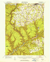
 - 1946 Map of Renovo East, 1953 Print
 1946 Renovo East1953 Print · USGSCovers Brown Township, including South Renovo, Gallagher Township, and other nearby areas3 unique versions available
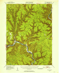
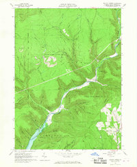
 - 1946 Map of Cedar Run, 1956 Print
 1946 Cedar Run1956 Print · USGSCovers Brown Township, including Morris Township, Cedar Run, and other nearby areas4 unique versions available
 - 1946 Map of Slate Run, 1958 Print
 1946 Slate Run1958 Print · USGSCovers Brown Township, including McHenry Township, Slate Run, and other nearby areas4 unique versions available
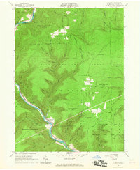
 - 1946 Map of Morris, 1965 Print
 1946 Morris1965 Print · USGSCovers Brown Township, including Morris Township, Duncan Township, and other nearby areas3 unique versions available
 - 1947 Map of Galeton, 1953 Print
 1947 Galeton1953 Print · USGSCovers Brown Township, including Galeton, Gaines Township, and other nearby areas3 unique versions available
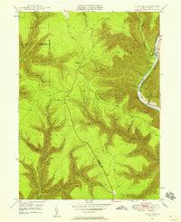
 - 1947 Map of Lee Fire Tower, 1954 Print
 1947 Lee Fire Tower1954 Print · USGSCovers Brown Township, including Abbott Township, Elk Township, and other nearby areas5 unique versions available
 - 1948 Map of Cedar Run
 1948 Cedar Run1948 Print · USGSCovers Brown Township, including Morris Township, Cedar Run, and other nearby areas2 unique versions available
 - 1948 Map of Slate Run
 1948 Slate Run1948 Print · USGSCovers Brown Township, including McHenry Township, Slate Run, and other nearby areas2 unique versions available
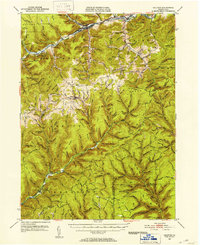
 - 1950 Map of Lee Fire Tower
 1950 Lee Fire Tower1950 Print · USGSCovers Brown Township, including Abbott Township, Elk Township, and other nearby areas
 - 1950 Map of Morris
 1950 Morris1950 Print · USGSCovers Brown Township, including Morris Township, Duncan Township, and other nearby areas
 - 1954 Map of Williamsport
 1954 Williamsport1954 Print · USGSCovers Brown Township, including Vestal, Williamsport, and other nearby areas
 - 1960 Map of Williamsport
 1960 Williamsport1960 Print · USGSCovers Brown Township, including Vestal, Williamsport, and other nearby areas
 - 1962 Map of Williamsport, 1966 Print
 1962 Williamsport1966 Print · USGSCovers Brown Township, including Vestal, Williamsport, and other nearby areas5 unique versions available
 - 1965 Map of Williamsport
 1965 Williamsport1965 Print · USGSCovers Brown Township, including Vestal, Williamsport, and other nearby areas
 - 1965 Map of English Center, 1967 Print
 1965 English Center1967 Print · USGSCovers Brown Township, including Brookside, Cogan House Township, and other nearby areas3 unique versions available
 - 1965 Map of Cammal, 1967 Print
 1965 Cammal1967 Print · USGSCovers Brown Township, including Lebo Vista, Bluestone, and other nearby areas4 unique versions available
 - 1966 Map of Williamsport
 1966 Williamsport1966 Print · USGSCovers Brown Township, including Vestal, Williamsport, and other nearby areas
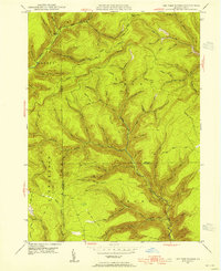
 - 1977 Map of Lee Fire Tower, 1979 Print
 1977 Lee Fire Tower1979 Print · USGSCovers Brown Township, including Abbott Township, Elk Township, and other nearby areas
 - 1977 Map of Cedar Run, 1979 Print
 1977 Cedar Run1979 Print · USGSCovers Brown Township, including Morris Township, Cedar Run, and other nearby areas
 - 1977 Map of Morris, 1979 Print
 1977 Morris1979 Print · USGSCovers Brown Township, including Morris Township, Duncan Township, and other nearby areas
 - 1981 Map of Wellsboro, 1982 Print
 1981 Wellsboro1982 Print · USGSCovers Brown Township, including Mansfield, Wellsboro, and other nearby areas
Showing maps 1-25 of 32
Top cities near Brown Township
- Morris Township historical maps
- Gaines Township historical maps
- Gallagher Township historical maps
- Abbott Township historical maps
- Duncan Township historical maps
- Stony Fork historical maps
Top neighborhoods of Brown Township
- Hilborn historical maps
- Beulah Land historical maps
- Slate Run historical maps
- Cedar Pines historical maps
- Cedar Run historical maps
Frequently asked questions
- What are the different types of historical maps available for Brown Township?
- What is the oldest map of Brown Township?
- Where can I purchase historical maps of Brown Township for my home or office?
- Where can I download high-res historical maps of Brown Township?
- Are there historical topographic maps available for Brown Township?
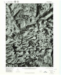
- Is there historical aerial imagery available for Brown Township?
- Where are historical maps of Brown Township sourced from?