1960s Maps of McKean County, Pennsylvania
Explore 20 historic maps of McKean County from the 1960s. These maps offer a rare glimpse into what life looked like during the 1960s — showing old roads, neighborhoods, homes, and landmarks that have changed or disappeared over time.
Whether you're researching your family's past, planning a metal detecting trip, or studying how McKean County's landscape evolved across the 1960s, these high-resolution maps are a powerful tool for exploring the history of this region.
- Focus on a specific era: All maps on this page are from the 1960s, giving you a focused view of this time period.
- See what’s changed: Compare century-old streets, trails, and buildings to today's modern landscape using overlays and satellite layers.
- Research with precision: Use these maps for genealogy, historical research, land use analysis, or educational projects.
- View, download, or print: Maps are fully viewable online in high resolution, and can be downloaded or printed for your own records.
Start exploring McKean County's history through authentic maps from the 1960s. This is your window into the past.
McKean County, PA maps
(20)- 1966 Map of Russell City, 1967 Print
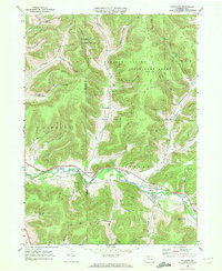
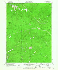 1966 Russell City1967 Print · USGSElk and Forest Counties in the mid-1960s were centers of active timber and energy production within the Allegheny National Forest. Genealogists and researchers can trace the rail-and-resource economy through sites like Russell City, Sheffield Junction, and the numerous gas wells dotting the hills.4 unique versions available
 - 1966 Map of James City, 1967 Print
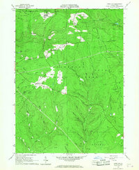 1966 James City1967 Print · USGSThe Pennsylvania Wilds in the 1960s are shown as a hub of energy production and forestry management. Researchers can trace the legacy of resource extraction through numerous Gas Wells and the Baltimore and Ohio Railroad near James City.3 unique versions available
 - 1966 Map of Westline, 1967 Print
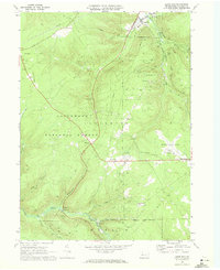
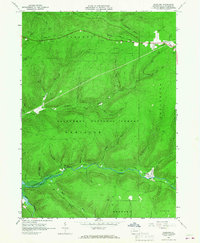 1966 Westline1967 Print · USGSMcKean County's industrial and forest lands are captured in the mid-1960s, a period of transition for the local landscape. Researchers can trace the Old Railroad Grade and numerous oil wells near Marshburg and Klondike.4 unique versions available
 - 1966 Map of Kane, 1967 Print
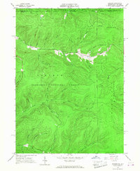
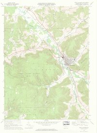
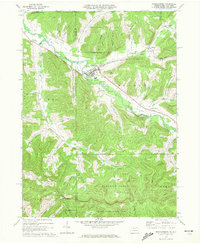
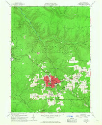 1966 Kane1967 Print · USGSMcKean County's industrial and forest heritage is on full display in the 1960s, centered on the growing town of Kane. Genealogists and historians can trace the Forest Lawn Cem, local schools, and industry sites like the Coal Mine and numerous Oil Wells.3 unique versions available
 - 1966 Map of Stickney, 1968 Print
 1966 Stickney1968 Print · USGSThe Pennsylvania and New York border highlands are captured here in the mid-sixties, dominated by the Allegheny National Forest. Researchers can find evidence of the regional energy economy through clusters of Oil Wells and trace old routes like Boatroad and Harlow Trail.3 unique versions available
 - 1966 Map of Cornplanter Bridge, 1968 Print
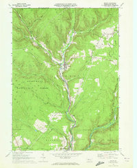
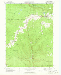
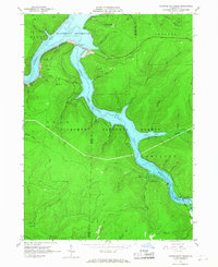 1966 Cornplanter Bridge1968 Print · USGSThe Allegheny River valley and its major tributaries appear here just as the reservoir was becoming a central feature of the landscape in the mid-1960s. Researchers can trace the infrastructure of the newly created Allegheny Reservoir, the crossing at Cornplanter Bridge, and numerous Oil Wells scattered across the forest.3 unique versions available
 - 1966 Map of Cornplanter Run, 1968 Print
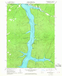 1966 Cornplanter Run1968 Print · USGSThe Pennsylvania-New York borderlands appear here in the mid-sixties, just as the new reservoir reshaped the valley. Researchers can find old petroleum sites in the Oil Field and trace legacy sites like the Riverview-Corydon Cem and Camp Olmsted.4 unique versions available
 - 1966 Map of Ludlow, 1968 Print
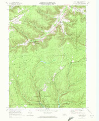
 1966 Ludlow1968 Print · USGSMcKean County's timberlands and gas fields are captured in the mid-sixties, showing the intersection of industrial work and forest conservation. Researchers can locate the small community of Ludlow, the Hoffman Farm Camp, and the winding Old Railroad Grade.4 unique versions available
 - 1969 Map of Eldred, 1972 Print
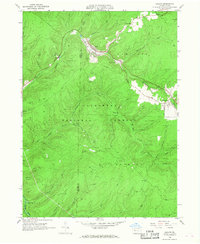
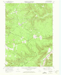
 1969 Eldred1972 Print · USGSMcKean County and the New York border region are captured here in the late sixties, showing the active Bradford Oil Field and the Allegheny River corridor. Researchers can trace family sites at Lamphier Cem, find the Township Sch, or explore the rail network through Larabee and West Eldred.3 unique versions available
 - 1969 Map of Roulette, 1972 Print
 1969 Roulette1972 Print · USGSThe Allegheny River valley in Potter County comes into focus during the late sixties, showing a landscape shaped by timber, gas, and rail. Researchers can find family landmarks like Lyman Cem, the Drive-in Theater near Burtville, and an Old RR Grade.4 unique versions available
 - 1969 Map of Port Allegany, 1972 Print
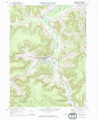
 1969 Port Allegany1972 Print · USGSMcKean County's river valley and energy fields come into focus during the late sixties as the river-and-rail economy evolved. Genealogists and historians can locate family burial sites at St Gabriels Cem and Birch Grove Ch Cem or trace the early footprint of Johnson Airfield.2 unique versions available
 - 1969 Map of Hazel Hurst, 1972 Print
 1969 Hazel Hurst1972 Print · USGSMcKean and Elk Counties are shown during a period of industrial change in the late 1960s, documenting a landscape of gas fields and timbered ridges. Genealogists and historians can trace the paths of the Baltimore and Ohio Railroad and old settlements like Hazel Hurst and Marvindale.
 - 1969 Map of Wilcox, 1972 Print
 1969 Wilcox1972 Print · USGSElk County's river valleys and oil fields are captured here in the late sixties as industrial extraction and public lands coexisted. You can trace the Penn Central rail line through Wilcox, find the Wardville Cem, and locate the Strip Mine near Rasselas.3 unique versions available
 - 1969 Map of Shinglehouse, 1972 Print
 1969 Shinglehouse1972 Print · USGSThe Oswayo Creek valley in the late sixties reveals a landscape shaped by the Shinglehouse Oil Field and the borough of Shinglehouse. Researchers can trace old family landmarks and rural communities from Myrtle and East Sharon to the Maple Grove Cem and Bell Run Union Ch.2 unique versions available
 - 1969 Map of Derricks City, 1972 Print
 1969 Derricks City1972 Print · USGSThe Pennsylvania-New York borderlands near McKean County are shown here in the late sixties, centered on the intensive petroleum operations of the Bradford Oil Field. Genealogists and researchers can trace old school sites like Lincoln School and family landmarks such as Corwins Corners.3 unique versions available
 - 1969 Map of Cyclone, 1972 Print
 1969 Cyclone1972 Print · USGSMcKean County's oil and timber heritage is on full display in this late-sixties survey of the Pennsylvania highlands. Genealogists and industrial historians can trace the paths of the Baltimore and Ohio Railroad Grade and locate old extraction sites like the Strip Mines near Mount Alton.2 unique versions available
 - 1969 Map of Lewis Run, 1972 Print
 1969 Lewis Run1972 Print · USGSThe oil-rich plateaus of McKean County are captured here during the late sixties, showing the heavy concentration of wells throughout the Allegheny National Forest. Genealogists and historians can locate family landmarks like the Ryan Sch, McKean Memorial Park (Cem), and small settlements like Taintor and Marshburg.3 unique versions available
 - 1969 Map of Smethport, 1972 Print
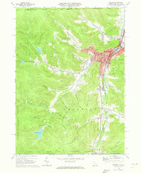
 1969 Smethport1972 Print · USGSSmethport and its valley surroundings are documented here at the end of the sixties, showing a landscape defined by industry and community. Researchers can trace the Penn Central rail lines and explore the extent of the Sartwell Oil Field or the grounds of St Elizabeths Cem.
 - 1969 Map of Mt. Jewett, 1973 Print
 1969 Mt. Jewett1973 Print · USGSThe Allegheny highlands in the late sixties reveal an landscape of deep-woods industry and remote rail stops. Genealogists and historians can trace family roots through Mt Jewett, local sites like Lebanon Ch, and old settlements at Sergeant and Hutchins.4 unique versions available
 - 1969 Map of Bradford, 1973 Print
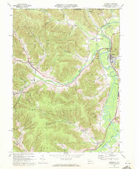
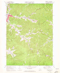
 1969 Bradford1973 Print · USGSMcKean County's industrial landscape was still defined by its rail-and-oil economy during the late sixties. Genealogists and local historians can trace family roots through Willow Dale Cem, or locate long-standing landmarks like Hazelton Mills and Custer City.3 unique versions available
End of results
Showing maps 1-20 of 20
Top cities of McKean County
- Bradford historical maps
- Kane historical maps
- Lafayette Township historical maps
- Port Allegany historical maps
- Liberty Township historical maps
- Smethport historical maps
See more
Frequently asked questions
- What are the different types of historical maps available for McKean County?
- What is the oldest map of McKean County?
- Where can I purchase historical maps of McKean County for my home or office?
- Where can I download high-res historical maps of McKean County?
- Are there historical topographic maps available for McKean County?
- Is there historical aerial imagery available for McKean County?
- Where are historical maps of McKean County sourced from?