Old Maps of McKean County, Pennsylvania for Metal Detecting
Plan your next treasure hunt with 191 historic maps of McKean County. Find old homesites, ghost towns, trails, and gathering spots that may be lost to time — perfect for identifying promising metal detecting locations.
- Locate forgotten sites: Uncover places like long-lost settlements, abandoned rail lines, or gathering spots.
- Plan better hunts: Use map overlays combined with LiDAR or satellite views to narrow in on historically rich areas.
- Made for detectorists: Thousands of hobbyists use these maps to discover relics, coins, and hidden history.
Use these historic maps to boost your research and find new opportunities beneath the surface of McKean County.
McKean County, PA maps
(191)- 1924 Map of Bradford
 1924 Bradford1924 Print · USGSMcKean County's industrial heartland is captured here in the mid-1920s, showing a landscape defined by timber, chemicals, and heavy rail. Trace early infrastructure from the KINZUA VIADUCT to family-named landmarks like Corwins Corners and Bells Camp.2 unique versions available
 - 1926 Map of Bradford
 1926 Bradford1926 Print · USGSNorthwestern Pennsylvania's oil and timber country comes alive in the mid-twenties, centered on the bustling industrial valley of Bradford. Researchers can trace the path of the Bradford Electric Ry, find local homesteads near Custer City, or locate the famed Kinzua Viaduct.4 unique versions available
 - 1933 Map of Smethport, 1960 Print
 1933 Smethport1960 Print · USGSNorthern Pennsylvania’s river valleys were centers of industry and transit in the early 1930s as rail lines followed the winding water gaps. Genealogists can trace family roots through numerous valley schoolhouses like Bush Hill Sch and rural settlements including Duke Center and Turtlepoint.
 - 1934 Map of Kane
 1934 Kane1934 Print · USGSThe timber and oil lands of McKean and Elk counties are captured here in the mid-1930s as a network of railroads and pipelines. Researchers can trace family roots in settlements like De Young PO, locate CCC Camp No 7, or find the Greendale Sch.3 unique versions available
 - 1934 Map of Coudersport
 1934 Coudersport1934 Print · USGSPotter and McKean Counties appear here in the mid-1930s, showing a landscape of deep hollows and river-valley rail towns. Genealogists can trace family names through dozens of rural landmarks like Sartwell Cr Ch, Knowlton Station, and Shinglehouse.3 unique versions available
 - 1935 Map of Mt. Jewett
 1935 Mt. Jewett1935 Print · USGSElk and McKean counties at the height of the Great Depression reveal a landscape shaped by competing timber and rail interests. Researchers can trace the junction of three major railroads and find vanished operations at Burning Well and Instanter.3 unique versions available
 - 1936 Map of Kinzua
 1936 Kinzua1936 Print · USGSThe Allegheny River valley remains in its natural state in the mid-1930s, long before the creation of the Allegheny Reservoir. Genealogists and historians can locate vanished riverfront settlements like Corydon and Kinzua, as well as the original boundaries of the Cornplanter Indian Reservation.
 - 1937 Map of Smethport
 1937 Smethport1937 Print · USGSMcKean County's river valleys and oil-country settlements are captured here in the mid-1930s as the regional rail network still connected remote hollows. Genealogists and historians can trace the exact locations of local schools like Newell Creek Sch, old family landmarks such as Devils Den, and the rural layout of Smethport.3 unique versions available
 - 1938 Map of Coudersport
 1938 Coudersport1938 Print · USGSNorthern Pennsylvania during the mid-1930s was a landscape of deep hollows and river-bottom settlements tied to the Allegheny and Oswayo. Researchers can trace the placement of rural landmarks like Crandall Hill Fire Tower, Sartwell Creek Ch, and the Plank Road Sch.3 unique versions available
 - 1939 Map of Kane
 1939 Kane1939 Print · USGSThe northern Pennsylvania plateau in the late 1930s is a landscape of timber-towns and industrial rail sidings. Genealogists and researchers can trace the old Baltimore and Ohio line through Kane, James City, and the rural Russell City De Young P O.3 unique versions available
 - 1940 Map of Mt. Jewett
 1940 Mt. Jewett1940 Print · USGSNorthern Pennsylvania’s timber and rail country is captured here during the mid-1930s, showing a landscape defined by industrial development. Researchers can locate vanished rural infrastructure like the Stenstrom Sch, the CCC Camp, and specific rail stops at Dahoga and Instanter.3 unique versions available
 - 1941 Map of Kinzua
 1941 Kinzua1941 Print · USGSThe Allegheny River valley and the Cornplanter Indian Reservation are shown here in the years before mid-century dam projects forever changed the landscape. Researchers can trace the river-level Pennsylvania Railroad, the Kinzua Coal Mine, and now-submerged settlements like Kinzua and Corydon.3 unique versions available
 - 1941 Map of Bradford, 1958 Print
 1941 Bradford1958 Print · USGSMcKean County's industrial landscape was at its peak during the early 1940s, marked by a dense network of mountain railroads and small oil-country settlements. Genealogists can trace family roots through numerous rural landmarks like Songbird Sch, Irishtown, and Davis Gifford PO.2 unique versions available
 - 1944 Map of Bradford
 1944 Bradford1944 Print · USGSMcKean County and the New York borderlands are shown here during the mid-1940s, a period defined by heavy rail traffic and mountain settlements. You can trace old property lines and rural schoolhouses like Bolivar Run Sch, or find the Gifford PO and Big Shanty Sta along the timber and oil valleys.
 - 1948 Map of Crosby, 1952 Print
 1948 Crosby1952 Print · USGSPost-war McKean and Cameron counties appear here as a landscape of mountain rail lines and valley settlements. Trace the Pennsylvania Railroad through Hamlin Sta, locate the Sweets Sch, or find family names near Clermont Cem.3 unique versions available
 - 1948 Map of Emporium, 1952 Print
 1948 Emporium1952 Print · USGSThe northern Pennsylvania highlands come into focus in the late 1940s, showing a network of mountain settlements and headwater streams. You can trace family roots at Wharton Cem and St Marks Cem or locate old schoolhouse sites like Reesville Sch.3 unique versions available
 - 1948 Map of Keating Summit, 1958 Print
 1948 Keating Summit1958 Print · USGSThe high plateau of the McKean and Potter County border comes to life in this post-war survey, centered on the railroad pass at Keating Summit. Genealogists and local historians can trace the remote valley settlements of Liberty and Odin or locate family landmarks in Slabtown Hollow.3 unique versions available
 - 1948 Map of Emporium, 1958 Print
 1948 Emporium1958 Print · USGSEmporium and the Sinnemahoning valley are captured here just after the war, showing the railroad and highway networks through the Cameron County mountains. Genealogists can trace family names across Newton Cem, Sizerville, and Prospect Park.6 unique versions available
 - 1948 Map of Wildwood Fire Tower, 1958 Print
 1948 Wildwood Fire Tower1958 Print · USGSThe Pennsylvania high country of Elk and McKean counties comes into focus in the years just after the war, showing a landscape of deep hollows and forest runs. Genealogists and hikers can trace the remote reaches of Wellendorf Station, Devils Hole, and Boy Scout Hollow.5 unique versions available
 - 1948 Map of Rich Valley, 1962 Print
 1948 Rich Valley1962 Print · USGSCameron County in the late 1940s is defined by its deep valleys and the winding path of the Sinnemahoning. Genealogists and historians can trace old homesteads and landmarks like Lockwood, the Swesey Sch, and the North Creek Chapel along the rail and river corridors.4 unique versions available
 - 1948 Map of Norwich, 1965 Print
 1948 Norwich1965 Print · USGSThe hills of McKean County are captured here in the late 1940s, showing a landscape shaped by timber, early industry, and deep hollows. Researchers can locate the settlement of Norwich and trace the paths of Railroad Run, a Pipe Line, and family-named landmarks like Evans Hill.4 unique versions available
 - 1948 Map of Crosby, 1965 Print
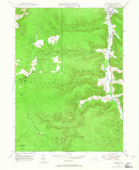 1948 Crosby1965 Print · USGSMcKean County at the end of the 1940s reveals a rugged landscape of narrow valley settlements and high-altitude pipe lines. Local historians can trace the rail sidings at Hamlin Sta and search for family roots at Norwich Cem or the isolated village of Betula.3 unique versions available
 - 1949 Map of Kinzua, 1954 Print
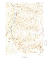 1949 Kinzua1954 Print · USGSThe Allegheny River valley remains the heart of this region in the late 1940s, just before major changes altered the landscape. Researchers can trace riverside life in Kinzua and Corydon or locate the historic Cornplanter Indian Reservation.4 unique versions available
 - 1950 Map of Rich Valley
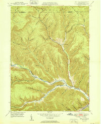 1950 Rich Valley1950 Print · USGSCameron and McKean counties in the early postwar era are defined by the steep hollows of the Pennsylvania Wilds. Genealogists can trace family names and small-town footprints at Lockwood, Weber City, and the North Creek Chapel.2 unique versions available
 - 1950 Map of Norwich
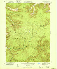 1950 Norwich1950 Print · USGSNorthern Pennsylvania's timber and oil lands appear here at mid-century, focused on the settlement of Norwich. Genealogists and historians can trace family-named terrain like Evans Hill and explore the drainage of Potato Creek.
Showing maps 1-25 of 191
Top cities of McKean County
- Bradford historical maps
- Kane historical maps
- Lafayette Township historical maps
- Port Allegany historical maps
- Liberty Township historical maps
- Smethport historical maps
See more
Frequently asked questions
- What are the different types of historical maps available for McKean County?
- What is the oldest map of McKean County?
- Where can I purchase historical maps of McKean County for my home or office?
- Where can I download high-res historical maps of McKean County?
- Are there historical topographic maps available for McKean County?
- Is there historical aerial imagery available for McKean County?
- Where are historical maps of McKean County sourced from?