2020s Maps of Lafayette Township, Pennsylvania
Explore 6 historic maps of Lafayette Township from the 2020s. These maps offer a rare glimpse into what life looked like during the 2020s — showing old roads, neighborhoods, homes, and landmarks that have changed or disappeared over time.
Whether you're researching your family's past, planning a metal detecting trip, or studying how Lafayette Township's landscape evolved across the 2020s, these high-resolution maps are a powerful tool for exploring the history of this region.
- Focus on a specific era: All maps on this page are from the 2020s, giving you a focused view of this time period.
- See what’s changed: Compare century-old streets, trails, and buildings to today's modern landscape using overlays and satellite layers.
- Research with precision: Use these maps for genealogy, historical research, land use analysis, or educational projects.
- View, download, or print: Maps are fully viewable online in high resolution, and can be downloaded or printed for your own records.
Start exploring Lafayette Township's history through authentic maps from the 2020s. This is your window into the past.
Lafayette Township, PA maps
(6)- 2023 Map of Westline, 2023 Print
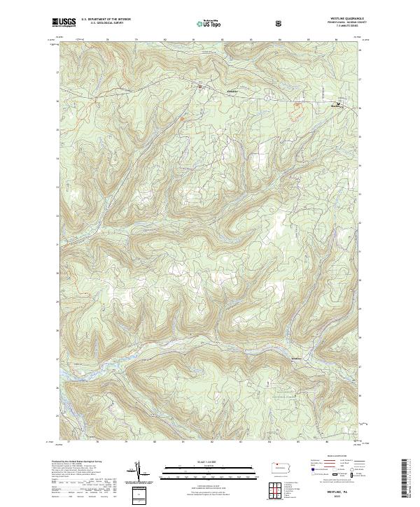 2023 Westline2023 Print · USGSMcKean County's highland forests and winding creek valleys are documented here in the early twenty-first century. Researchers can locate the mountain settlement of Westline, the Marshburg Cem, and the path of the North Country National Scenic Trl.
 - 2023 Map of Lewis Run, 2023 Print
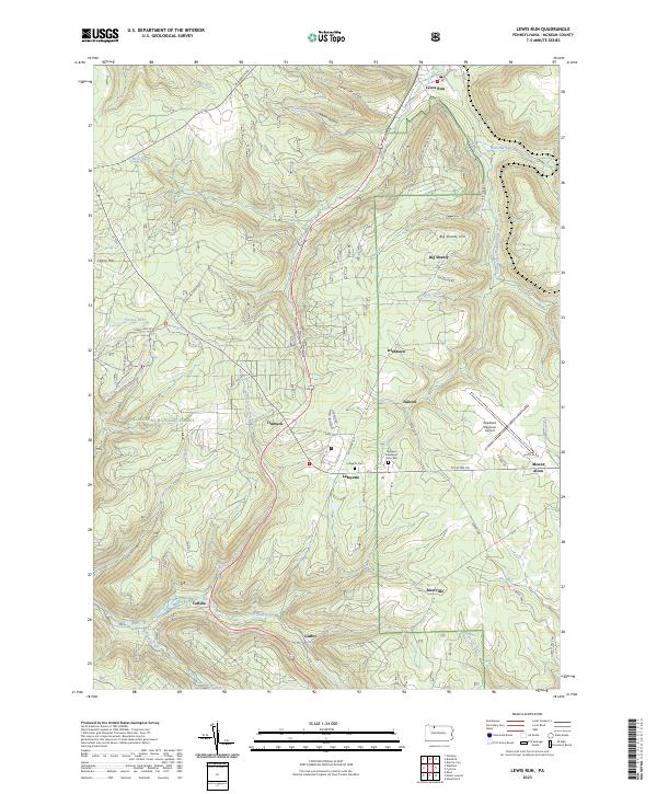 2023 Lewis Run2023 Print · USGSMcKean County's highland forests and small valley settlements are captured in this recent survey. Researchers can trace local lineage near Lafayette or explore the geography of Big Shanty and the Bradford Regional Airport.
 - 2023 Map of Stickney, 2023 Print
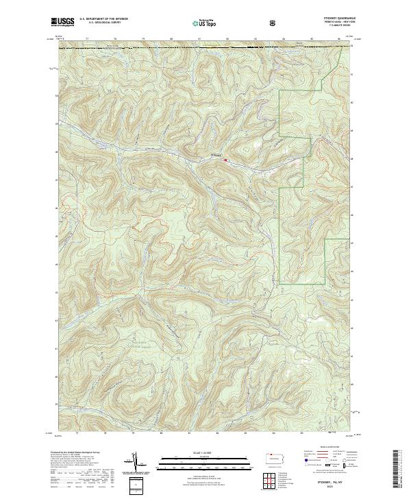 2023 Stickney2023 Print · USGSMcKean County at the turn of the twenty-first century reveals a landscape shaped by timber and forest recreation along the New York border. Trace old landmarks like Schoolhouse Hollow and Shingle Mill Hollow near the hamlet of Stickney.
 - 2023 Map of Cyclone, 2023 Print
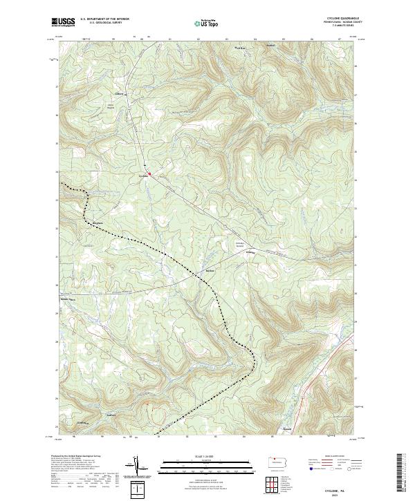 2023 Cyclone2023 Print · USGSMcKean County's highland plateaus and steep valleys are captured here in the 2020s. Genealogists and historians can trace the roads and homesteads of Cyclone, Kushequa, and Mount Alton near the striking Kinzua Gorge.
 - 2023 Map of Bradford, 2023 Print
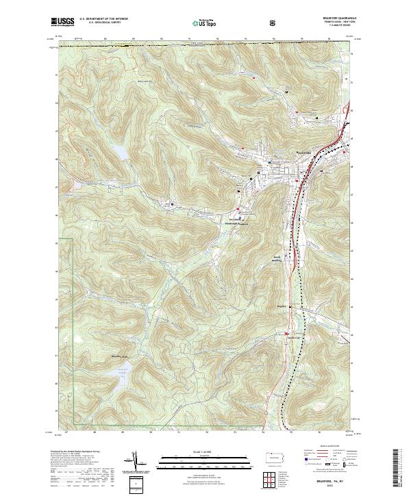 2023 Bradford2023 Print · USGSBradford and its southern suburbs are shown in high detail during the early 2020s, nestled between the Allegheny National Forest and the New York state line. Researchers can locate numerous local landmarks including the Tefares Israel Congregation and Cem, Hazelton Mills, and Oak Hill Cem.
 - 2023 Map of Derrick City, 2023 Print
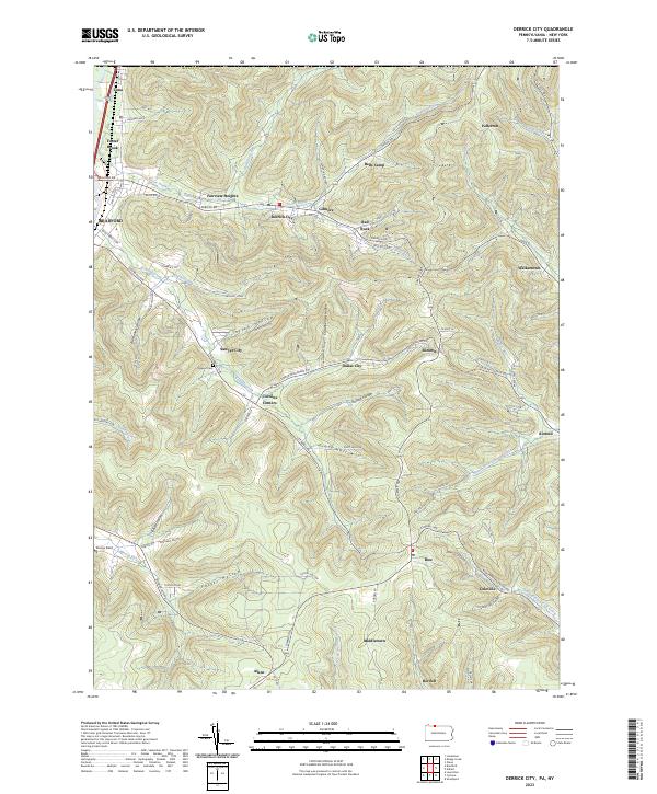 2023 Derrick City2023 Print · USGSThe hills of McKean County appear in high detail during the early 2020s, revealing a landscape defined by industrial legacy and deep hollows. Researchers can trace historic settlements like Gilmore and Derrick City, or locate family sites at the Sawyer Cem and Corwins Corners.
End of results
Showing maps 1-6 of 6
Top cities near Lafayette Township
- Bradford historical maps
- Allegany historical maps
- Kane historical maps
- Wetmore historical maps
- Carrollton historical maps
- Mount Jewett historical maps
See more
Top neighborhoods of Lafayette Township
- Westline historical maps
- Marshburg historical maps
- Riterville historical maps
- Taintor historical maps
- Timbuck historical maps
- Big Shanty historical maps
See more
Frequently asked questions
- What are the different types of historical maps available for Lafayette Township?
- What is the oldest map of Lafayette Township?
- Where can I purchase historical maps of Lafayette Township for my home or office?
- Where can I download high-res historical maps of Lafayette Township?
- Are there historical topographic maps available for Lafayette Township?
- Is there historical aerial imagery available for Lafayette Township?
- Where are historical maps of Lafayette Township sourced from?