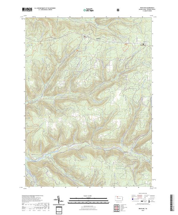
2023 Map of Westline
USGS Topo · Published 2023About this map
Allegheny National Forest dominates this section of McKean County, where the terrain is defined by the deep dissection of the plateau by Kinzua Creek and Chappel Fork. The small settlement of Westline sits at the confluence of several mountain streams, serving as a hub for the Kinzua Valley Trl and the Westline X-C Ski Trl. Further north, the village of Marshburg is marked by the Marshburg Cem near the junction of Forrestery Rd and Chappel Fork Rd. The landscape reflects a modern emphasis on recreation and conservation within the forest, evidenced by an extensive network of named paths such as the North Country National Scenic Trl and the Timberdoodle Flats Interp Trl. These trails follow the contours of high points like Paines Summit and trace the many narrow valleys, including White Gravel Creek and Sugar Run, that characterize this heavily forested region of Pennsylvania.
Find a feature on this map
49 named features on this map. Tap any name to fly to it.
Don’t see what you’re looking for? This feature index may not catch every label — zoom into the map to look around manually.
Map Details
Editions of this 2023 Westline Map
This is the sole edition of this map. No revisions or reprints were ever made.
Other maps of this area

1924 · Bradford
USGS Topo · 1:62,500

1926 · Bradford
USGS Topo · 1:62,500

1934 · Kane
USGS Topo · 1:48,000

1935 · Mt. Jewett
USGS Topo · 1:48,000

1936 · Kinzua
USGS Topo · 1:48,000

1939 · Kane
USGS Topo · 1:62,500

1940 · Mt. Jewett
USGS Topo · 1:62,500

1941 · Kinzua
USGS Topo · 1:62,500

1941 · Bradford
USGS Topo · 1:62,500

1944 · Bradford
USGS Topo · 1:62,500
Featured Places
- Lafayette Township, PA
- Westline, Lafayette Township
- Hamilton Township, PA
- Wetmore Township, PA
- Corydon Township, PA