1940s Maps of Mercer County, Pennsylvania
Explore 3 historic maps of Mercer County from the 1940s. These maps offer a rare glimpse into what life looked like during the 1940s — showing old roads, neighborhoods, homes, and landmarks that have changed or disappeared over time.
Whether you're researching your family's past, planning a metal detecting trip, or studying how Mercer County's landscape evolved across the 1940s, these high-resolution maps are a powerful tool for exploring the history of this region.
- Focus on a specific era: All maps on this page are from the 1940s, giving you a focused view of this time period.
- See what’s changed: Compare century-old streets, trails, and buildings to today's modern landscape using overlays and satellite layers.
- Research with precision: Use these maps for genealogy, historical research, land use analysis, or educational projects.
- View, download, or print: Maps are fully viewable online in high resolution, and can be downloaded or printed for your own records.
Start exploring Mercer County's history through authentic maps from the 1940s. This is your window into the past.
Mercer County, PA maps
(3)- 1943 Map of Mercer
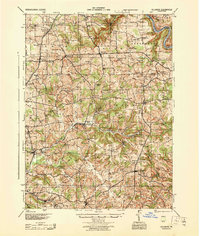
 1943 Mercer1943 Print · USGSMid-century Mercer County and northern Lawrence County are captured here as vital hubs of Pennsylvania rail and milling. Researchers can trace the legacy of local industry at Kimbles Mills, the Number Five Mine, and the Slippery Rock State Normal School.
 - 1943 Map of Stoneboro
 1943 Stoneboro1943 Print · USGSMercer County during the Second World War remains a patchwork of rail-side boroughs and family crossroads. Researchers can trace the legacy of early industry and education through landmarks like Reeds Furnace, Stoneboro, and the many rural schoolhouses like Kerrtown Sch.
 - 1944 Map of Hilliards
 1944 Hilliards1944 Print · USGSThe rural borderlands of Butler and Venango counties are captured here in the mid-1940s, showing a landscape of small farming hamlets and rail-side industry. Genealogists can locate family landmarks such as the Anderson Stone House, Gillmans Mill, and dozens of local schoolhouses like Pike Sch.
End of results
Showing maps 1-3 of 3
Top cities of Mercer County
- Hermitage historical maps
- Sharon historical maps
- Grove City historical maps
- Farrell historical maps
- Greenville historical maps
- Sharpsville historical maps
See more
Frequently asked questions
- What are the different types of historical maps available for Mercer County?
- What is the oldest map of Mercer County?
- Where can I purchase historical maps of Mercer County for my home or office?
- Where can I download high-res historical maps of Mercer County?
- Are there historical topographic maps available for Mercer County?
- Is there historical aerial imagery available for Mercer County?
- Where are historical maps of Mercer County sourced from?