Old Maps of Mercer County, Pennsylvania for Metal Detecting
Plan your next treasure hunt with 169 historic maps of Mercer County. Find old homesites, ghost towns, trails, and gathering spots that may be lost to time — perfect for identifying promising metal detecting locations.
- Locate forgotten sites: Uncover places like long-lost settlements, abandoned rail lines, or gathering spots.
- Plan better hunts: Use map overlays combined with LiDAR or satellite views to narrow in on historically rich areas.
- Made for detectorists: Thousands of hobbyists use these maps to discover relics, coins, and hidden history.
Use these historic maps to boost your research and find new opportunities beneath the surface of Mercer County.
Mercer County, PA maps
(169)- 1905 Map of Neshannock, 1960 Print
 1905 Neshannock1960 Print · USGSNear the Pennsylvania-Ohio border after the turn of the century, the river valleys were heavy with steam rail and industry. Researchers can trace historic station stops like Skidmore Eastbrook Sta and local landmarks like the White Chapel or Neshannock Falls.
 - 1906 Map of Youngstown, 1958 Print
 1906 Youngstown1958 Print · USGSThe Mahoning Valley's industrial heartland is caught at its early twentieth-century peak, showing the massive rail and steel infrastructure at the state border. Researchers can trace the lineage of local neighborhoods and schools like Hell Street School, Idora Park, and Tibbetts Corners.
 - 1907 Map of Neshannock
 1907 Neshannock1907 Print · USGSMercer and Lawrence counties are shown here at the height of the steam and electric rail era. Genealogists and local historians can trace family-named landmarks like Books Woods School, Mathews School, and Fayetteville Fay PO.5 unique versions available
 - 1907 Map of Kinsman, 1940 Print
 1907 Kinsman1940 Print · USGSEastern Trumbull County thrived at the start of the century as a vital crossroads of Ohio and Pennsylvania rail lines. Local historians can trace the foundations of Kinsman, Orangeville, and the remote State Line Church during the height of the steam rail era.2 unique versions available
 - 1908 Map of Shenango
 1908 Shenango1908 Print · USGSMercer County at the height of the steam era reveals a landscape defined by an intricate network of competing rail lines and rural hamlets. Genealogists can trace family roots through numerous country schools like Ray School and churches such as Goodhope Church.5 unique versions available
 - 1908 Map of Youngstown, 1937 Print
 1908 Youngstown1937 Print · USGSThe Mahoning Valley at the height of its industrial boom is defined by a massive concentration of rail lines and riverfront steel towns. Genealogists and historians can trace the footprint of early neighborhood schools like Bell School, find the original layout of Idora Park, and locate vanished rail stops along the ERIE RAILROAD.2 unique versions available
 - 1909 Map of Franklin, 1956 Print
 1909 Franklin1956 Print · USGSVenango County at the dawn of the twentieth century is a landscape defined by the deep meanders of the Allegheny River and a dense network of competing railroads. Genealogists can trace rural life through numerous landmarks like Five Points School, Hickory Grove Church, and the State Institute for Feeble Minded at Polk.2 unique versions available
 - 1910 Map of Hilliards, 1956 Print
 1910 Hilliards1956 Print · USGSButler and Venango Counties come into focus during this early twentieth-century survey of western Pennsylvania's hill country. Researchers can trace the era's rural infrastructure through dozens of sites like Mechanicsville Wesley PO, Rankin Church, and the Boyer's Annandale Sta.
 - 1911 Map of Franklin
 1911 Franklin1911 Print · USGSVenango County at the peak of the rail era shows the busy confluence of the Allegheny River and French Creek. Trace the legacy of early industrial settlements like Coal City, family landmarks at McKenzie Cors, and the grounds of the State Institute for Feeble Minded.4 unique versions available
 - 1911 Map of Stoneboro, 1960 Print
 1911 Stoneboro1960 Print · USGSMercer County at the height of its rural rail era was a dense network of farming hamlets and local schools. Genealogists can trace family names at Williams Corners, find many one-room schools like Ross School, or locate the hamlet of Fiddlers Green.
 - 1912 Map of Hilliards
 1912 Hilliards1912 Print · USGSButler and Venango Counties at the height of the rail era are shown here in intricate detail. Genealogists can trace family names across dozens of rural institutions, from Wesley PO and Sutton Mill to the remote Whiskerville.4 unique versions available
 - 1913 Map of Stoneboro
 1913 Stoneboro1913 Print · USGSMercer County at the turn of the century shows a landscape of river-valley agriculture and developing rail lines. Researchers can trace family history through dozens of rural schools like Pike School and settlements such as Sheakleyville or Fiddlers Green.5 unique versions available
 - 1913 Map of Mercer
 1913 Mercer1913 Print · USGSMercer and Grove City anchor this early twentieth-century landscape during a period of coal mining and railway expansion. Genealogists can trace family roots through numerous local schools like Bottle Hill School and rural settlements such as Pardoe and Amsterdam.6 unique versions available
 - 1939 Map of Mercer, 1959 Print
 1939 Mercer1959 Print · USGSWestern Pennsylvania during the late 1930s shows a landscape of thriving coal mining, manufacturing, and education. Researchers can trace the rail-and-river economy through the Pennsylvania railroad lines, the Number Five Mine, and the local Normal School.
 - 1943 Map of Mercer
 1943 Mercer1943 Print · USGSMid-century Mercer County and northern Lawrence County are captured here as vital hubs of Pennsylvania rail and milling. Researchers can trace the legacy of local industry at Kimbles Mills, the Number Five Mine, and the Slippery Rock State Normal School.
 - 1943 Map of Stoneboro
 1943 Stoneboro1943 Print · USGSMercer County during the Second World War remains a patchwork of rail-side boroughs and family crossroads. Researchers can trace the legacy of early industry and education through landmarks like Reeds Furnace, Stoneboro, and the many rural schoolhouses like Kerrtown Sch.
 - 1944 Map of Hilliards
 1944 Hilliards1944 Print · USGSThe rural borderlands of Butler and Venango counties are captured here in the mid-1940s, showing a landscape of small farming hamlets and rail-side industry. Genealogists can locate family landmarks such as the Anderson Stone House, Gillmans Mill, and dozens of local schoolhouses like Pike Sch.
 - 1950 Map of Cleveland
 1950 Cleveland1950 Print · USGSCovers Mercer County, including Cleveland, Akron, and other nearby areas
 - 1951 Map of Campbell, 1953 Print
 1951 Campbell1953 Print · USGSThe Mahoning River valley in the early fifties shows a dense industrial corridor of rails and riverside towns on the Ohio-Pennsylvania line. Genealogists can trace family landmarks like White Sch, St Johns Cem, and Holy Rosary Cem.
 - 1954 Map of Sharon West, 1956 Print
 1954 Sharon West1956 Print · USGSThe industrial heart of the Ohio-Pennsylvania border comes alive in the mid-1950s, centered on the bustling rail hubs and river towns. Researchers can trace family history through the neighborhoods of Hubbard, locate the Slope Ch, or study the grounds of Oakwood Cem.
 - 1956 Map of Cleveland, 1967 Print
 1956 Cleveland1967 Print · USGSNortheast Ohio and Western Pennsylvania are shown at their industrial height during the mid-fifties, from the steel mills to the lakeshore. Researchers can trace the massive Ravenna Arsenal, the Ohio Turnpike, and vanished rail sidings of the B & O RR.3 unique versions available
 - 1957 Map of Warren, 1964 Print
 1957 Warren1964 Print · USGSThe northern Pennsylvania oil and timber country comes into focus in the mid-fifties, showing the region before modern highway expansions. Trace the industrial rail networks of the Pennsylvania RR and the early Allegheny River Reservoir near Warren and Oil City.4 unique versions available
 - 1958 Map of Warren
 1958 Warren1958 Print · USGSNorthern Pennsylvania’s timber and oil country is captured here during the late fifties, showing the interplay of industrial valleys and vast state forests. Genealogists can trace family connections across the Cornplanter Indian Reservation or through rail hubs like Oil City and Saint Marys.
 - 1958 Map of Sharpsville, 1959 Print
 1958 Sharpsville1959 Print · USGSMercer County's river valley and rail networks are captured here in the late fifties as suburban growth meets long-standing rural townships. Researchers can pinpoint family history at Fell Cem, local schools like Pebly Sch, and the industrial corridors of the Erie railroad.5 unique versions available
 - 1958 Map of Edinburg, 1959 Print
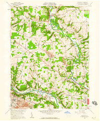 1958 Edinburg1959 Print · USGSThe Shenango and Mahoning rivers meet in the late fifties amidst a dense network of major railroads and industrial hubs. Genealogists and historians can trace local landmarks like Kings Chapel, Hopewell Cem, and the now-vanished New Castle Trade Sch.4 unique versions available
Showing maps 1-25 of 169
Top cities of Mercer County
- Hermitage historical maps
- Sharon historical maps
- Grove City historical maps
- Farrell historical maps
- Greenville historical maps
- Sharpsville historical maps
See more
Frequently asked questions
- What are the different types of historical maps available for Mercer County?
- What is the oldest map of Mercer County?
- Where can I purchase historical maps of Mercer County for my home or office?
- Where can I download high-res historical maps of Mercer County?
- Are there historical topographic maps available for Mercer County?
- Is there historical aerial imagery available for Mercer County?
- Where are historical maps of Mercer County sourced from?