1960s Maps of Jackson Township, Pennsylvania
Explore 8 historic maps of Jackson Township from the 1960s. These maps offer a rare glimpse into what life looked like during the 1960s — showing old roads, neighborhoods, homes, and landmarks that have changed or disappeared over time.
Whether you're researching your family's past, planning a metal detecting trip, or studying how Jackson Township's landscape evolved across the 1960s, these high-resolution maps are a powerful tool for exploring the history of this region.
- Focus on a specific era: All maps on this page are from the 1960s, giving you a focused view of this time period.
- See what’s changed: Compare century-old streets, trails, and buildings to today's modern landscape using overlays and satellite layers.
- Research with precision: Use these maps for genealogy, historical research, land use analysis, or educational projects.
- View, download, or print: Maps are fully viewable online in high resolution, and can be downloaded or printed for your own records.
Start exploring Jackson Township's history through authentic maps from the 1960s. This is your window into the past.
Jackson Township, PA maps
(8)- 1960 Map of Newark
 1960 Newark1960 Print · USGSThe industrial heart of the Mid-Atlantic is shown at mid-century, stretching from the dense urban centers of Newark and Philadelphia to the Blue Mountain ridges. Researchers can trace historic rail lines, coastal defenses at Fort Hancock, and the riverfront growth of Trenton and Easton.3 unique versions available
 - 1960 Map of Broadheadsville, 1962 Print
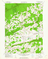 1960 Broadheadsville1962 Print · USGSMonroe County settlements and the southern Poconos are captured here in the early 1960s. Researchers can trace family roots through St Johns Ch, Effort Cem, and local landmarks like the Fairground and Pleasant Valley Sch.7 unique versions available
 - 1960 Map of Saylorsburg, 1962 Print
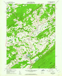 1960 Saylorsburg1962 Print · USGSMonroe County was transitioning from its rural roots to a burgeoning retreat destination in the early sixties. Researchers can trace family history through numerous landmarks like Green Ridge Cem, the Township Sch, and the Old Railroad Grade.6 unique versions available
 - 1962 Map of Scranton, 1977 Print
 1962 Scranton1977 Print · USGSThe industrial heart of eastern Pennsylvania and the New York Catskills are captured here in the early sixties. Genealogists and historians can trace the dense valley settlements from Scranton to Wilkes-Barre and the rail lines of the Erie Lackawanna Railroad.2 unique versions available
 - 1964 Map of Newark
 1964 Newark1964 Print · USGSGreater New Jersey and eastern Pennsylvania appear at the peak of their industrial and rail-centered development in the mid-sixties. Genealogists and historians can trace the paths of the Pennsylvania RR, identify mid-century landmarks like CAMP KILMER, or follow the Schuylkill River through READING.2 unique versions available
 - 1965 Map of Scranton
 1965 Scranton1965 Print · USGSThe tri-state highlands of Pennsylvania, New York, and New Jersey come alive in the mid-sixties as industry and recreation converge. Trace the intricate rail lines of the Erie Lackawanna RR or locate landmarks like the U S Military Academy.2 unique versions available
 - 1966 Map of Mount Pocono, 1967 Print
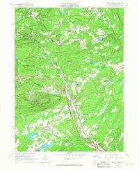 1966 Mount Pocono1967 Print · USGSMid-century Monroe County comes to life as the modern resort era begins to shape these highlands. Trace family roots at Pocono Union Cem, the Erie-Lackawanna rail corridor, or the growing campus of Pocono Mountain Jr-Sr High Sch.5 unique versions available
 - 1966 Map of Pocono Pines, 1967 Print
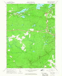 1966 Pocono Pines1967 Print · USGSThe Pocono plateau in the mid-sixties shows a landscape of rising lakeside vacation communities and vast protected woodlands. Researchers can trace the Erie-Lackawanna rail lines, the Old Railroad Grade, and local centers like Pocono Pines.6 unique versions available
End of results
Showing maps 1-8 of 8
Top cities near Jackson Township
- East Stroudsburg historical maps
- Tobyhanna historical maps
- Stroudsburg historical maps
- Bangor historical maps
- Pen Argyl historical maps
- Mount Pocono historical maps
See more
Top neighborhoods of Jackson Township
- Reeders historical maps
- Wooded Acres historical maps
- Appenzell historical maps
- Neola historical maps
- Jackson Heights historical maps
- Northridge historical maps
See more
Frequently asked questions
- What are the different types of historical maps available for Jackson Township?
- What is the oldest map of Jackson Township?
- Where can I purchase historical maps of Jackson Township for my home or office?
- Where can I download high-res historical maps of Jackson Township?
- Are there historical topographic maps available for Jackson Township?
- Is there historical aerial imagery available for Jackson Township?
- Where are historical maps of Jackson Township sourced from?