Old Maps of Jackson Township, Pennsylvania for Genealogy
Trace your family roots with 54 historic maps of Jackson Township. These high-res maps reveal old neighborhoods, homesites, landmarks, and streets — helping you uncover where your ancestors lived and how the area evolved over time.
- Explore historic neighborhoods: Identify where your relatives may have lived in the 1800s or 1900s.
- Compare maps over time: Trace the changes in streets, buildings, and landmarks for multi-generational research.
- Perfect for genealogy & ancestry research: Used by family historians and researchers to map out lineage and migration.
These maps are an incredible resource for exploring your personal connection to Jackson Township's past.
Jackson Township, PA maps
(54)- 1914 Map of Wind Gap, 1956 Print
 1914 Wind Gap1956 Print · USGSNorthampton and Monroe Counties are captured here just before the First World War, dominated by the industrial rail corridor at Wind Gap. Genealogists can locate dozens of named schools like Michael Valley School and early quarries at Chapman Quarries.
 - 1916 Map of Wind Gap
 1916 Wind Gap1916 Print · USGSThe Pocono foothills and Blue Mountain ridge are captured here at the height of the steam-rail era. Genealogists can trace family names through dozens of rural landmarks like St. Joseph School, Haynes Mill, and the busy rail junction at Wind Gap.7 unique versions available
 - 1919 Map of Pocono
 1919 Pocono1919 Print · USGSMonroe County was a critical military and rail corridor at the close of the Great War. Researchers can trace the massive Tobyhanna Military Reservation and the early rail-centered footprints of Mount Pocono, Tannerville, and Cresco.
 - 1921 Map of Pocono, 1962 Print
 1921 Pocono1962 Print · USGSThe Pocono Mountains at the start of the 1920s reveal a landscape of military training grounds, remote mountain schools, and early summer resorts. Trace the rail lines of the Wilkes-Barre and Eastern RR or locate rural landmarks like Cherry Lane Church and Beaver Brook School.
 - 1923 Map of Pocono
 1923 Pocono1923 Print · USGSMonroe County was evolving into a mountain retreat in the early twenties, connected by the Delaware Lackawanna and Western RR. Researchers can trace early resort life at Lake Naomi, find rural schools like Butz School, and locate the expansive Artillery Reservation.5 unique versions available
 - 1943 Map of Wind Gap
 1943 Wind Gap1943 Print · USGSThe Pennsylvania countryside near the Monroe and Northampton county line is captured here during the wartime era. Researchers can trace the path of the Lehigh and New England railroad through the Wind Gap pass or locate local landmarks like St Joseph Sch and Ross Common.
 - 1943 Map of Pocono
 1943 Pocono1943 Print · USGSMonroe County was a well-established retreat and transportation hub in the early 1940s, centered around the Delaware Lackawanna and Western railroad. Researchers can trace old mountain roads and family-named landmarks like Camelback Mountain, Naomi Pines Sch, and the Mount Pocono Airport.
 - 1943 Map of Bethlehem
 1943 Bethlehem1943 Print · USGSNorthampton and Lehigh counties hummed with industry and river commerce during the early war years. Researchers can trace the path of the Lehigh Valley RR, locate family-named landmarks like Chief Tatamy, and find rural schools such as Mexico School and Poplar Valley Sch.
 - 1944 Map of Newark, 1971 Print
 1944 Newark1971 Print · USGSThe industrial corridor from Philadelphia to New York was in a period of massive transition during the mid-forties. Genealogists and researchers can trace the rail lines of the Lehigh Valley RR, locate military installations like Picatinny Arsenal, and explore the early sprawl near Levittown.5 unique versions available
 - 1949 Map of Newark
 1949 Newark1949 Print · USGSThe industrial corridor between Philadelphia and New York comes alive in this post-war survey. Genealogists and historians can trace the massive rail networks of the Reading Railroad and locate major installations like Fort Dix or Picatinny Arsenal.2 unique versions available
 - 1950 Map of Scranton, 1952 Print
 1950 Scranton1952 Print · USGSMid-century Northeast Pennsylvania and the Hudson Valley come alive in this survey of the tri-state region. Genealogists and historians can trace the dense rail networks of the Erie RR and DL&W RR between industrial hubs like Scranton and Wilkes-Barre.
 - 1953 Map of Scranton
 1953 Scranton1953 Print · USGSNortheastern Pennsylvania and the Catskills are shown in great detail during the early fifties, a time when rail lines and river valleys dictated the region's growth. Genealogists and historians can trace the industrial hearts of Scranton and Wilkes-Barre or locate remote landmarks like High Point and Lake Wallenpaupack.
 - 1956 Map of Newark
 1956 Newark1956 Print · USGSThe industrial heart of the Mid-Atlantic is captured here at the dawn of the highway era, tracing the dense corridors between Newark and Philadelphia. Genealogists and local historians can map the rail networks of the Reading RR or locate mid-century military life at Fort Dix Military Reservation.2 unique versions available
 - 1957 Map of Newark
 1957 Newark1957 Print · USGSThe industrial and military heart of the Mid-Atlantic is mapped during its post-war suburban boom. Genealogists and historians can trace the intricate rail corridors of the Reading Railroad and locate key landmarks from Princeton University to Fort Hancock.
 - 1959 Map of Scranton
 1959 Scranton1959 Print · USGSThe northern coalfields and the Hudson Valley meet in this mid-century survey of the Pennsylvania and New York borderlands. Genealogists and historians can trace the intricate rail networks of the Erie Railroad and the vast waters of Lake Wallenpaupack.2 unique versions available
 - 1959 Map of Pocono
 1959 Pocono1959 Print · USGSThe Pocono Mountains region is captured here in the late fifties, showcasing its evolution from a railway-dependent timber and ice landscape to a premier resort destination. Researchers can locate dozens of country schoolhouses like Maplewood Sch and trace the paths of the Erie RR through Hawley and Kimbles.
 - 1960 Map of Newark
 1960 Newark1960 Print · USGSThe industrial heart of the Mid-Atlantic is shown at mid-century, stretching from the dense urban centers of Newark and Philadelphia to the Blue Mountain ridges. Researchers can trace historic rail lines, coastal defenses at Fort Hancock, and the riverfront growth of Trenton and Easton.3 unique versions available
 - 1960 Map of Broadheadsville, 1962 Print
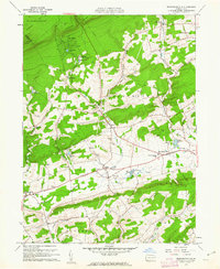 1960 Broadheadsville1962 Print · USGSMonroe County settlements and the southern Poconos are captured here in the early 1960s. Researchers can trace family roots through St Johns Ch, Effort Cem, and local landmarks like the Fairground and Pleasant Valley Sch.7 unique versions available
 - 1960 Map of Saylorsburg, 1962 Print
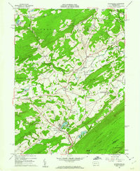 1960 Saylorsburg1962 Print · USGSMonroe County was transitioning from its rural roots to a burgeoning retreat destination in the early sixties. Researchers can trace family history through numerous landmarks like Green Ridge Cem, the Township Sch, and the Old Railroad Grade.6 unique versions available
 - 1962 Map of Scranton, 1977 Print
 1962 Scranton1977 Print · USGSThe industrial heart of eastern Pennsylvania and the New York Catskills are captured here in the early sixties. Genealogists and historians can trace the dense valley settlements from Scranton to Wilkes-Barre and the rail lines of the Erie Lackawanna Railroad.2 unique versions available
 - 1964 Map of Newark
 1964 Newark1964 Print · USGSGreater New Jersey and eastern Pennsylvania appear at the peak of their industrial and rail-centered development in the mid-sixties. Genealogists and historians can trace the paths of the Pennsylvania RR, identify mid-century landmarks like CAMP KILMER, or follow the Schuylkill River through READING.2 unique versions available
 - 1965 Map of Scranton
 1965 Scranton1965 Print · USGSThe tri-state highlands of Pennsylvania, New York, and New Jersey come alive in the mid-sixties as industry and recreation converge. Trace the intricate rail lines of the Erie Lackawanna RR or locate landmarks like the U S Military Academy.2 unique versions available
 - 1966 Map of Mount Pocono, 1967 Print
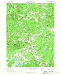 1966 Mount Pocono1967 Print · USGSMid-century Monroe County comes to life as the modern resort era begins to shape these highlands. Trace family roots at Pocono Union Cem, the Erie-Lackawanna rail corridor, or the growing campus of Pocono Mountain Jr-Sr High Sch.5 unique versions available
 - 1966 Map of Pocono Pines, 1967 Print
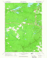 1966 Pocono Pines1967 Print · USGSThe Pocono plateau in the mid-sixties shows a landscape of rising lakeside vacation communities and vast protected woodlands. Researchers can trace the Erie-Lackawanna rail lines, the Old Railroad Grade, and local centers like Pocono Pines.6 unique versions available
 - 1976 Map of Mount Pocono, 1978 Print
 1976 Mount Pocono1978 Print · USGSMonroe County was undergoing significant land-use changes in the mid-seventies, as seen in this detailed aerial orthophotomap. Genealogists and local historians can trace property developments and road networks near Tannersville, Bartonsville, and Mount Pocono.
Showing maps 1-25 of 54
Top cities near Jackson Township
- East Stroudsburg historical maps
- Tobyhanna historical maps
- Stroudsburg historical maps
- Bangor historical maps
- Pen Argyl historical maps
- Mount Pocono historical maps
See more
Top neighborhoods of Jackson Township
- Reeders historical maps
- Wooded Acres historical maps
- Appenzell historical maps
- Neola historical maps
- Jackson Heights historical maps
- Northridge historical maps
See more
Frequently asked questions
- What are the different types of historical maps available for Jackson Township?
- What is the oldest map of Jackson Township?
- Where can I purchase historical maps of Jackson Township for my home or office?
- Where can I download high-res historical maps of Jackson Township?
- Are there historical topographic maps available for Jackson Township?
- Is there historical aerial imagery available for Jackson Township?
- Where are historical maps of Jackson Township sourced from?