1970s Maps of Northampton County, Pennsylvania
Explore 5 historic maps of Northampton County from the 1970s. These maps offer a rare glimpse into what life looked like during the 1970s — showing old roads, neighborhoods, homes, and landmarks that have changed or disappeared over time.
Whether you're researching your family's past, planning a metal detecting trip, or studying how Northampton County's landscape evolved across the 1970s, these high-resolution maps are a powerful tool for exploring the history of this region.
- Focus on a specific era: All maps on this page are from the 1970s, giving you a focused view of this time period.
- See what’s changed: Compare century-old streets, trails, and buildings to today's modern landscape using overlays and satellite layers.
- Research with precision: Use these maps for genealogy, historical research, land use analysis, or educational projects.
- View, download, or print: Maps are fully viewable online in high resolution, and can be downloaded or printed for your own records.
Start exploring Northampton County's history through authentic maps from the 1970s. This is your window into the past.
Northampton County, PA maps
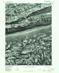
(5)- 1976 Map of Wind Gap, 1978 Print
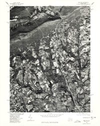 1976 Wind Gap1978 Print · USGSNorthampton County land use and mountain-gap settlements are captured in high detail in the mid-seventies. Trace the 1976 development of rural Moorestown and Stockertown, or the industrial footprint of Penn Argyl and Wind Gap.
 - 1976 Map of Palmerton, 1978 Print
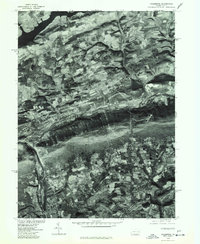 1976 Palmerton1978 Print · USGSPalmerton and the Lehigh Valley area appear in sharp detail in this mid-seventies orthophotoquad. Researchers can trace the industrial layout of Palmerton or the rural surroundings of Danielsville, Slatington, and Beltzville Lake.
 - 1976 Map of Stroudsburg, 1978 Print
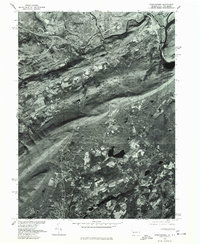 1976 Stroudsburg1978 Print · USGSThe Delaware Water Gap region comes into focus during the mid-1970s, showing the concentrated development of the river towns. Genealogists and local historians can trace the street patterns and rural boundaries around Stroudsburg, Roseto, and East Bangor.
 - 1976 Map of Saylorsburg, 1978 Print
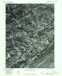 1976 Saylorsburg1978 Print · USGSThe Monroe County countryside appears in photographic detail during the mid-seventies, showing the intersection of ridge-top forests and valley farms. Genealogists and land researchers can trace exact property layouts around Saylorsburg, Sciota, and Snydersville.
 - 1976 Map of Kunkletown, 1978 Print
 1976 Kunkletown1978 Print · USGSThe northern Pennsylvania countryside is frozen in time in the mid-1970s, showcasing the agricultural patterns of Northampton County. Local historians can trace the rural layouts of Kunkletown, Point Phillip, and Petersville.
End of results
Showing maps 1-5 of 5
Top cities of Northampton County
- Easton historical maps
- Lower Saucon Township historical maps
- Hanover Township historical maps
- Northampton historical maps
- Wilson historical maps
- Nazareth historical maps
See more
Frequently asked questions
- What are the different types of historical maps available for Northampton County?
- What is the oldest map of Northampton County?
- Where can I purchase historical maps of Northampton County for my home or office?
- Where can I download high-res historical maps of Northampton County?
- Are there historical topographic maps available for Northampton County?
- Is there historical aerial imagery available for Northampton County?
- Where are historical maps of Northampton County sourced from?