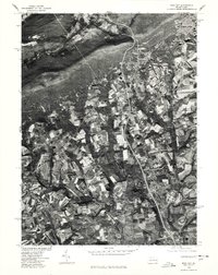
1976 Map of Wind Gap
USGS Topo · Published 1978About this map
Wind Gap serves as the central hub of this 1976 orthophotoquad, which reveals a complex mosaic of agriculture and industry at the base of the Blue Mountain. The aerial perspective from the Soil Conservation Service highlights the intricate field patterns and woodlots surrounding Moorestown and Stockertown. At the northern edge, the residential and industrial density of Penn Argyl contrasts sharply with the forested ridge, providing a clear view of the transportation corridors that define this mountain pass. This photographic survey documents the mid-1970s landscape before modern suburban development began to significantly alter the historic farmland and rural crossroads of Northampton County.
Find a feature on this map
4 named features on this map. Tap any name to fly to it.
Don’t see what you’re looking for? This feature index may not catch every label — zoom into the map to look around manually.
Map Details
Editions of this 1976 Wind Gap Map
This is the sole edition of this map. No revisions or reprints were ever made.
Other maps of this area

1890 · Easton
USGS Topo · 1:62,500

1891 · Easton
USGS Topo · 1:62,500

1891 · Delaware Water Gap
USGS Topo · 1:62,500

1893 · Delaware Water Gap
USGS Topo · 1:62,500

1894 · Allentown
USGS Topo · 1:62,500

1914 · Wind Gap
USGS Topo · 1:62,500

1916 · Wind Gap
USGS Topo · 1:62,500

1932 · Easton
USGS Topo · 1:62,500

1936 · Delaware Water Gap
USGS Topo · 1:48,000

1939 · Allentown
USGS Topo · 1:62,500
Featured Places
- Pen Argyl, PA
- Wind Gap, PA
- Bushkill Township, PA
- Rismiller, Bushkill Township
- Wardsburg, Plainfield Township