Old Maps of Northampton County, Pennsylvania for Hiking & Exploration
Hike through history with 152 historic maps of Northampton County. Explore old trails, ghost towns, and forgotten backroads — perfect for outdoor adventurers and local explorers.
- Rediscover forgotten places: Map out old mining camps, roads, and footpaths that no longer exist on modern maps.
- Layer with modern tools: Combine with LiDAR or satellite views to plan hikes through historical terrain.
- Made for exploration: Popular among hikers, overlanders, and local history lovers.
Use these maps to find adventure and explore the hidden past of Northampton County.
Northampton County, PA maps
(152)- 1890 Map of Easton
 1890 Easton1890 Print · USGSThe Delaware River valley thrived as a transport hub during the 1890s, where three major canals and multiple railroads met at the Pennsylvania-New Jersey border. Genealogists and industrial historians can trace the paths of the Morris Canal, the works at Durham Furnace, and the strategic Musconetcong Tunnel.
 - 1891 Map of Easton
 1891 Easton1891 Print · USGSThe Delaware River valley thrived as a corridor of heavy industry and transit in the 1890s. Trace the path of historic waterways and early rail lines, including the Morris Canal, the ironworks at Durham Furnace, and rural crossroads like Still Valley.8 unique versions available
 - 1891 Map of Delaware Water Gap
 1891 Delaware Water Gap1891 Print · USGSThe Delaware River corridor was a bustling industrial and transport hub in the late nineteenth century. Genealogists and historians can trace the region's slate mining roots at the Old Bangor Slate Quarry or locate historic river crossings like Myeres Ferry and Hartzells Ferry.
 - 1893 Map of Delaware Water Gap
 1893 Delaware Water Gap1893 Print · USGSThe Delaware River borderlands between Pennsylvania and New Jersey are captured here in the late nineteenth century as the slate industry and railroads transformed the valley. Researchers can locate the Old Bangor Slate Quarry, trace the river crossings at Myeres Ferry, and explore old stops like Stone Church P. O.12 unique versions available
 - 1894 Map of Allentown
 1894 Allentown1894 Print · USGSThe Lehigh Valley's industrial heartland is caught in a moment of rapid Victorian-era growth along the river and canal corridor. Genealogists and local historians can trace the early footprints of Allentown and Nazareth, or locate vanished rail stops along the Lehigh Valley R.R. and Central R.R. of N.J.10 unique versions available
 - 1902 Map of Slatington
 1902 Slatington1902 Print · USGSLehigh County's industrial and quarrying heart comes into focus at the dawn of the 1900s. Researchers can trace the path of the Lehigh Canal and locate family landmarks like Peters Store, Jordan Church, and the Consolidated Quarries.5 unique versions available
 - 1914 Map of Wind Gap, 1956 Print
 1914 Wind Gap1956 Print · USGSNorthampton and Monroe Counties are captured here just before the First World War, dominated by the industrial rail corridor at Wind Gap. Genealogists can locate dozens of named schools like Michael Valley School and early quarries at Chapman Quarries.
 - 1916 Map of Wind Gap
 1916 Wind Gap1916 Print · USGSThe Pocono foothills and Blue Mountain ridge are captured here at the height of the steam-rail era. Genealogists can trace family names through dozens of rural landmarks like St. Joseph School, Haynes Mill, and the busy rail junction at Wind Gap.7 unique versions available
 - 1922 Map of Mauch Chunk, 1952 Print
 1922 Mauch Chunk1952 Print · USGSThe industrial Lehigh Valley thrives in the early 1920s, dominated by the winding river and two major competing railroad lines. Genealogists can locate old rural landmarks like the Larrytown Poor Farm, Indian Hills School, and the busy rail hub of Mauch Chunk.2 unique versions available
 - 1924 Map of Mauch Chunk
 1924 Mauch Chunk1924 Print · USGSCarbon County in the early twenties is a landscape of industrial power and rural mountain life, dominated by the winding Lehigh River. Genealogists and historians can trace family roots through numerous small schools like Lentz School and old settlements from Mauch Chunk to Palmerton.4 unique versions available
 - 1932 Map of Easton
 1932 Easton1932 Print · USGSThe Delaware River valley thrived as a corridor of industry and transport in the early 1930s, bridging Pennsylvania and New Jersey. Genealogists and historians can trace the legacy of early industry along the Morris Canal or locate local landmarks like St Josephs Ch and Mine Hill.5 unique versions available
 - 1936 Map of Delaware Water Gap
 1936 Delaware Water Gap1936 Print · USGSThe Delaware River valley thrived in the mid-thirties as a critical junction for coal-hauling railroads and mountain tourism. Local historians can trace family roots through numerous rural landmarks like Spoke Factory Sch, Ross Cem, and Slateford Junction.4 unique versions available
 - 1937 Map of Allentown West
 1937 Allentown West1937 Print · USGSLehigh County at the end of the Depression era reveals a dense network of rural schoolhouses and crossroads hamlets before post-war expansion. Genealogists can trace family names at James Peters Sch or Heidelberg Sch, and locate landmarks like Schantz Spr and Rising Sun.
 - 1939 Map of Allentown
 1939 Allentown1939 Print · USGSThe Lehigh Valley thrives as an industrial and aviation hub in the mid-1930s, where rail lines and early airfields meet historic Pennsylvania townships. Researchers can trace family roots through dozens of rural landmarks like Washington Sch, Christian Springs, and the Vera Cruz Sta.4 unique versions available
 - 1941 Map of Delaware Water Gap
 1941 Delaware Water Gap1941 Print · USGSThe Delaware River valley is captured here in the early 1940s, showing the borderlands of Pennsylvania and New Jersey. Genealogists can trace family names through dozens of rural landmarks like Three Church Hill, Brass Castle, and the Stone Church PO.
 - 1942 Map of Allentown West
 1942 Allentown West1942 Print · USGSLehigh County during the early war years displays a landscape of industrial river towns and agrarian crossroads. Researchers can locate dozens of country schools like Snyder Sch, historic landmarks like Cedar Crest College, and the sprawling Trexler Game Preserve.3 unique versions available
 - 1942 Map of Delaware Water Gap
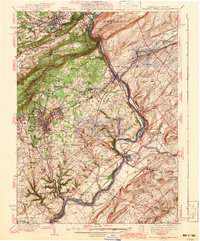 1942 Delaware Water Gap1942 Print · USGSThe Delaware River gorge and its surrounding ridges come into focus during the early war years, highlighting a critical rail and river junction. Trace local history through family-named landmarks like Miller Ch, rural Quaker Plain Sch, and the unique name of Manunka Chunk.3 unique versions available
 - 1943 Map of Bangor
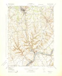 1943 Bangor1943 Print · USGSThe slate and cement industries of the Pennsylvania-New Jersey border are captured in high detail at the height of wartime production. Genealogists and industrial historians can trace rail spurs to the Old Bangor Slate Quarry, locate the Middaghs PO, and find rural landmarks like Three Church Hill.
 - 1943 Map of Portland
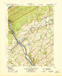 1943 Portland1943 Print · USGSThe Delaware River valley was a bustling corridor of rail and river transit during the early years of the Second World War. Researchers can trace the paths of several major railroads, locate family sites like the Fairview Cemetery, and find old infrastructure such as the Myers Ferry and Hainesburg RR Sta.2 unique versions available
 - 1943 Map of Mauch Chunk
 1943 Mauch Chunk1943 Print · USGSThe Lehigh River corridor is captured here during the mid-forties, showing the vital rail and industry centers of Carbon County. Genealogists and researchers can trace dozens of rural schoolhouses and family-named landmarks like the Larrytown Poor Farm, St Pauls Ch, and Three O'clock Spring.
 - 1943 Map of Wind Gap
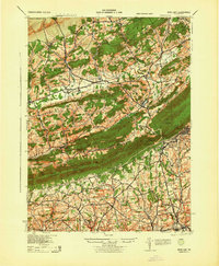 1943 Wind Gap1943 Print · USGSThe Pennsylvania countryside near the Monroe and Northampton county line is captured here during the wartime era. Researchers can trace the path of the Lehigh and New England railroad through the Wind Gap pass or locate local landmarks like St Joseph Sch and Ross Common.
 - 1943 Map of Easton
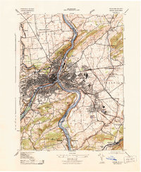 1943 Easton1943 Print · USGSEaston and Phillipsburg emerge as a powerhouse of industrial and river activity at the height of the 1940s. Genealogists and historians can trace the paths of the Lehigh Canal, locate the South Easton Cem, and identify old sites like Island Park and the Vulcanite Cement Co.
 - 1943 Map of Bethlehem
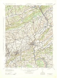 1943 Bethlehem1943 Print · USGSNorthampton and Lehigh counties hummed with industry and river commerce during the early war years. Researchers can trace the path of the Lehigh Valley RR, locate family-named landmarks like Chief Tatamy, and find rural schools such as Mexico School and Poplar Valley Sch.
 - 1943 Map of Riegelsville
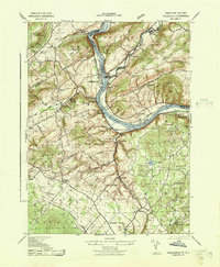 1943 Riegelsville1943 Print · USGSThe Delaware River corridor comes alive in the early 1940s, highlighting the industrial and transport ties between eastern Pennsylvania and New Jersey. Genealogists and historians can trace the foundations of local industry at Durham Furnace or locate family roots near Durham Union Church and the Finesville School.
 - 1943 Map of Belvidere
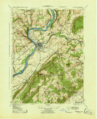 1943 Belvidere1943 Print · USGSThe river and rail corridors of Warren County define this wartime landscape as it stood in the early 1940s. Genealogists and historians can trace the local industry of Belvidere, the early runways of Martins Creek Airport, and the historic industrial site of Oxford Furnace.
Showing maps 1-25 of 152
Top cities of Northampton County
- Easton historical maps
- Lower Saucon Township historical maps
- Hanover Township historical maps
- Northampton historical maps
- Wilson historical maps
- Nazareth historical maps
See more
Frequently asked questions
- What are the different types of historical maps available for Northampton County?
- What is the oldest map of Northampton County?
- Where can I purchase historical maps of Northampton County for my home or office?
- Where can I download high-res historical maps of Northampton County?
- Are there historical topographic maps available for Northampton County?
- Is there historical aerial imagery available for Northampton County?
- Where are historical maps of Northampton County sourced from?