Old Maps of Porter Township, Pennsylvania for Hiking & Exploration
Hike through history with 71 historic maps of Porter Township. Explore old trails, ghost towns, and forgotten backroads — perfect for outdoor adventurers and local explorers.
- Rediscover forgotten places: Map out old mining camps, roads, and footpaths that no longer exist on modern maps.
- Layer with modern tools: Combine with LiDAR or satellite views to plan hikes through historical terrain.
- Made for exploration: Popular among hikers, overlanders, and local history lovers.
Use these maps to find adventure and explore the hidden past of Porter Township.
Porter Township, PA maps
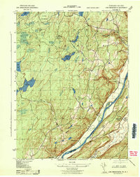
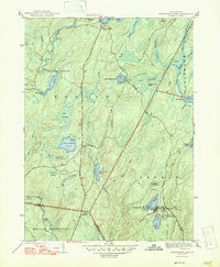
(71)- 1891 Map of Wallpack
 1891 Wallpack1891 Print · USGSThe Delaware River valley and Kittatinny Mountain ridges define this late nineteenth-century borderland between Pennsylvania and New Jersey. Genealogists can locate historic river crossings like Dingmans Ferry and trace early rail lines including the Paulins Kill Railroad.
 - 1893 Map of Wallpack
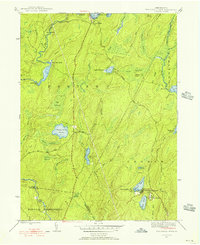
 1893 Wallpack1893 Print · USGSThe Delaware River valley and Kittatinny Mountain are captured here during the late nineteenth century, showing a landscape defined by ferries and early rail. You can trace old river crossings like Smiths Ferry or locate the rural post office at Peters Valley Bevans P.O. and the rail stop at Emmons Station.8 unique versions available
 - 1913 Map of Milford, 1958 Print
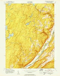
 1913 Milford1958 Print · USGSBefore the Tri-State area was suburbanized, this early twentieth-century survey captures the rugged river economy of the Delaware valley. Genealogists can trace family roots at McCartys Corner or locate vanished rural schoolhouses like the McCain School and Woodtown School.
 - 1915 Map of Milford
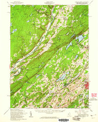
 1915 Milford1915 Print · USGSThe Delaware River valley at the tri-state border comes alive in this pre-war survey, capturing a world of riverside rail stations and remote mountain schoolhouses. Genealogists can locate family landmarks like McCarthys Corner or trace rural education at the Yale Forest School and Quicktown School.7 unique versions available
 - 1924 Map of Bushkill
 1924 Bushkill1924 Print · USGSThe Pennsylvania and New Jersey borderlands come to life in the mid-twenties, showing a landscape of small school districts and traditional river crossings. Researchers can locate family landmarks like Marshall Falls, trace the Delaware Lackawanna and Western rail line, and find old sites like Smoky Hill School.
 - 1935 Map of Hawley, 1955 Print
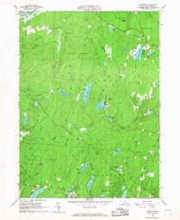
 1935 Hawley1955 Print · USGSThe Pocono Mountains and the massive shoreline of Lake Wallenpaupack dominate this mid-century survey of northeastern Pennsylvania. Local historians can trace the Erie rail line through Hawley and Rowland or locate the High Knob Fire Tower and rural Blooming Grove School.2 unique versions available
 - 1938 Map of Hawley
 1938 Hawley1938 Print · USGSThe Pocono Mountains and the southern reaches of the Lackawaxen River appear here in the late thirties. Genealogists and local historians can trace the rural communities of Blooming Grove and Greeley or locate the Paupack Ch and numerous family-named swamps.3 unique versions available
 - 1943 Map of Bushkill
 1943 Bushkill1943 Print · USGSMonroe County and the Delaware River valley are captured in the early 1940s during a time of rural persistence and local industry. Genealogists and historians can locate family landmarks like Dimicks Ferry, St Thomas Chapel, and the vanished sites of Craig Meadows.2 unique versions available
 - 1943 Map of Lake Maskenozha
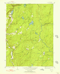
 1943 Lake Maskenozha1943 Print · USGSThe Delaware River valley at the height of the war years is documented here in detail, showing the borderlands of Pike County and Sussex County. Genealogists and local historians can trace old homesteads and landmarks like Wallpack Center, Egypt Mills, and the Wallpack Center School.3 unique versions available
 - 1943 Map of Twelvemile Pond, 1956 Print
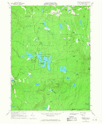
 1943 Twelvemile Pond1956 Print · USGSPike County in the 1940s was a landscape of dense woodlands and seasonal retreats at the intersection of several townships. Researchers can trace the footprints of local social life at the Hunters Range Sch and private institutions like the Beaver Run Club and Camp Tamiment.6 unique versions available
 - 1943 Map of Skytop, 1956 Print
 1943 Skytop1956 Print · USGSMonroe County in the early 1940s is shown as a landscape of remote mountain camps and private clubs. Genealogists and historians can trace family locations near McComas Chapel, Skytop, and the numerous seasonal sites like Camp Canadensis and Camp Girard.4 unique versions available
 - 1944 Map of Milford
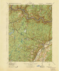 1944 Milford1944 Print · USGSThe tri-state Delaware River valley was a network of river-bound hamlets and upland schools during the 1940s. Genealogists and local historians can trace family locations through named sites like Dark Swamp Sch, Mongaup Sta, and Quicktown.
 - 1947 Map of Skytop
 1947 Skytop1947 Print · USGSThe high Poconos were transitioning into a major recreational hub after the war, centered around private clubs and summer camps. Genealogists and historians can locate family landmarks like McComas Chapel or trace the early boundaries of Camp Girard and the Hiawatha Club.2 unique versions available
 - 1947 Map of Twelvemile Pond
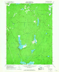
 1947 Twelvemile Pond1947 Print · USGSPike County was a landscape of sporting clubs and high wetlands in the years following the war. Genealogists and historians can locate the Hunters Range Sch, trace the Old Shohola Road, and explore the grounds of Camp Taminiment and Sandyville.2 unique versions available
 - 1950 Map of Scranton, 1952 Print
 1950 Scranton1952 Print · USGSMid-century Northeast Pennsylvania and the Hudson Valley come alive in this survey of the tri-state region. Genealogists and historians can trace the dense rail networks of the Erie RR and DL&W RR between industrial hubs like Scranton and Wilkes-Barre.
 - 1953 Map of Scranton
 1953 Scranton1953 Print · USGSNortheastern Pennsylvania and the Catskills are shown in great detail during the early fifties, a time when rail lines and river valleys dictated the region's growth. Genealogists and historians can trace the industrial hearts of Scranton and Wilkes-Barre or locate remote landmarks like High Point and Lake Wallenpaupack.
 - 1954 Map of Lake Maskenozha, 1955 Print
 1954 Lake Maskenozha1955 Print · USGSThe Delaware River valley thrived as a hub for summer camps and small riverfront communities in the mid-1950s. Genealogists and local historians can trace legacy sites like Wallpack Center, Egypt Mills, and the Holy Trinity Ch near the New Jersey border.5 unique versions available
 - 1954 Map of Dingmans Ferry, 1960 Print
 1954 Dingmans Ferry1960 Print · USGSSussex County, New Jersey, and the Delaware River valley are captured here in the mid-fifties, just as the region’s recreation economy was at its peak. Genealogists and historians can trace the foundations of Stillwater and Branchville, or locate remote landmarks like Wallpack Center and Millbrook.2 unique versions available
 - 1959 Map of Scranton
 1959 Scranton1959 Print · USGSThe northern coalfields and the Hudson Valley meet in this mid-century survey of the Pennsylvania and New York borderlands. Genealogists and historians can trace the intricate rail networks of the Erie Railroad and the vast waters of Lake Wallenpaupack.2 unique versions available
 - 1959 Map of Pocono
 1959 Pocono1959 Print · USGSThe Pocono Mountains region is captured here in the late fifties, showcasing its evolution from a railway-dependent timber and ice landscape to a premier resort destination. Researchers can locate dozens of country schoolhouses like Maplewood Sch and trace the paths of the Erie RR through Hawley and Kimbles.
 - 1962 Map of Scranton, 1977 Print
 1962 Scranton1977 Print · USGSThe industrial heart of eastern Pennsylvania and the New York Catskills are captured here in the early sixties. Genealogists and historians can trace the dense valley settlements from Scranton to Wilkes-Barre and the rail lines of the Erie Lackawanna Railroad.2 unique versions available
 - 1965 Map of Scranton
 1965 Scranton1965 Print · USGSThe tri-state highlands of Pennsylvania, New York, and New Jersey come alive in the mid-sixties as industry and recreation converge. Trace the intricate rail lines of the Erie Lackawanna RR or locate landmarks like the U S Military Academy.2 unique versions available
 - 1965 Map of Edgemere, 1967 Print
 1965 Edgemere1967 Print · USGSThe Poconos highlands in the 1960s reveal a landscape of summer camps and residential estates tucked between glacial lakes and dense woods. Trace the development of Sagamore Estates, find remote outposts like Camp Speers, and follow old trails through Dark Swamp.4 unique versions available
 - 1966 Map of Promised Land, 1968 Print
 1966 Promised Land1968 Print · USGSPike County's high forest plateaus are captured here in the mid-sixties, a period of established conservation and recreation. Genealogists and hikers can trace the roads around Roemersville, find the Blooming Grove Sch, and locate the Lookout Tower on High Knob.3 unique versions available
 - 1966 Map of Pecks Pond, 1968 Print
 1966 Pecks Pond1968 Print · USGSThe Pocono plateau in the mid-1960s is defined here by its dense network of glacial lakes and growing recreation communities. Researchers can trace local landmarks like Pecks Pond, the early development at Hemlock Farms, and family-named features like Madden Hill.3 unique versions available
Showing maps 1-25 of 71
Top cities near Porter Township
- East Stroudsburg historical maps
- Delaware historical maps
- Blairstown historical maps
- Lackawaxen Township historical maps
- Hampton Township historical maps
- Blooming Grove Township historical maps
See more
Top neighborhoods of Porter Township
Frequently asked questions
- What are the different types of historical maps available for Porter Township?
- What is the oldest map of Porter Township?
- Where can I purchase historical maps of Porter Township for my home or office?
- Where can I download high-res historical maps of Porter Township?
- Are there historical topographic maps available for Porter Township?
- Is there historical aerial imagery available for Porter Township?
- Where are historical maps of Porter Township sourced from?