Old Maps of Wharton Township, Pennsylvania for Academic Research
Study the evolution of Wharton Township with 72 high-resolution historic maps. Whether you're teaching, researching, or modeling changes in land use, these maps provide essential visual documentation of urban, environmental, and geographic change.
- Analyze long-term change: Track patterns in development, transportation, and natural features.
- Ideal for environmental or urban studies: Support academic projects with primary historical map data.
- Use in the classroom or lab: Educators and researchers rely on these maps to bring historical context to life.
These maps are a powerful tool for teaching, research, and visualizing how Wharton Township has changed over the decades.
Wharton Township, PA maps
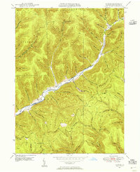
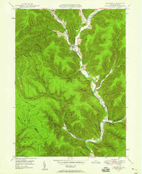
(72)- 1945 Map of Driftwood, 1953 Print
 1945 Driftwood1953 Print · USGSCameron County communities thrive along the river bends and rail lines at the end of World War II. Researchers can trace the dual rail paths of the Pennsylvania and Baltimore and Ohio railroads through Driftwood and locate the First Fork Sch.4 unique versions available
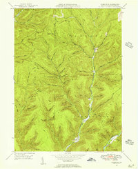
 - 1945 Map of First Fork, 1954 Print
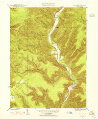 1945 First Fork1954 Print · USGSThe deep valleys of Cameron and Potter counties appear here in the mid-1940s, centered on the First Fork Sinnemahoning Creek corridor. Local researchers can locate the First Fork School, Gilmore Cem, and early ridge-top routes like Square Timber Road.3 unique versions available
 - 1946 Map of Renovo West, 1953 Print
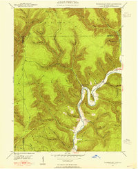
 1946 Renovo West1953 Print · USGSClinton County's river valleys and ridgelines come alive in this mid-century survey of the Pennsylvania wilds. Trace the industrial footprint of the Pennsylvania RR through Renovo or find family history at Laurel Hill Cem and Summerson Cem.9 unique versions available
 - 1946 Map of Hammersley Fork, 1954 Print
 1946 Hammersley Fork1954 Print · USGSThe deep valleys of north-central Pennsylvania appear just after the war as small creek-side settlements remain the primary nodes of local life. Genealogists can trace family names at Summerson Cem and McCoy Cem or locate the old Central Sch near Hammersley Fork.4 unique versions available
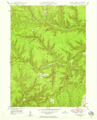
 - 1946 Map of Tamarack, 1955 Print
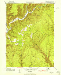 1946 Tamarack1955 Print · USGSClinton and Potter Counties appear in the mid-forties as a landscape of deep valleys and vital watershed headwaters. Genealogists and historians can trace the remote highlands surrounding Tamarack, locating local landmarks like Browns Mill and the Tamarack Lookout Tower.4 unique versions available
 - 1947 Map of First Fork
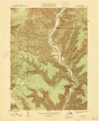 1947 First Fork1947 Print · USGSNorth-central Pennsylvania's mountain valleys are captured here in the mid-1940s, as small settlements and logging-era roads traced the winding First Fork Sinnemahoning Creek. Genealogists can locate the First Fork Sch and family burial sites like Smith Cem and Gilmore Cem.2 unique versions available
 - 1947 Map of Conrad, 1952 Print
 1947 Conrad1952 Print · USGSPotter County’s timbered ridges and deep hollows are captured here just after the war, showing a rural landscape before modern development. Researchers can locate family cemeteries like Angell Cem and Reed Cem, or trace the old Jersey Shore Turnpike.4 unique versions available
 - 1947 Map of Conrad, 1956 Print
 1947 Conrad1956 Print · USGSPotter County’s deep valleys and timberlands are captured here in the mid-1940s as industry and nature intersected. Genealogists and hikers can trace old homesteads near Conrad, find the McFall Cem, and follow the historic Hammersley Trail.5 unique versions available
 - 1947 Map of Short Run, 1956 Print
 1947 Short Run1956 Print · USGSPotter County’s timbered ridges and deep hollows are documented here just after the war, showing the remote township corners and mountain trails. Trace family-named landmarks like Knickerbocker Hol and Yochum Run or find the early paths at Short Run.2 unique versions available
 - 1947 Map of Cherry Springs, 1958 Print
 1947 Cherry Springs1958 Print · USGSPotter County's forested ridges and deep hollows are captured here just after the war, showing a landscape defined by timber, transit, and conservation. Genealogists and hikers can trace the Coudersport Pike to Corbett or locate landmarks like Lyman Run Camp and the Cherry Springs Fire Tower.2 unique versions available
 - 1948 Map of Hammersley Fork
 1948 Hammersley Fork1948 Print · USGSClinton and Potter counties appear here in the late 1940s, highlighting the rural communities nestled along the winding waters of Kettle Creek. Genealogists can locate family landmarks such as Summerson Cem, McCoy Cem, and the Central Sch.2 unique versions available
 - 1948 Map of Tamarack
 1948 Tamarack1948 Print · USGSThe northern reaches of Clinton County are captured here just after the war, showing a landscape defined by deep creek valleys and forest fire lookouts. Researchers can locate the Tamarack Lookout Tower, the Cem near Cross Fork, and the distinct boggy terrain of Tamarack Swamp.2 unique versions available
 - 1948 Map of Emporium, 1952 Print
 1948 Emporium1952 Print · USGSThe northern Pennsylvania highlands come into focus in the late 1940s, showing a network of mountain settlements and headwater streams. You can trace family roots at Wharton Cem and St Marks Cem or locate old schoolhouse sites like Reesville Sch.3 unique versions available
 - 1948 Map of Wharton, 1958 Print
 1948 Wharton1958 Print · USGSMid-century Potter County comes to life along the winding First Fork Sinnemahoning Creek and its narrow tributary hollows. Genealogists can pinpoint old family burial grounds like Forest Hill Cem and local landmarks like the Reesville Sch.3 unique versions available
 - 1949 Map of Short Run
 1949 Short Run1949 Print · USGSPotter County’s high plateaus and steep hollows are caught in fine detail during the late 1940s as forest roads began replacing old upland paths. Researchers can trace historic routes like the Splash Dam Trail and locate family-named landmarks such as Knickerbocker Hol and Bunnell Ridge.
 - 1949 Map of Cherry Springs
 1949 Cherry Springs1949 Print · USGSPotter County’s high plateaus and deep hollows are captured here in the late 1940s, showing a landscape shaped by forestry and early aviation. Genealogists and historians can trace old homesteads and landmarks like Lyman Run Camp, Mount Brodhead, and the Cherry Springs Fire Tower.
 - 1950 Map of Conrad
 1950 Conrad1950 Print · USGSPotter County’s remote valley landscapes are captured here at the start of the 1950s, showing the intersection of forest management and the gas industry. Researchers can find old family sites at McFall Cem or trace the early paths of Wild Boy Trail and Gravel Lick Trail.
 - 1950 Map of Wharton
 1950 Wharton1950 Print · USGSPotter County's deep-cut valleys and river confluences are captured here in the post-war era. Genealogists and historians can locate remote family landmarks like Reesville Sch, the Splash Dam on Bailey Run, and the burial grounds at Forest Hill Cem.2 unique versions available
 - 1954 Map of Williamsport
 1954 Williamsport1954 Print · USGSNorth-central Pennsylvania in the mid-fifties is defined by the winding West Branch Susquehanna River and its industrial valley. Local historians can trace the massive Susquehanna Ordnance Depot and the extensive rail networks of the Pennsylvania Railroad.
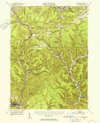
 - 1957 Map of Warren, 1964 Print
 1957 Warren1964 Print · USGSThe northern Pennsylvania oil and timber country comes into focus in the mid-fifties, showing the region before modern highway expansions. Trace the industrial rail networks of the Pennsylvania RR and the early Allegheny River Reservoir near Warren and Oil City.4 unique versions available
 - 1958 Map of Warren
 1958 Warren1958 Print · USGSNorthern Pennsylvania’s timber and oil country is captured here during the late fifties, showing the interplay of industrial valleys and vast state forests. Genealogists can trace family connections across the Cornplanter Indian Reservation or through rail hubs like Oil City and Saint Marys.
 - 1959 Map of Warren
 1959 Warren1959 Print · USGSNorthern Pennsylvania's oil and timber country comes alive in this late-fifties study of the forest-clad plateaus. Trace the historic Cornplanter (Indian Reservation), the sprawling Oil Field, and the rail lines of the Pennsylvania RR.2 unique versions available
 - 1960 Map of Williamsport
 1960 Williamsport1960 Print · USGSNorth-central Pennsylvania in the mid-twentieth century was a vital corridor of rail and river industry stretching from the New York line to the coal regions. Genealogists can trace the rail networks of the Pennsylvania RR and Lehigh Valley RR connecting towns like Williamsport, Towanda, and Lock Haven.
 - 1962 Map of Williamsport, 1966 Print
 1962 Williamsport1966 Print · USGSNorth-central Pennsylvania was a landscape of industrial river hubs and vast state woodlands in the early sixties. Researchers can trace the path of the Pennsylvania Railroad through Williamsport and explore the remote reaches of Bucktail State Park.5 unique versions available
 - 1965 Map of Williamsport
 1965 Williamsport1965 Print · USGSNorth-central Pennsylvania in the mid-1960s is defined by the industrial river towns and vast timberlands of the Allegheny Plateau. Researchers can trace historic rail lines like the Erie Lackawanna and Reading as they thread through Williamsport, Lock Haven, and Jersey Shore.
Showing maps 1-25 of 72
Top cities near Wharton Township
- Roulette Township historical maps
- Sweden Township historical maps
- Austin historical maps
- Leidy Township historical maps
- Abbott Township historical maps
- Driftwood historical maps
Top neighborhoods of Wharton Township
- Conrad historical maps
- Jamison historical maps
- Logue historical maps
- Five Points historical maps
- Hammersley historical maps
- Berge Run historical maps
Frequently asked questions
- What are the different types of historical maps available for Wharton Township?
- What is the oldest map of Wharton Township?
- Where can I purchase historical maps of Wharton Township for my home or office?
- Where can I download high-res historical maps of Wharton Township?
- Are there historical topographic maps available for Wharton Township?
- Is there historical aerial imagery available for Wharton Township?
- Where are historical maps of Wharton Township sourced from?