2020s Maps of Pine Grove Township, Pennsylvania
Explore 4 historic maps of Pine Grove Township from the 2020s. These maps offer a rare glimpse into what life looked like during the 2020s — showing old roads, neighborhoods, homes, and landmarks that have changed or disappeared over time.
Whether you're researching your family's past, planning a metal detecting trip, or studying how Pine Grove Township's landscape evolved across the 2020s, these high-resolution maps are a powerful tool for exploring the history of this region.
- Focus on a specific era: All maps on this page are from the 2020s, giving you a focused view of this time period.
- See what’s changed: Compare century-old streets, trails, and buildings to today's modern landscape using overlays and satellite layers.
- Research with precision: Use these maps for genealogy, historical research, land use analysis, or educational projects.
- View, download, or print: Maps are fully viewable online in high resolution, and can be downloaded or printed for your own records.
Start exploring Pine Grove Township's history through authentic maps from the 2020s. This is your window into the past.
Pine Grove Township, PA maps
(4)- 2023 Map of Pine Grove, 2023 Print
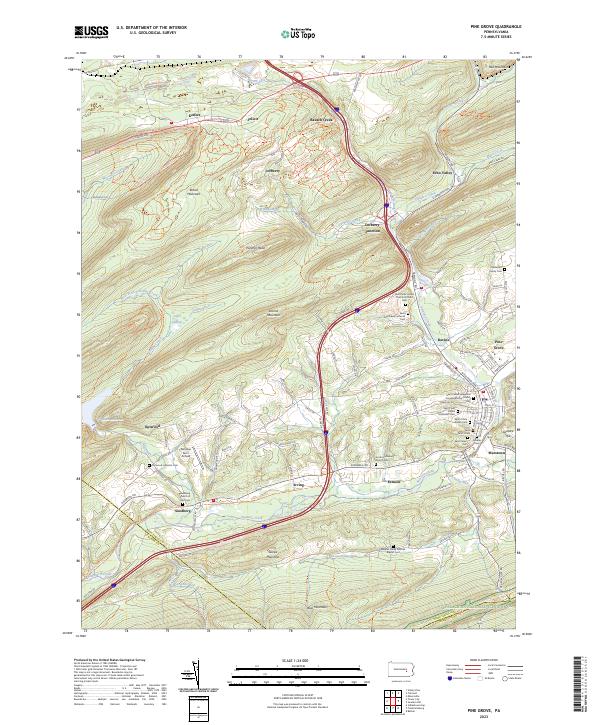 2023 Pine Grove2023 Print · USGSThe Swatara Creek valley comes alive in this contemporary look at Schuylkill County's ridges and rural crossroads. Local historians can trace family names at the Haldeman Family Cem or locate the old landing at Fairview Farm Airfield.
 - 2023 Map of Tower City, 2023 Print
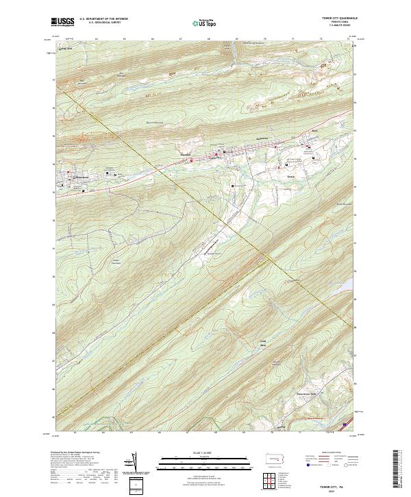 2023 Tower City2023 Print · USGSThe northern anthracite region comes to life in this detailed survey of the valley between Big Lick Mountain and Peters Mountain. Genealogists and local historians can trace the foundations of Tower City and Williamstown, locating local landmarks like the Sacred Heart Cem and the Gold Mine.
 - 2023 Map of Swatara Hill, 2023 Print
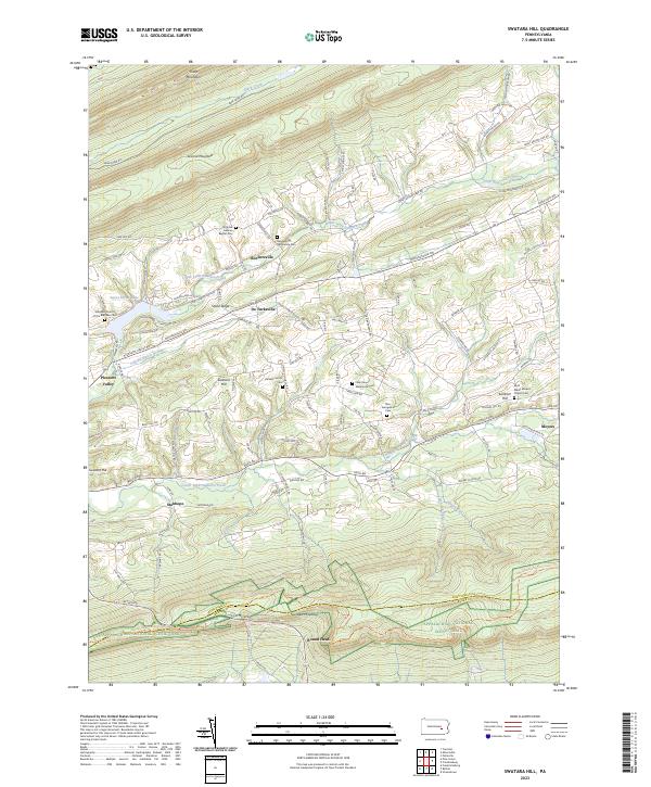 2023 Swatara Hill2023 Print · USGSSchuylkill County at the opening of the 2020s remains a landscape of high ridges and narrow agricultural valleys. Genealogists can trace family names through numerous rural burial sites like Hetzel's Church Cem or find the path of the Appalachian National Scenic Trail over Round Head.
 - 2023 Map of Fredericksburg, 2023 Print
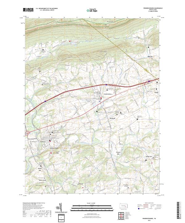 2023 Fredericksburg2023 Print · USGSLebanon County is depicted here in recent years, showing the enduring agricultural and religious landscape between Blue Mountain and Swatara Creek. Researchers can trace family sites at Grove Farm Cem or explore the route of the historic Union Canal.
End of results
Showing maps 1-4 of 4
Top cities near Pine Grove Township
- Lebanon historical maps
- Pottsville historical maps
- Hershey historical maps
- Palmyra historical maps
- Annville historical maps
- Bethel Township historical maps
See more
Top neighborhoods of Pine Grove Township
- Stanhope historical maps
- Outwood historical maps
- Beuchler historical maps
- Exmoor historical maps
- North Pine Grove historical maps
- Paradise historical maps
See more
Frequently asked questions
- What are the different types of historical maps available for Pine Grove Township?
- What is the oldest map of Pine Grove Township?
- Where can I purchase historical maps of Pine Grove Township for my home or office?
- Where can I download high-res historical maps of Pine Grove Township?
- Are there historical topographic maps available for Pine Grove Township?
- Is there historical aerial imagery available for Pine Grove Township?
- Where are historical maps of Pine Grove Township sourced from?