Old Maps of Conemaugh Township, Pennsylvania for Hiking & Exploration
Hike through history with 50 historic maps of Conemaugh Township. Explore old trails, ghost towns, and forgotten backroads — perfect for outdoor adventurers and local explorers.
- Rediscover forgotten places: Map out old mining camps, roads, and footpaths that no longer exist on modern maps.
- Layer with modern tools: Combine with LiDAR or satellite views to plan hikes through historical terrain.
- Made for exploration: Popular among hikers, overlanders, and local history lovers.
Use these maps to find adventure and explore the hidden past of Conemaugh Township.
Conemaugh Township, PA maps
(50)- 1904 Map of Johnstown, 1954 Print
 1904 Johnstown1954 Print · USGSJohnstown and the Cambria County coalfields are shown in detail during their industrial peak in the early twentieth century. Researchers can trace ancestral neighborhoods like Morrellville and Franklin, or locate historic landmarks such as the Old Portage RR Tunnel and Grandview Cemetery.2 unique versions available
 - 1907 Map of Johnstown
 1907 Johnstown1907 Print · USGSJohnstown and the surrounding coal valleys are captured here at the height of their industrial expansion in the early twentieth century. Researchers can trace the path of the Pennsylvania RR and find vanished local landmarks like Expedit PO and the Old Portage RR Tunnel.6 unique versions available
 - 1913 Map of Somerset, 1961 Print
 1913 Somerset1961 Print · USGSSomerset County was a rugged crossroads of rail and mountain ridges in the decade before the First World War. Local historians can trace the Pittsburgh and Philadelphia Road and find vanished local landmarks like Rectors Mill, the Quemahoning Tunnel, and Sipesville Station.
 - 1914 Map of Windber, 1955 Print
 1914 Windber1955 Print · USGSSomerset County coal and rail towns thrive along the Allegheny front during the height of the early industrial era. Genealogists and historians can trace the foundations of Windber, locate the Old Shade Furnace, and map family-named schools like Keafer School.3 unique versions available
 - 1915 Map of Somerset
 1915 Somerset1915 Print · USGSSomerset and the surrounding Laurel Ridge region are captured here during the peak of the early twentieth-century coal boom. Genealogists and historians can trace family-named sites and industrial landmarks including Husband Mine, Rectors Mill, and the Quemahoning Tunnel.6 unique versions available
 - 1916 Map of Windber
 1916 Windber1916 Print · USGSSomerset County coal country and the Laurel Highlands come alive in the decade before the Great War. Genealogists and historians can trace family locations through dozens of named sites like Old Shade Furnace, Stauffer Mine No 3, and Walkers Mill.4 unique versions available
 - 1920 Map of New Florence, 1958 Print
 1920 New Florence1958 Print · USGSThe Conemaugh River valley at the dawn of the 1920s shows a landscape defined by the PENNSYLVANIA RR and industrial coal towns. Genealogists can locate family homesteads near dozens of named country schools like Wallace School or trace the old Lincoln Highway through Armagh.
 - 1921 Map of New Florence
 1921 New Florence1921 Print · USGSWestmoreland and Indiana counties are captured in the early 1920s as industrial rail corridors and the Lincoln Highway begin to modernize the rural landscape. Genealogists can locate family landmarks like Campbell's Mill, the Centerville Huff PO, and several country schools including Robbs School.
 - 1922 Map of New Florence
 1922 New Florence1922 Print · USGSWestern Pennsylvania in the early 1920s shows a landscape of river-carved ridges and busy rail corridors connecting coal and quarry towns. Genealogists can trace family footprints across dozens of rural schools and stations like Lockport Station, Centerville (Huff PO), and Grafton.5 unique versions available
 - 1944 Map of Somerset
 1944 Somerset1944 Print · USGSThe Laurel Highlands during the early years of the Pennsylvania Turnpike are captured here, showing the transition from old mountain roads to modern highways. Genealogists can trace family names at Rector Mill, Rhoads Field, and dozens of local schools like Knepper Sch.
 - 1944 Map of Windber
 1944 Windber1944 Print · USGSSomerset County's coal and rail corridors are captured here during the 1940s, showing the region's industrial peak. Genealogists can locate family landmarks like Kaufman Ch, Stoystown Sta, and numerous country schools such as Breastwork Sch.
 - 1944 Map of New Florence
 1944 New Florence1944 Print · USGSWestmoreland and Indiana counties during the wartime years reveal a landscape shaped by coal, steam, and rail. Genealogists can trace family footprints in vanished settlements and school districts like Robindale Smokeless PO, Scottglen Sta, and Mahan Sch.
 - 1953 Map of Pittsburgh
 1953 Pittsburgh1953 Print · USGSWestern Pennsylvania's industrial landscape at the start of the fifties shows the steel and rail corridors between Pittsburgh and Altoona. Trace family roots in river towns like Tarentum or follow the Pennsylvania Turnpike across Laurel Hill.
 - 1954 Map of Pittsburgh
 1954 Pittsburgh1954 Print · USGSWestern Pennsylvania in the early fifties remains a powerhouse of heavy industry and vital transit corridors. Genealogists and historians can trace the rail-and-river network connecting Pittsburgh, Johnstown, and Altoona via the Pennsylvania RR and the Lincoln Highway.2 unique versions available
 - 1958 Map of Pittsburgh
 1958 Pittsburgh1958 Print · USGSWestern Pennsylvania in the late fifties shows an industrial heartland defined by the confluence of the Allegheny River and Monongahela River. Researchers can trace the sprawling rail networks of the Pennsylvania RR and find established towns like Butler, Latrobe, and Windber.5 unique versions available
 - 1959 Map of Pittsburgh
 1959 Pittsburgh1959 Print · USGSWestern Pennsylvania in the late fifties is captured here at the height of its industrial era. Genealogists and historians can trace the riverfront growth of Pittsburgh, the rail works at Altoona, and the mountain gaps of Laurel Hill.
 - 1964 Map of Pittsburgh
 1964 Pittsburgh1964 Print · USGSWestern Pennsylvania in the late fifties and early sixties shows a landscape of powerful river industries and expanding highways. Genealogists and historians can trace the rail corridors of the Pennsylvania RR through industrial hubs like Johnstown, Altoona, and Nanty Glo.
 - 1964 Map of Rachelwood, 1966 Print
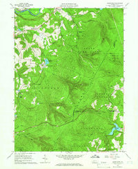 1964 Rachelwood1966 Print · USGSLaurel Ridge and the Conemaugh River define this Pennsylvania mountain landscape during the early sixties. Researchers can trace family sites and local landmarks like Legat Cem, the historic Baldwin Furnace, and Ross Mountain Park.3 unique versions available
 - 1964 Map of Johnstown, 1966 Print
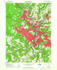 1964 Johnstown1966 Print · USGSThe Conemaugh River valley is captured in the mid-1960s as a dense industrial and rail hub. Genealogists can trace family roots through neighborhood landmarks like Grandview Cemetery, St Nicholas Ch, and the many schools of Westmont and Southmont.6 unique versions available
 - 1967 Map of Boswell, 1971 Print
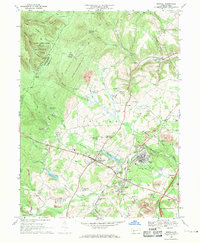 1967 Boswell1971 Print · USGSSomerset County’s coal country and rural settlements are captured in the late 1960s, showing the intersection of heavy industry and small-town life. Genealogists can trace family landmarks like Klines Mill, St Marys Ch, and the many cemeteries near Boswell.5 unique versions available
 - 1971 Map of Hooversville, 1973 Print
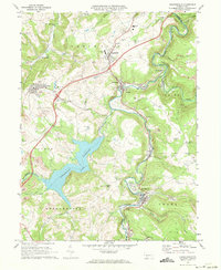 1971 Hooversville1973 Print · USGSSomerset County in the early seventies shows a landscape shaped by coal and water, from the banks of Stony Creek to the hilltop mines. Genealogists and historians can trace family locations near Hooversville, Thomas Mill, and Kaufman Cem.3 unique versions available
 - 1973 Map of Rachelwood, 1984 Print
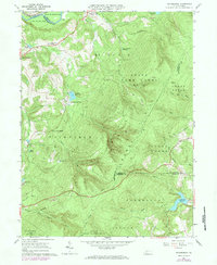 1973 Rachelwood1984 Print · USGSLaurel Hill and its surrounding valleys are captured here in the early seventies, showing a landscape defined by mountain ridges and river forks. Trace local history through the Baldwin Furnace, Legat Cem, and the rural Church in the Wilderness.
 - 1977 Map of Boswell, 1979 Print
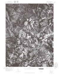 1977 Boswell1979 Print · USGSSomerset County's rural and town landscapes are captured in the late seventies through high-resolution aerial imagery. Trace the street grids and field patterns around Boswell and Jennerstown or follow the banks of Quemahoning Creek.
 - 1977 Map of Rachelwood, 1979 Print
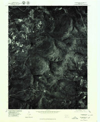 1977 Rachelwood1979 Print · USGSWestmoreland County rural life and water infrastructure are captured in this late-seventies aerial survey. Local researchers can trace the footprint of Rachelwood and locate major landmarks like Tubmill Reservoir and Mirror Lake.
 - 1977 Map of Hooversville, 1979 Print
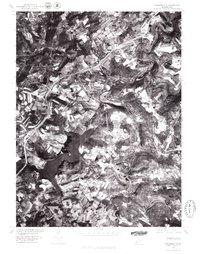 1977 Hooversville1979 Print · USGSSomerset County's landscape appears in sharp relief during the late seventies, showing the industrial and agricultural patterns of the Allegheny Plateau. Trace the development of Hooversville and Jerome alongside the Quemahoning Reservoir.
Showing maps 1-25 of 50
Top cities near Conemaugh Township
- Johnstown historical maps
- Somerset historical maps
- Franklin historical maps
- Westmont historical maps
- Windber historical maps
- Stonycreek Township historical maps
See more
Top neighborhoods of Conemaugh Township
- Foustwell historical maps
- Maple Ridge historical maps
- Thomas Mill historical maps
- Davidsville historical maps
- Krings historical maps
- Tire Hill historical maps
See more
Frequently asked questions
- What are the different types of historical maps available for Conemaugh Township?
- What is the oldest map of Conemaugh Township?
- Where can I purchase historical maps of Conemaugh Township for my home or office?
- Where can I download high-res historical maps of Conemaugh Township?
- Are there historical topographic maps available for Conemaugh Township?
- Is there historical aerial imagery available for Conemaugh Township?
- Where are historical maps of Conemaugh Township sourced from?