1970s Maps of Somerset Township, Pennsylvania
Explore 8 historic maps of Somerset Township from the 1970s. These maps offer a rare glimpse into what life looked like during the 1970s — showing old roads, neighborhoods, homes, and landmarks that have changed or disappeared over time.
Whether you're researching your family's past, planning a metal detecting trip, or studying how Somerset Township's landscape evolved across the 1970s, these high-resolution maps are a powerful tool for exploring the history of this region.
- Focus on a specific era: All maps on this page are from the 1970s, giving you a focused view of this time period.
- See what’s changed: Compare century-old streets, trails, and buildings to today's modern landscape using overlays and satellite layers.
- Research with precision: Use these maps for genealogy, historical research, land use analysis, or educational projects.
- View, download, or print: Maps are fully viewable online in high resolution, and can be downloaded or printed for your own records.
Start exploring Somerset Township's history through authentic maps from the 1970s. This is your window into the past.
Somerset Township, PA maps
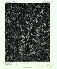
(8)- 1971 Map of Stoystown, 1973 Print
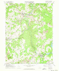 1971 Stoystown1973 Print · USGSSomerset County's industrial and rural character is caught in transition during the early seventies as coal extraction and residential development expanded. Genealogists can locate family landmarks like Walker Cem and Hayman Ch or trace the Baltimore and Ohio rail line through Shanksville and Stoystown.4 unique versions available
 - 1977 Map of Berlin, 1978 Print
 1977 Berlin1978 Print · USGSSomerset County agriculture and industry are captured in high detail in the late seventies. Genealogists and local researchers can trace family lands near Berlin and identify the specific layouts of small settlements like Macdonaldton and Shaft.
 - 1977 Map of Murdock, 1979 Print
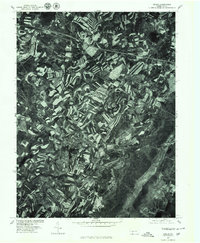
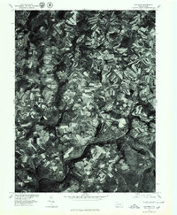
 1977 Murdock1979 Print · USGSSomerset County in the late seventies is captured in this orthophoto study, showcasing the rural landscape and mining activity of the era. Researchers can trace land use patterns around Somerset and the smaller hamlets of Beachdale and Murdock.
 - 1977 Map of Stoystown, 1979 Print
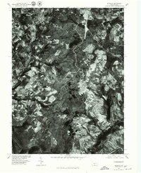
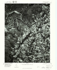
 1977 Stoystown1979 Print · USGSSomerset County agriculture and industry are visible in this late 1970s orthophotograph as the region balanced farming with surface mining. Researchers can trace the development of small communities like Stoystown, Shanksville, and Kimmelton along the banks of Stony Creek.
 - 1977 Map of Somerset, 1979 Print
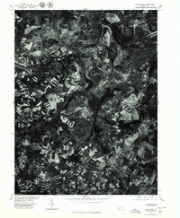
 1977 Somerset1979 Print · USGSSomerset and the surrounding Pennsylvania countryside appear in clear aerial detail during the late seventies as major highways began to reshape the region. Genealogists and local historians can trace the footprints of Somerset, Sipe Sville, and Geiger against the backdrop of the modern 219 and 70 76 corridors.
 - 1977 Map of Rockwood, 1979 Print
 1977 Rockwood1979 Print · USGSSomerset County agriculture and riverfront life are captured here in the late seventies as the region maintained its traditional rural character. Trace the development of Rockwood and New Centerville or locate family property near Trent and Chippewa Lake.
 - 1977 Map of Bakersville, 1979 Print
 1977 Bakersville1979 Print · USGSSomerset County agriculture and highland forests are captured here in the late seventies. Researchers can trace property lines and field patterns around Bakersville, Lavansville, and the waters of Kooser Lake.
 - 1979 Map of Morgantown, 1983 Print
 1979 Morgantown1983 Print · USGSThe northern Appalachian borderlands are captured here in the late seventies, showing the tri-state area of West Virginia, Pennsylvania, and Maryland. Genealogists and historians can trace the Mason and Dixon Line through mountain settlements like Markleysburg and across the Youghiogheny River Lake.
End of results
Showing maps 1-8 of 8
Top cities near Somerset Township
- Somerset historical maps
- Meyersdale historical maps
- Berlin historical maps
- Milford historical maps
- Boswell historical maps
- Paint historical maps
See more
Top neighborhoods of Somerset Township
- Friedens historical maps
- Wells Creek historical maps
- Fairview historical maps
- Lavansville historical maps
- Geiger historical maps
- Snydersville historical maps
See more
Frequently asked questions
- What are the different types of historical maps available for Somerset Township?
- What is the oldest map of Somerset Township?
- Where can I purchase historical maps of Somerset Township for my home or office?
- Where can I download high-res historical maps of Somerset Township?
- Are there historical topographic maps available for Somerset Township?
- Is there historical aerial imagery available for Somerset Township?
- Where are historical maps of Somerset Township sourced from?