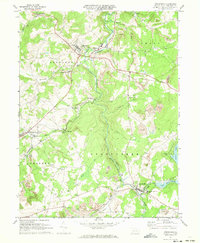
1971 Map of Stoystown
USGS Topo · Published 1973About this map
Stony Creek carves a deep valley through the center of this Somerset County landscape, dictating the placement of the Baltimore and Ohio railroad and several small industrial settlements. In the early 1970s, the region was defined by a mix of traditional agriculture and intensive coal operations, evidenced by numerous strip mines and a tipple dotting the hills near Kimmelton and Mostoller. The map documents the community infrastructure of the era, from the Forbes High Sch near Kantner to the Shanksville-Stonycreek Sch in the borough of Shanksville.
Find a feature on this map
37 named features on this map. Tap any name to fly to it.
Don’t see what you’re looking for? This feature index may not catch every label — zoom into the map to look around manually.
Map Details
Editions of this 1971 Stoystown Map
4 editions found
Other maps of this area

1913 · Somerset
USGS Topo · 1:62,500

1914 · Windber
USGS Topo · 1:62,500

1915 · Somerset
USGS Topo · 1:62,500

1916 · Windber
USGS Topo · 1:62,500

1921 · Meyersdale
USGS Topo · 1:62,500

1923 · Berlin
USGS Topo · 1:48,000

1929 · Berlin
USGS Topo · 1:62,500

1939 · Meyersdale
USGS Topo · 1:62,500

1944 · Somerset
USGS Topo · 1:62,500

1944 · Windber
USGS Topo · 1:62,500