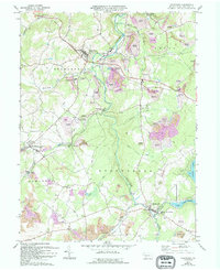
1971 Map of Stoystown
USGS Topo · Published 1994About this map
Stonycreek River carves through this Somerset County landscape, defining a region where industry and small-town life are deeply intertwined. The map illustrates a transitional period in the 1970s, where extensive Reclaimed Strip Mine areas sit alongside active Strip Mine operations and Gas Well sites, revealing the heavy imprint of resource extraction. The community of Stoystown serves as a northern hub, while to the south, Shanksville is situated near the confluence of Rhoads Cr and the river. The presence of Shanksville-Stoystown Sch and Forbes High Sch highlights the local infrastructure of the era. Notably, the map documents both traditional landmarks like the Covered Bridge and modern developments like Indian Lake, providing a detailed record of the county's shifting land use from agriculture and mining to recreation.
Find a feature on this map
39 named features on this map. Tap any name to fly to it.
Don’t see what you’re looking for? This feature index may not catch every label — zoom into the map to look around manually.
Map Details
Editions of this 1971 Stoystown Map
4 editions found
Other maps of this area

1913 · Somerset
USGS Topo · 1:62,500

1914 · Windber
USGS Topo · 1:62,500

1915 · Somerset
USGS Topo · 1:62,500

1916 · Windber
USGS Topo · 1:62,500

1921 · Meyersdale
USGS Topo · 1:62,500

1923 · Berlin
USGS Topo · 1:48,000

1929 · Berlin
USGS Topo · 1:62,500

1939 · Meyersdale
USGS Topo · 1:62,500

1944 · Somerset
USGS Topo · 1:62,500

1944 · Windber
USGS Topo · 1:62,500