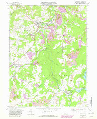
1971 Map of Stoystown
USGS Topo · Published 1982About this map
Stony Creek and the Baltimore And Ohio railroad line anchor the industrial landscape of Somerset County during the early 1970s. The region is characterized by extensive coal operations, including the Reading No 3 mine and numerous Strip Mines and Mine Dumps that indicate the scale of the local extraction economy. These industrial sites are interspersed with established communities like Stoystown, Friedens, and Shanksville, where local life centered around institutions such as the Shanksville-Stonycreek Sch and Rayman Ch.
Find a feature on this map
45 named features on this map. Tap any name to fly to it.
Don’t see what you’re looking for? This feature index may not catch every label — zoom into the map to look around manually.
Map Details
Editions of this 1971 Stoystown Map
4 editions found
Other maps of this area

1913 · Somerset
USGS Topo · 1:62,500

1914 · Windber
USGS Topo · 1:62,500

1915 · Somerset
USGS Topo · 1:62,500

1916 · Windber
USGS Topo · 1:62,500

1921 · Meyersdale
USGS Topo · 1:62,500

1923 · Berlin
USGS Topo · 1:48,000

1929 · Berlin
USGS Topo · 1:62,500

1939 · Meyersdale
USGS Topo · 1:62,500

1944 · Somerset
USGS Topo · 1:62,500

1944 · Windber
USGS Topo · 1:62,500