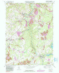
1971 Map of Stoystown
USGS Topo · Published 1990About this map
Stony Creek and the Baltimore and Ohio railroad corridor define this Somerset County landscape, where industrial coal operations meet small-town life. Extensive strip mine excavations, shown in purple revision shading, underscore the area's continued reliance on the local coal seams during the late 20th century. In Shanksville, the Shanksville-Stonycreek School and Walker Cemetery provide essential touchpoints for family history researchers.
Find a feature on this map
36 named features on this map. Tap any name to fly to it.
Don’t see what you’re looking for? This feature index may not catch every label — zoom into the map to look around manually.
Map Details
Editions of this 1971 Stoystown Map
4 editions found
Other maps of this area

1913 · Somerset
USGS Topo · 1:62,500

1914 · Windber
USGS Topo · 1:62,500

1915 · Somerset
USGS Topo · 1:62,500

1916 · Windber
USGS Topo · 1:62,500

1921 · Meyersdale
USGS Topo · 1:62,500

1923 · Berlin
USGS Topo · 1:48,000

1929 · Berlin
USGS Topo · 1:62,500

1939 · Meyersdale
USGS Topo · 1:62,500

1944 · Somerset
USGS Topo · 1:62,500

1944 · Windber
USGS Topo · 1:62,500